We are in the process of migrating all NASA Earth science data sites into Earthdata from now until end of 2026. Not all NASA Earth science data and resources will appear here until then. Thank you for your patience as we make this transition.
Read about the Web Unification Project
Sentinel-1 Resources
Earthdata resources for users working with NASA’s Sentinel-1 data include tutorials and other learning resources, news announcements such as instrument updates and data releases, user guides and related documents, and frequently asked questions.
Sentinel-1 Learning Resources

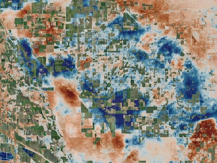
The Emergency Environmental Health Dashboard helped local communities assess water quality risks and infrastructure damage following Hurricane Helene and Tropical Storm Chantal.
Data in Action
Nov. 18, 2025

Access resources for exploring and working with OPERA Surface Displacement from Sentinel-1 (DISP-S1) products.
StoryMap
Sept. 2, 2025
Este webinar ezpresentará una introducción a SAR así como un repaso de las características de los datos de SAR históricos, actuales y futuros.
Training
Nov. 6-20, 2024

Join us on Thursday, May 29, to learn about the NASA JPL OPERA Surface Displacement (OPERA-DISP) dataset and how to access and explore the data using ASF DAAC's Displacement Portal.
Webinar
May 14, 2025
This ARSET training teaches participants how satellite-based Earth observations can inform landslide science and disaster planning.
Training
March 11-18, 2025

Learn how to create and unwrap an interferogram with GMT5SAR script in the cloud for Windows in NASA’s Alaska Satellite Facility Distributed Active Archive Center (ASF DAAC) tutorial.
Tutorial
Feb. 3, 2025

Learn to create and unwrap an interferogram with GMT5SAR script in the cloud — OS X in this data recipe from NASA’s Alaska Satellite Facility Distributed Active Archive Center (ASF DAAC).
Data Recipe
Feb. 3, 2025

Learn how to create a deformation map from unwrapped interferograms in this data recipe from NASA’s Alaska Satellite Facility Distributed Active Archive Center (ASF DAAC).
Data Recipe
Feb. 3, 2025
SHOWING 8 OF 65
Sentinel-1 News
View All News
Filters

Image captured on December 18, 2025, by the C-Band SAR instrument aboard ESA's Sentinel-1A platform.
Worldview Image of the Week
Jan. 29, 2026

Image captured on December 18, 2025, by the C-SAR instrument aboard ESA's Sentinel-1A platform.
Worldview Image of the Week
Jan. 2, 2026
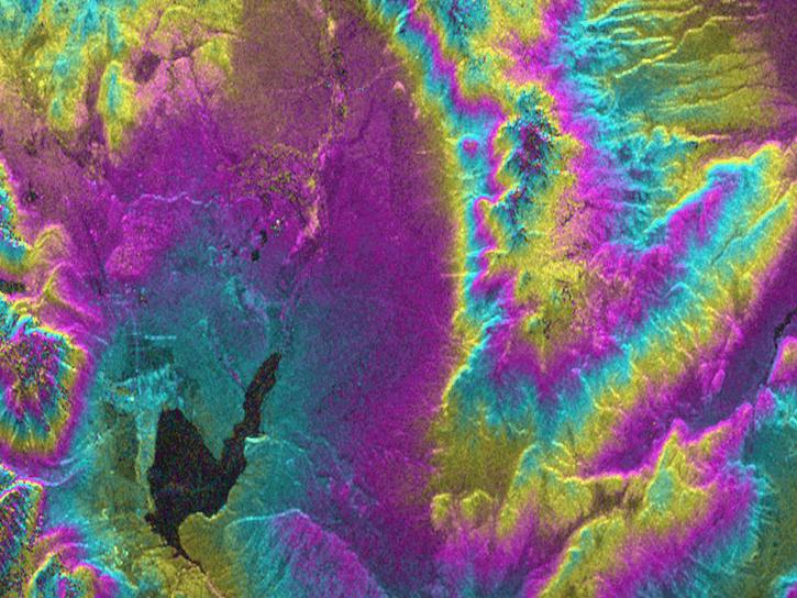
The OPERA Level 3 displacement products provide detailed information on land surface changes, and include the first open-access InSAR time-series displacement products available over North America.
News
May 22, 2025
Join us on Thursday, May 29, to learn about the NASA JPL OPERA Surface Displacement (OPERA-DISP) dataset and how to access and explore the data using ASF DAAC's Displacement Portal.
Webinar
May 14, 2025

A summary of datasets, products, and resources released by NASA’s Distributed Active Archive Centers (DAACs) in April 2025.
News
May 13, 2025

The radiometric terrain corrected synthetic aperture radar data are NASA’s first to meet Committee on Earth Observations Satellites specifications.
News
Dec. 11, 2024
As an expert in interferometric synthetic aperture radar (InSAR), Dr. Bekaert is on the cutting edge of data science.
Data User Story
Nov. 7, 2024

A summary of datasets, products, and resources released by NASA’s Distributed Active Archive Centers (DAACs) in October 2024.
News
Nov. 4, 2024
SHOWING 8 OF 44
Frequently Asked Questions
Earthdata Forum
Our online forum provides a space for users to browse thousands of FAQs about research needs, data, and data applications. You can also submit new questions for our experts to answer.
Submit Questions to Earthdata Forumand View Expert Responses