We are in the process of migrating all NASA Earth science data sites into Earthdata from now until end of 2026. Not all NASA Earth science data and resources will appear here until then. Thank you for your patience as we make this transition.
Read about the Web Unification Project
Data Recipes
Follow one of our data recipes to accomplish a specific task, such as converting data into a certain format for analysis or visualization.
Featured Data Recipes

3 MIN READ
Learn how to create a time-enabled multidimensional mosaic dataset using GeoTIFF/COG files within the GIS desktop program ArcGIS Pro.
Nov. 17, 2025

11 MIN READ
Learn how to phase unwrap an interferogram in this data recipe from NASA’s Alaska Satellite Facility Distributed Active Archive Center (ASF DAAC).
Oct. 18, 2024
Filters
12 MIN READ
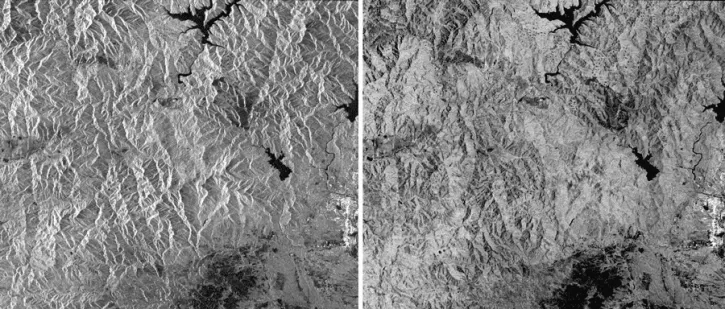
This data recipe shows how to generate an RTC image from Sentinel-1 data using easy-to-follow instructions in a graphical user interface (GUI).
Oct. 18, 2017

6 MIN READ
This data recipe shows how to bring gridded netCDF data into ArcMap and create a GeoTIFF file enabling GIS analysis and map making.
Oct. 10, 2017

4 MIN READ
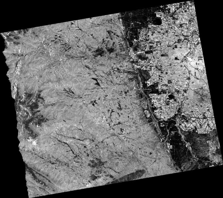
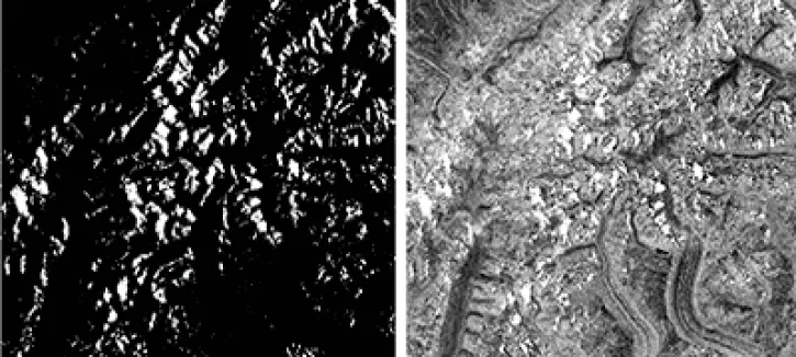
The log-ratio scaling method is an effective approach for change detection in SAR imagery, suppressing background noise and enhancing change features.
Oct. 2, 2017

30 MIN READ
Learn how to work with ASTER Level 1 Precision Terrain Corrected Registered At-Sensor Radiance ASTER L1T HDF-EOS (.hdf) files in R.
Aug. 4, 2017

2 MIN READ
This API allows users to visualize Atmospheric Infrared Sounder data using a Common Metadata Repository search result.
Jan. 5, 2017

4 MIN READ
Learn how to create and unwrap an interferogram with GMT5SAR script in this NASA Alaska Satellite Facility Distributed Active Archive Center (ASF DAAC) data recipe.
Oct. 18, 2016
2 MIN READ
This data recipe walks users through viewing Radiometrically Terrain-Corrected (RTC) images in ArcGIS.
Oct. 18, 2016
3 MIN READ
This data recipe guides users to terrain correct CEOS-formatted data granules for legacy platforms.
Oct. 18, 2016
SHOWING 8 OF 61