Data archived by ASF DAAC have been processed into a series of projects including:
OPERA CSLC and RTC Products
Level-2 co-registered single look complex (CSLC) and radiometrically terrain corrected (RTC) SAR products derived from Sentinel-1 and NISAR data. These products are created by the Observational Products for End-Users from Remote Sensing Analysis (OPERA) project at NASA's Jet Propulsion Laboratory (JPL).
Sentinel-1 Bursts
These are the image components merged in azimuth-time order to create a Sentinel-1 IW or EW SLC sub-swath. Burst products are particularly useful for those interested in using data for small geographic areas, and for workflows that require precise alignment of co-geolocated SLC data (e.g., interferometry and time series analyses).
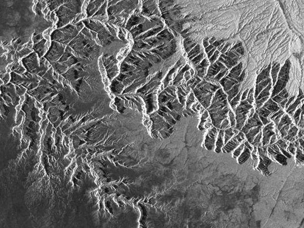
ALOS PALSAR Radiometrically Terrain Corrected Dataset
12.5-m and 30-m pixel spacing RTC GeoTIFF products. Data coverage is worldwide except for Antarctica, Greenland, Iceland, and northern Eurasia (above 60 degrees).
Global Seasonal Sentinel-1 Interferometric Coherence and Backscatter Dataset
First-of-its-kind multi-seasonal representation of the Earth, comprised of C-band SAR repeat-pass interferometric coherence and backscatter images. Global coverage; includes all land masses and ice sheets from 82 degrees northern to 78 degrees southern latitude.
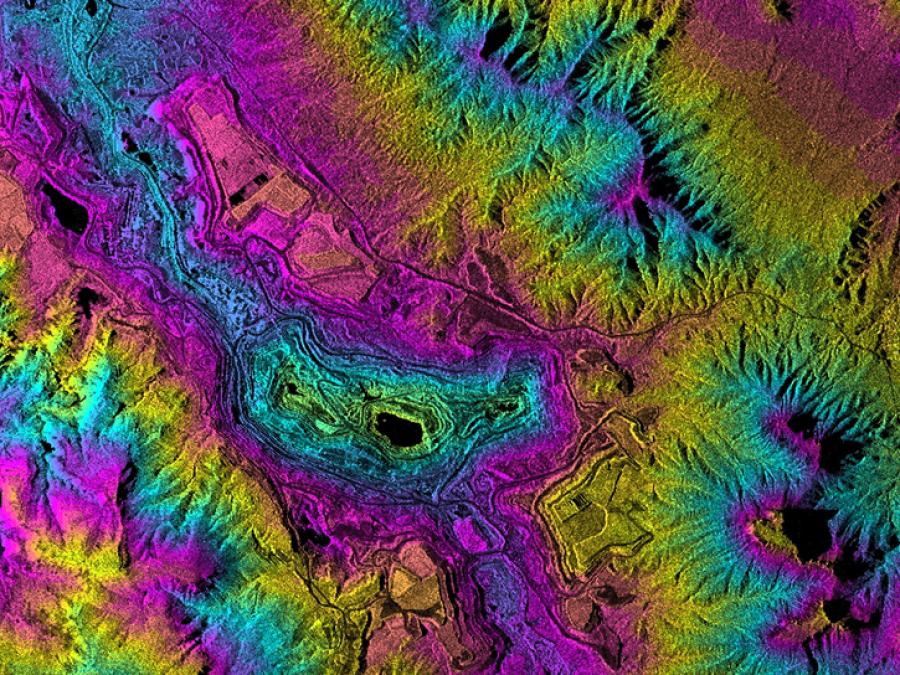
ARIA Sentinel-1 Geocoded Unwrapped (GUNW) Interferograms
Level-2 interferometric products generated by the Jet Propulsion Lab (JPL) ARIA project. The creation, discovery, and distribution of these products is to support InSAR science around tectonically active regions, volcanoes, or areas of subsidence/uplift.
RADARSAT-1Antarctic Mapping Project (RAMP)
Derived data acquired 1997 and 2000 from two RADARSAT-1 satellite missions (AMM-1 and MAMM) to map features of Antarctica and measure ice sheet dynamics. Datasets are available as image tiles and mosaics, and velocity maps. Also available are ice velocity maps from mini-MAMM missions in 2004 and 2007.
Sea Ice MEaSUREs
Three-day SAR composite mosaics of sea ice movement throughout the year, 1989-2014. Coverage includes the entire Arctic basin and the Southern Ocean.
Wetlands MEaSUREs
Maps of wetland extents, vegetation types, and seasonal inundation, derived from SAR data for areas covering crucial wetlands systems.
Global time series maps of inundated areas derived from multiple passive, active, and optical satellite sensors optimized for inundation detection.
Terrestrial Ecology
ALOS PALSAR images for 42 selected sites from various terrestrial-ecology and meteorological-monitoring networks, including FLUXNET, AmeriFlux, Long Term Ecological Research (LTER), and the Greenland Climate Network (GC-Net).
Global Ice Sheet Mapping Orbiter (GISMO)
A part of the NASA Instrument Incubator Project (IIP) with a specific focus in measuring the surface topography of ice sheets, ice-sheet thickness, and uncovering physical properties of the glacier bed using SAR, 2006-2008.
Glacier Speed
The first near-comprehensive dataset of wintertime glacier-flow speeds throughout Alaska — available here and described in Burgess et al., Nature Communications, 2013 — reveals complex patterns of glacier flow throughout the state.
International Polar Year 2007 - 2009
International Polar Year (IPY) was a collaborative research event focused on the Arctic and Antarctic. The history of IPY started in 1882 with the first year-long International Polar Year. Since then, a second IPY occurred in 1932-33 and an International Geophysical Year took place in 1957 -1958. The fourth IPY spanned two years (2007-2009) in order to emphasize a sense of urgency in polar research.