We are in the process of migrating all NASA Earth science data sites into Earthdata from now until end of 2026. Not all NASA Earth science data and resources will appear here until then. Thank you for your patience as we make this transition.
Read about the Web Unification Project
Glaciers/Ice Sheets News
Articles, resources, and announcements from Glaciers/Ice Sheets.

The second data release since launch includes Level-1 to Level-3 L-band data products from locations around the world.
News
Feb. 27, 2026
NISAR L-band data products are now available, giving users a first look at data products from NISAR acquisitions.
News
Jan. 23, 2026

Image captured on January 13, 2026, by the MODIS instrument aboard the Aqua platform.
Worldview Image of the Week
Jan. 15, 2026

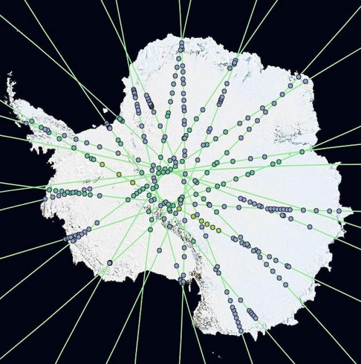
The Global Land Ice Measurements from Space (GLIMS) Glacier Database provides timely data on more than 200,000 glaciers around the world.
Feature Article
April 8, 2025
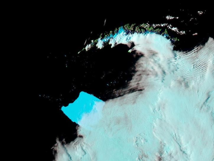
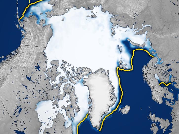
Image captured on Mar 4, 2025, by the MODIS instrument aboard the Aqua platform.
Worldview Image of the Week
March 6, 2025

This is the first in a five-part webinar series to introduce NASA's Ice, Cloud, and land Elevation-2 (ICESat-2) platform and the platform's data, tools, and applications.
Webinar
Oct. 28, 2024
Join us for a tour of enhanced data product landing pages, new user resources, data visualization tools, and a Jupyter Notebook tutorial to access cryospheric data at NASA's National Snow and Ice Data Center DAAC.
Webinar
Aug. 22, 2024
OpenAltimetry lets users explore changes on Earth’s surface around the globe and over time, and all they need is a web browser.
Feature Article
Dec. 20, 2023
SHOWING 8 OF 54