User Guides
Visible Infrared Imaging Radiometer Suite (VIIRS) 375 m Active Fire Algorithm User Guide (Updated July 2018)
MODIS Collection 6 Active Fire Product User's Guide, Revision B (Updated December 2018)
MODIS Collection 5 Active Fire Product User’s Guide, v2.5 (Updated 31 March 2013)
FIRMS, Active Fire, and Burned Area Publications
The publications listed below describe FIRMS, the MODIS Active Fire and Burned Area Products, and explore the level of accuracy of the products.
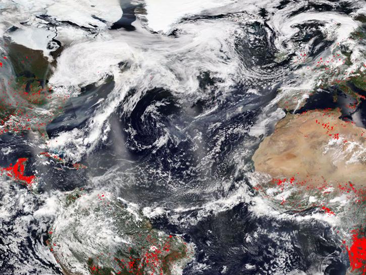
Read about FIRMS in the Earthdata article Fires from Space, and how near real-time MODIS fire detections are used in NASA's Sensing Our Planet publication Orbiting Watchtowers.
Giglio L., Schroeder, W., & Justice, C.O. (2016). The collection 6 MODIS active fire detection algorithm and fire products. Remote Sensing of Environment, 178: 31-41. doi:10.1016/j.rse.2016.02.054 PDF
Schroeder, W., Oliva, P., Giglio, L., & Csiszar, I. A. (2014). The New VIIRS 375m active fire detection data product: algorithm description and initial assessment. Remote Sensing of Environment, 143: 85-96. doi:10.1016/j.rse.2013.12.008 PDF
Justice, C.O., Giglio, L., et al. (2011). MODIS-Derived Global Fire Products. Land Remote Sensing and Global Environmental Change. B. Ramachandran, C.O. Justice, and M.J. Abrams, Springer New York. 11: 661-679. doi:10.1007/978-1-4419-6749-7_29
Davies, D.K., Ilavajhala, S., Wong, M.M., & Justice, C.O. (2009). Fire Information for Resource Management System: Archiving and Distributing MODIS Active Fire Data. IEEE Transactions on Geoscience and Remote Sensing, 47(1): 72-79. doi:10.1109/TGRS.2008.2002076
Schroeder, W., Prins, E., Giglio, L., Csiszar, I., Schimdt, C., Morisette, J., & Morton, D. (2008). Validation of GOES and MODIS active fire detection products using ASTER and ETM+ data. Remote Sensing of Environment, 112 (2008): 2711-2726. doi:10.1016/j.rse.2008.01.005
Csiszar, I., Morisette, J., & Giglio, L. (2006). Validation of active fire detection from moderate resolution satellite sensors: the MODIS example in Northern Eurasia. IEEE Transactions on Geoscience and Remote Sensing, 44(7): 1757-1764. doi:10.1109/TGRS.2006.875941
Giglio, L., van derWerf, G.R., Randerson, J.T., Collatz, G.J., & Kasibhatla, P. (2006). Global estimation of burned area using MODIS active fire observations. Atmospheric Chemistry and Physics, 6: 957-974. doi:10.5194/acp-6-957-2006
Wooster, M.J., Roberts, G., Perry, G.L.W., & Kaufman, Y.J. (2005). Retrieval of biomass combustion rates and totals from fire radiative power observations: FRP derivation and calibration relationships between biomass consumption and fire radiative energy release. Journal of Geophysical Research, 110, D24311. doi:10.1029/2005JD006318
Morisette, J.T., Giglio, L., Csiszar, I., Setzer, A., Schroeder, W., Morton, D., & Justice, C.O. (2005). Validation of MODIS active fire detection products derived from two algorithms. Earth Interactions, 9(9): 1-25. doi: 10.1175/EI141.1
Morisette, J.T., Giglio, L., Csiszar, I., & Justice, C.O. (2005). Validation of the MODIS Active fire product over Southern Africa with ASTER data. International Journal of Remote Sensing, 26: 4239-4264. doi:10.1080/01431160500113526
Wooster, M.J., Zhukov, B., & Oertel, D. (2003). Fire radiative energy for quantitative study of biomass burning: Derivation from the BIRD experimental satellite and comparison to MODIS fire products. Remote Sensing of Environment, 86(1): 83-107. doi:10.1016/S0034-4257(03)00070-1 PDF
Giglio, L., Descloitres, J., Justice, C.O., & Kaufman, Y. (2003). An enhanced contextual fire detection algorithm for MODIS. Remote Sensing of Environment, 87: 273-282. doi: 10.1016/S0034-4257(03)00184-6
Justice, C.O., Giglio, L., Korontzi, S., Owens, J., Morisette, J., Roy, D., Descloitres, J., Alleaume, S., Petitcolin, F., & Kaufman, Y.J. (2002). The MODIS fire products. Remote Sensing of Environment, 83: 244-262. doi:10.1016/S0034-4257(02)00076-7
Kaufman, Y.J., Justice, C.O., Flynn, L.P., Kendall, J.D., Prins, E.M., Giglio, L., Ward, D.E., Menzel, W.P., & Setzer, A.W. (1998). Potential global fire monitoring from EOS‐MODIS.Journal of Geophysical Research: Atmospheres (1984–2012), 103(D24): 32215-32238. doi:10.1029/98jd01644


