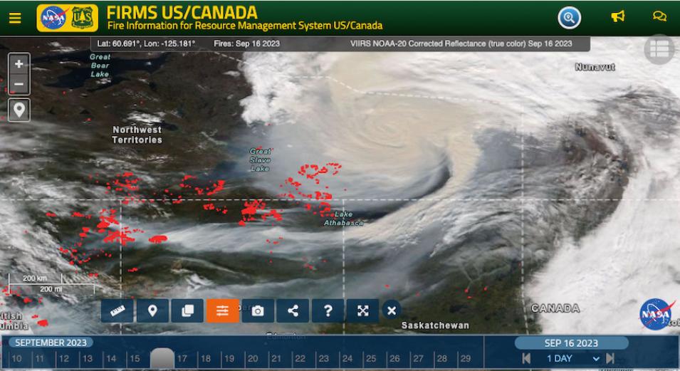
NASA's Fire Information for Resource Management System (FIRMS) enables access to global near real-time satellite imagery from multiple satellites and the ability to track active fire detections, burned areas, smoke plumes, and more. For the past 15 years, NASA FIRMS has provided value-added data products that provide critical information for wildfire management organizations and impacted individuals around the world. Consistently ranking among the top NASA sites visited, FIRMS has developed a broad community of stakeholders who use the system to support wildfire management, including national governments, individual federal agencies, non-governmental organizations, and individual citizens.
FIRMS recently released an expanded User Interface (UI) that supports an increasingly diverse user base and amplifies system accessibility. This expanded UI incorporates additional service and analysis capabilities categorized into a suite of features including Basic and Advanced modes, a Burned Area tab, a Smoke tab, and an Experimental tab (to capture products in development, such as active fire perimeter mapping products). Additional tabs provide easy access to the FIRMS US/Canada portal, Fire Alerts, and Downloads.
While the Basic mode provides a concise interface, provisioning readily interpretable information and data, the Advanced mode includes additional functionality. The features of the Advanced mode support wildfire practitioners and emergency response personnel who require additional information and context to inform active fire management and tactical wildfire response (including the ability to refine the active fire detection temporal search range to hourly and sub-daily [+10 minute] increments).
As the diversity of users engaging with FIRMS continues to expand, FIRMS continues to design a responsive user interface to support users and provide open and readily accessible wildfire data and information.
