Content from all Earth science data sites are migrating into this site from now until end of 2026. Not all NASA Earth science data will appear across the site until then. Thank you for your patience as we make this transition.
Read about the Web Unification Project
Snow Radar Resources
Earthdata resources for users working with NASA’s Snow Radar (SR) data include tutorials and other learning resources, news announcements such as instrument updates and data releases, user guides and related documents, and frequently asked questions.
Snow Radar Learning Resources

NASA’s Operation IceBridge airborne mission has flown over 700 flights through some of the most stunning regions of the Arctic and Antarctic. Join us to learn how to discover and access data that “bridges” the gap between the ICESat and ICESat-2 missions.
Webinar
SHOWING 1 OF 1

Data from NASA’s NSIDC DAAC helps scientists like Dr. Kristin Poinar develop the next generation of models for forecasting sea-level rise from melting glaciers and ice sheets.
Data User Story
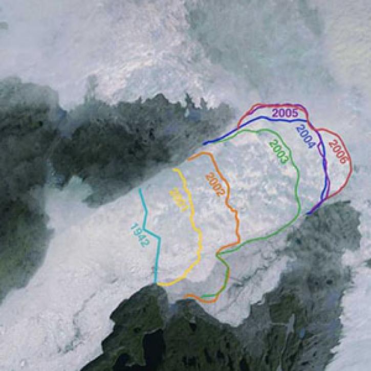
Greenland’s more than 200 major outlet glaciers are constantly on the move—many of them at some of the fastest speeds ever recorded.
Feature Article
SHOWING 2 OF 2
Frequently Asked Questions
Earthdata Forum
Our online forum provides a space for users to browse thousands of FAQs about research needs, data, and data applications. You can also submit new questions for our experts to answer.
Submit Questions to Earthdata Forumand View Expert Responses