We are in the process of migrating all NASA Earth science data sites into Earthdata from now until end of 2026. Not all NASA Earth science data and resources will appear here until then. Thank you for your patience as we make this transition.
Read about the Web Unification Project
Land Management Data Access and Tools
NASA has land management datasets that help researchers assess land use, condition, and other information. Access a range of data and data tools such as Worldview, FIRMS, and Giovanni to make the most of land management data.
Land Management Datasets
SHOWING 10 OF 17
Featured Land Management Observation Method: MODIS
The Moderate Resolution Imaging Spectroradiometer (MODIS) continually collects data in 36 spectral channels, surveying the entire planet every one to two days. MODIS data are used in studies across numerous disciplines, including vegetative health and changes in land cover and land use.
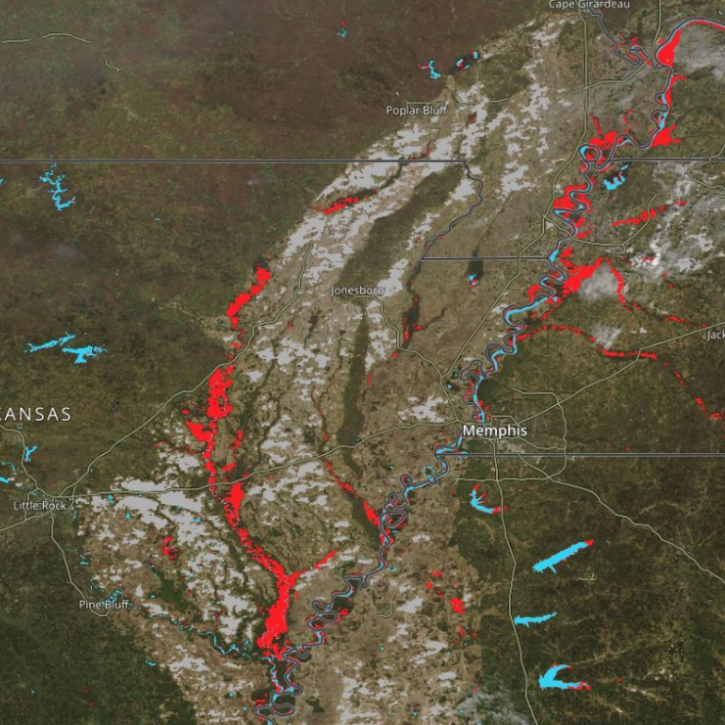
New Near Real-Time (NRT) Global Flood Mapping product from LANCE will continue production of data critical for detecting floods around the globe.
8 MIN READ

Scientists develop routine service for wildfire detection in the continental United States with a latency of less than 60 seconds.
6 MIN READ

Researchers taught the SatVision Top-of-Atmosphere foundation model to recognize MODIS imagery features.
4 MIN READ
Frequently Asked Questions
Earthdata Forum
Our online forum provides a space for users to browse thousands of FAQs about research needs, data, and data applications. You can also submit new questions for our experts to answer.
Submit Questions to Earthdata Forumand View Expert Responses