The Landsat Thematic Mapper (TM) was carried aboard the Landsat 4 and Landsat 5 satellites from July 1982 to May 2012 and had a 16-day repeat cycle. The TM is an advanced, multispectral-scanning, Earth-resources sensor designed to achieve higher image resolution, sharper spectral separation, improved geometric fidelity, and greater radiometric accuracy and resolution than the Multispectral Scanner System (MSS) sensor. TM data are sensed in seven spectral bands simultaneously. Band 6 senses thermal (heat) infrared radiation. Landsat can only acquire night scenes in Band 6. A TM scene has an instantaneous field of view (IFOV) of 30 m x 30 m in Bands 1-5 and 7, while band 6 has an IFOV of 120 m x 120 m on the ground.

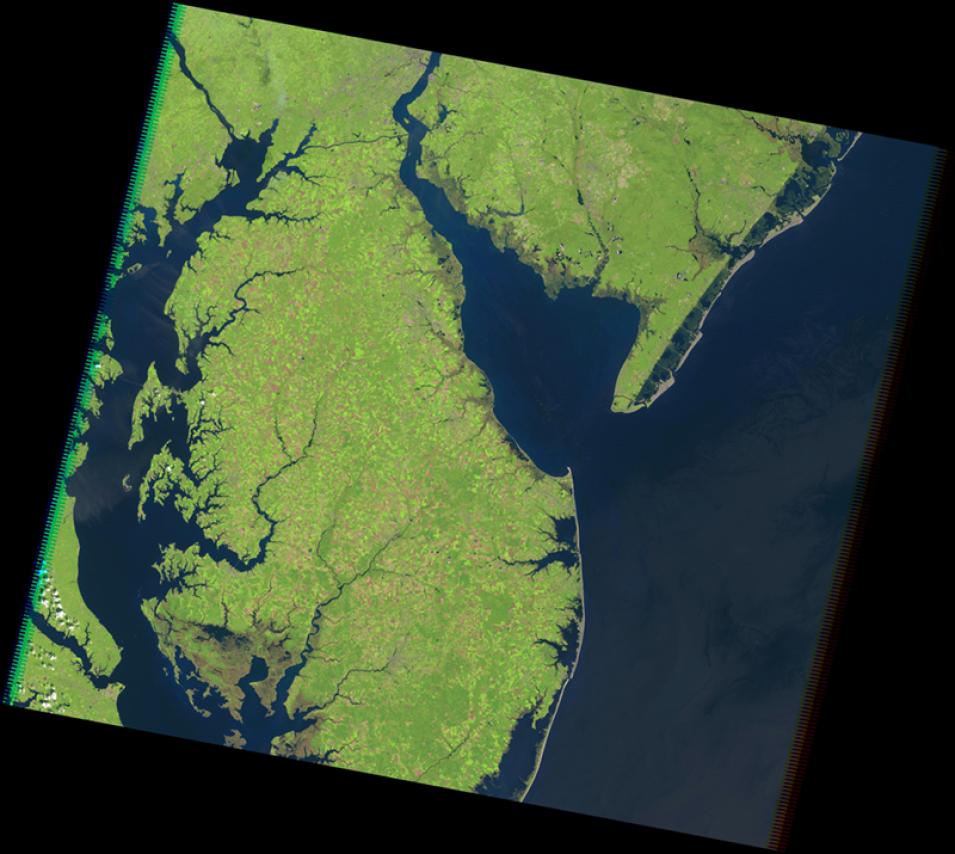
High resolution image of Chesapeake Bay showing green land and blue water
Image Caption

TM image of Chesapeake and Delaware Bay on the U.S. East Coast. Credit: USGS.

Instrument Type

Spectrometers/Radiometers

Instrument Subtype

Imaging Spectrometers/Radiometers

Specifications

Resolution

Spatial

30 m (120 m – thermal)

Spectral

0.45 – 12.5 µm

Temporal

16 days

Frequently Asked Questions

Earthdata Forum

Our online forum provides a space for users to browse thousands of FAQs about research needs, data, and data applications. You can also submit new questions for our experts to answer.

Submit Questions to Earthdata Forumand View Expert Responses

Earthdata
Forum