Content from all Earth science data sites are migrating into this site from now until end of 2026. Not all NASA Earth science data will appear across the site until then. Thank you for your patience as we make this transition.
Read about the Web Unification Project
Hazard Mitigation/Planning News
Articles, resources, and announcements from Hazard Mitigation/Planning.

Learn more about the NASA Commercial Satellite Data Acquisition (CSDA) program vendor ICEYE US and how to discover, access, and work with ICEYE's high-resolution SAR products.
Webinar

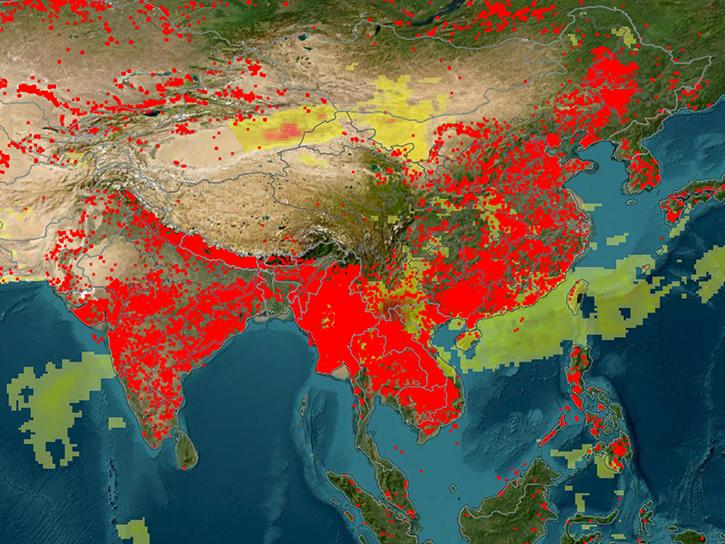
Image captured on Apr 10, 2025, by the MODIS instrument aboard the Terra platform.
Worldview Image of the Week
An upcoming training offered by NASA's ARSET program explores how to use FIRMS to track wildland fire activity and its effects.
News

The Compact Ocean Wind Vector Radiometer (COWVR) and Temporal Experiment for Storms and Tropical Systems (TEMPEST) datasets are the first from the Space Test Program - Houston 8 (STP-H8) mission that aims to test low-cost, light-weight instruments designed for weather applications.
News

Satellite-based maps offer quick first alerts and approximate locations of potential wildfires that are then precisely tracked and fought by teams on the ground.
Feature Article
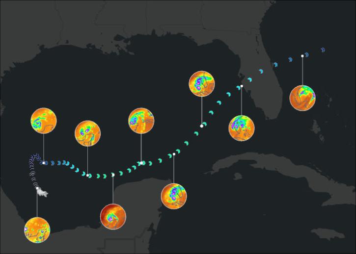
Join us on January 29 at 2PM ET (-05:00 UTC) to learn how to access and use MERRA-2, GPM, TROPICS, and LDAS data provided by NASA's Goddard Earth Sciences Data and Information Services Center (GES DISC) to investigate Hurricane Milton's milestones.
Webinar
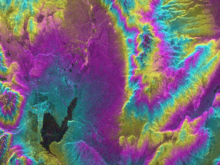
As an expert in interferometric synthetic aperture radar (InSAR), Dr. Bekaert is on the cutting edge of data science.
Data User Story

Sentinel-1 synthetic aperture radar (SAR) data are used to create maps of surface water extent for research, planning, and disaster response.
News
SHOWING 8 OF 57