Content from all Earth science data sites are migrating into this site from now until end of 2026. Not all NASA Earth science data will appear across the site until then. Thank you for your patience as we make this transition.
Read about the Web Unification Project
Convective Clouds/Systems (Observed/Analyzed) News
Articles, resources, and announcements from Convective Clouds/Systems (Observed/Analyzed).
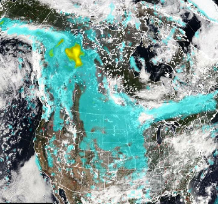
Pyrocumulonimbus (pyroCb) events (fire thunderstorms) caused by wildfires in western Canada were detected by the Ozone Mapping and Profiler Suite (OMPS) instrument July 19-24, 2024.
News
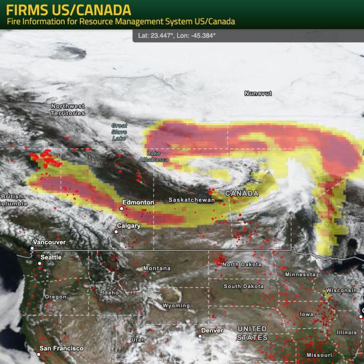
NASA’s Fire Information for Resource Management System (FIRMS) provides natural resource managers with near real-time active fire/hotspot locations using satellite-derived fire information.
Blog

View smoke in FIRMS using Corrected Reflectance Imagery or aerosol indices.
Blog

For meteorologist David Peterson, Ozone Mapping and Profiler Suite (OMPS) data are crucial for studying pyrocumulonimbus events.
Data User Story

NASA’s GHRC DAAC helps scientists like Dr. Timothy Lang use lightning data to better understand the processes in convective storms.
Data User Story

Who Uses NASA Earth Science Data? Dr. Greg Jenkins, to study weather, climate, atmospheric chemistry, and air quality of West Africa.
Data User Story
Two meteorologists pioneered a new application of a single passive microwave frequency using DAAC data in 1995.
Feature Article

SHOWING 8 OF 11