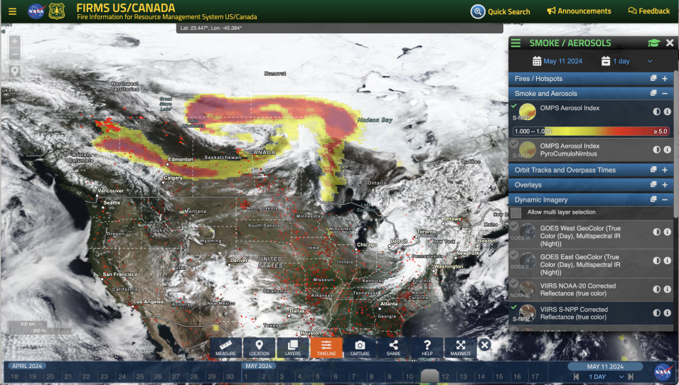
After experiencing the worst fire season on record in 2023 and continuing to face extreme drought conditions in British Columbia, Alberta, and the Northwest Territories, Canada is bracing for what may be another year of severe fires. Two pyrocumulonimbus (pyroCbs) clouds have already been identified around Fort Nelson (one on May 11 and one on May 13, 2024), and the continuing intensity and scale of the fires in the area have caused the evacuation of thousands of people.
PyroCbs are “fire thunderstorms” that can lift large plumes of smoke high up into the air, often reaching the stratosphere. The plumes can then travel long distances, affecting air quality in areas thousands of kilometers from their sources. The location and movement of these smoke plumes are monitored using measurements from satellite instruments such as the Ozone Mapping and Profiler Suite (OMPS) aboard the NASA/NOAA Suomi National Polar-orbiting Partnership (Suomi NPP), NOAA-20, and NOAA-21 satellites. The OMPS instruments, while primarily designed to determine the amount of atmospheric ozone, can also be used to detect atmospheric aerosols such as volcanic ash, dust, and smoke. One particular OMPS product, the Aerosol Index (AI), is extremely useful for monitoring and tracking the movement of such aerosols because it can detect them over any type of land surface (including ice) and over clouds.
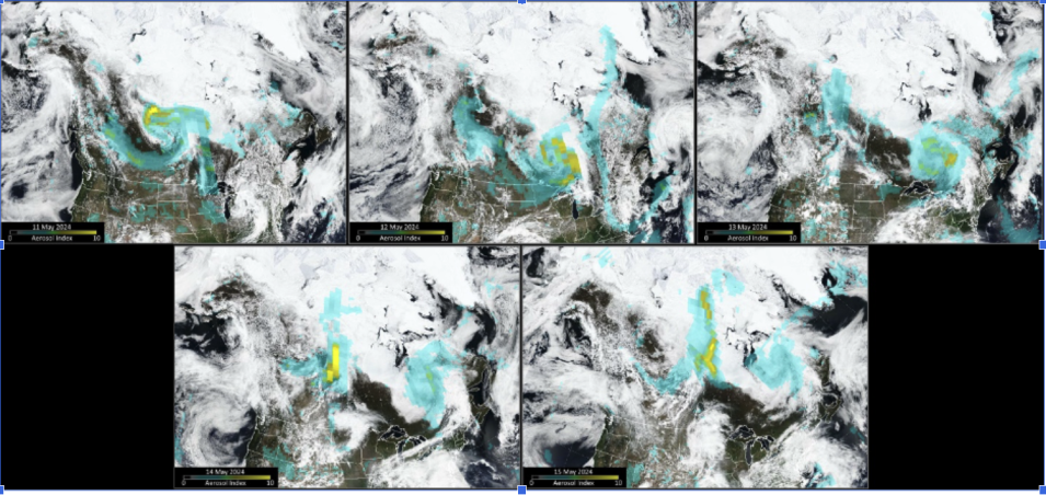
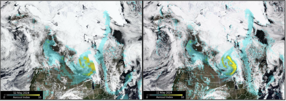
In the figure below, AI measurements from the Suomi-NPP OMPS instrument are shown overlaid on Suomi-NPP Visible Infrared Imaging Radiometer Suite (VIIRS) true-color imagery for May 11 to 15. Higher AI values (shown in yellow) represent higher density (and altitude) smoke plumes. The images acquired on May 11 and 12 show smoke being transported to northern parts of the United States, significantly impacting air quality in Minnesota and Wisconsin, where air quality alerts were issued. Large sections of eastern Canada were also heavily impacted.


