Striking New Ground

Lightning is much more complex—and extreme—than you think.

As legend goes, inventor, author, and diplomat Benjamin Franklin discovered electricity in 1752 when he tied a key to a kite string and flew the kite in a thunderstorm to attract lightning. Some historians debate whether Franklin actually conducted the experiment, which he described in a letter to the Pennsylvania Gazette. Had Franklin’s kite been struck, he would have been electrocuted. Instead, the metal key channeled ambient electricity in the stormy air. Neither did Franklin discover electricity; he was the first to suggest that lightning was, indeed, electricity. Initially, Franklin and others theorized that electricity was a fluid, and lightning illuminated its flow. The kite experiment presented a leap forward, helping prove that lightning was not a fluid at all - it was simply a huge spark caused by charged electrical forces.

Lightning is still unpredictable and hazardous to experiment with; physicist Georg Wilhelm Richmann died trying to replicate Franklin’s kite experiment. Today, however, technology provides safer ways to study lightning, and satellites now track the unruly electrical phenomena in the atmosphere, allowing researchers to learn more about its role in many of Earth’s processes. Lightning observations are helping researchers predict severe weather and may help pinpoint where wildfires have ignited. Changes in global lightning patterns may even shed light on changes in Earth’s climate.
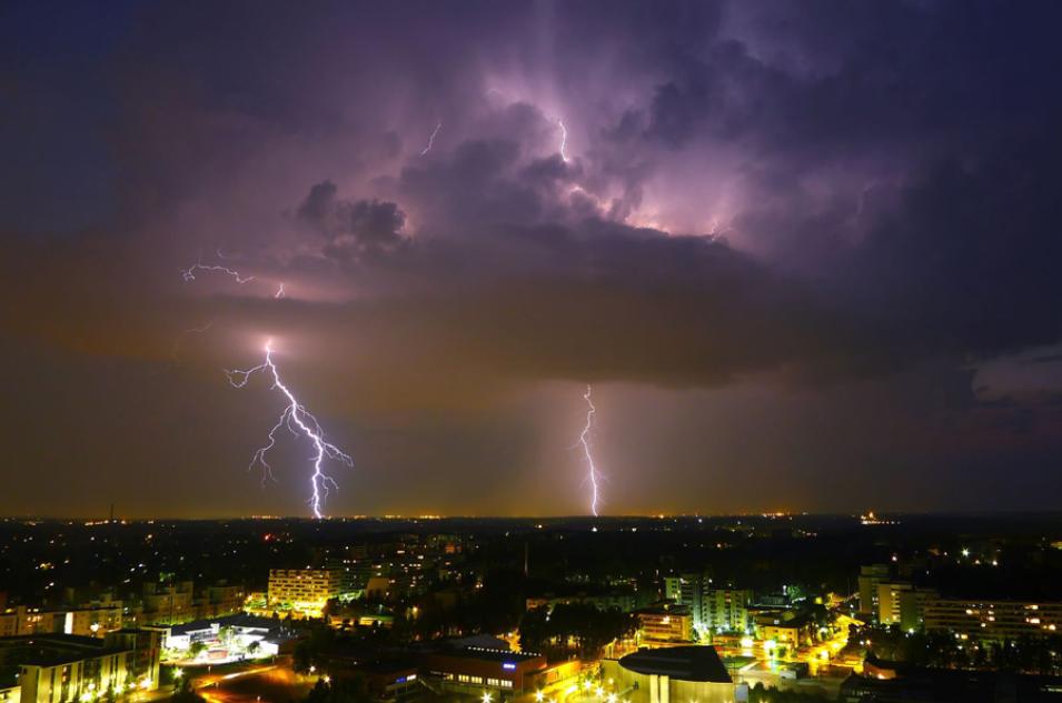
Photograph of a lightning storm over Helsinki, Finland
Image Caption

Lightning strikes near Helsinki, Finland during a 2012 storm. (Courtesy Timo Newton-Syms/Flickr)

Finding the flashes

Ground-based lightning mapping stations have recorded lightning for decades. The stations are often little more than an instrument box the size of a picnic cooler, powered by a single solar panel, and mounted with an antenna to detect passing lightning. “Those produce spectacular imagery of lightning flashes,” said Michael Peterson, a remote sensing scientist at Los Alamos National Laboratory. “But they have very limited range.”

The stations are often placed in rural areas with open fields, but can also be installed in cities on building rooftops. Stations are typically networked in arrays, which detect lightning within a radius of 200 to 300 kilometers (124 to 186 miles). Yet storms frequently sweep outside an array’s range, creating gaps in lightning detection. In addition, arrays exist in only a handful of states, plus Canada, Columbia, Spain, and France. The lack of continuous coverage limited what forecasters could learn about lightning and storm development.

To enable truly global lightning detection, NASA developed space-based lightning-sensing instruments. In 1997, NASA launched the Tropical Rainfall Measuring Mission (TRMM) satellite equipped with a Lightning Imaging Sensor (LIS). The TRMM LIS tracked lightning in a narrow band around the equator spanning 38 degrees North and South, a range that covered the entire length of the African continent, but missed many Northern Hemisphere countries. Like a powerful camera, LIS captured lightning flashes at about 500 frames per second, permitting researchers to follow the evolution of each flash in detail.

A new identical LIS instrument aboard the International Space Station (ISS) extends the TRMM LIS record and increases the swath of observations to 54 degrees North and South, which includes the contiguous United States and more of Europe and Asia. TRMM and ISS LIS standard, science quality data are both available at NASA's Global Hydrometeorology Resource Center (GHRC) Distributed Active Archive Center (DAAC). Near-real time ISS LIS data are available through NASA's Land, Atmosphere Near real-time Capability for EOS (LANCE).

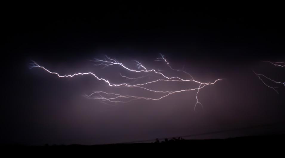
Photograph of branched lightning
Image Caption

Lightning flashes can be complex, such as when they break out into multiple branches. (Courtesy AR Nature Gal/Flickr)

Sensing storm stages

Global views from space reveal that many lightning flashes are far more than a single bolt crackling across the sky. “People tend to think of lightning as a point on a map,” Peterson said. “But the location of the strike hitting the ground only represents a small portion of the larger and complex flash structure. A lightning flash might span hundreds of miles from one point to the other end of it.”

“It’s challenging our view of lightning,” Peterson said. “Back in the olden days, the American Meteorological Society defined a lightning flash as just a series of electrical discharges within a very specific point in time and space.” Now, satellite sensors catch extreme flashes that span surprising distances. “A flash might begin close to Baltimore and might terminate in New York City, affecting four different states along its path,” Peterson said. In another case, Peterson and his colleagues mapped a bolt with 234 visible branches.

These long and often long-lasting extreme flashes can illuminate how storms intensify. “By looking at how the lightning is changing, we can also get a sense for how the storm is changing,” Peterson said. During initial stages when storms are smaller, lightning tends to occur as single flashes that light up a large portion of the surrounding sky. This is because light can more easily escape from smaller storm cells. As storms intensify and increase in size, flashes become more complex, and when viewed from the ground, burgeoning storm clouds may dim or shield parts of the lightning flashes.

“You get a transition from these large and stationary types of lightning flashes, which look like LEDs blinking in the middle of the cloud, to these horizontally extensive long lightning flashes,” Peterson said. Satellite instruments can see through clouds to track how flashes become extreme, developing not just vertically, from cloud to ground, but horizontally, from cloud to cloud.

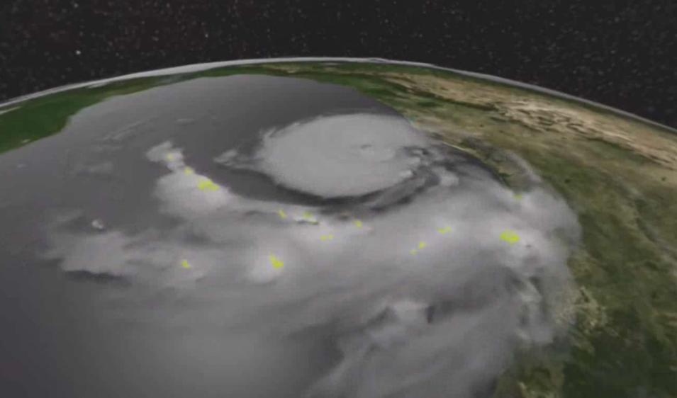
Monitoring this transition could help forecast severe storms. Peterson and other researchers use a combination of LIS, lightning mapping arrays, and other remote sensors, like the Geostationary Lightning Mapper (GLM), to better understand how lightning and storms develop and evolve together. In fact, researchers have used ISS LIS lightning data to watch squalls strengthen into storms as they sweep across the United States, and followed Hurricane Harvey as it intensified over the Gulf of Mexico in August 2017.

Data image showing ISS LIS data over Hurricane Harvey in August 2017
Image Caption

Lightning characteristics can help researchers monitor storm development. This image from the Lightning Imaging Sensor deployed on the International Space Station shows lightning (yellow pixels) in Hurricane Harvey as it approached the Texas coast in 2017. (Courtesy Michael Peterson)

Window into wildfire starts

Although stormy weather often brings much needed rain to arid regions, lightning carries the risk of wildfire. Phil Bitzer, a researcher at the University of Alabama in Huntsville, uses LIS to help identify lightning flashes that may have caused fires. “We noticed something peculiar about the flashes we were seeing,” Bitzer said. “These were actually flashes with something that we call continuing current.” Normally, a lightning flash has a flickering quality, appearing to turn off and on. But these peculiar flashes stayed on for a while longer, exhibiting continuing current.

“With normal lightning, when it strikes a tree, the current doesn’t last long enough to initiate a fire,” Bitzer said. When continuing current lightning strikes a tree, however, the current remains on long enough to heat a tree to its combustion temperature and erupt in flames. “That’s why these peculiar flashes are so important to detect,” Bitzer said.

LIS and GLM are especially useful for identifying continuing current flashes. Bitzer and his colleagues hope to develop an operational system to flag continuing current lightning against a backdrop of other meteorological data. With enough warning, scout teams or drones could pinpoint exact locations to monitor for potential fires, making it easier to quench wildfires before they spread.

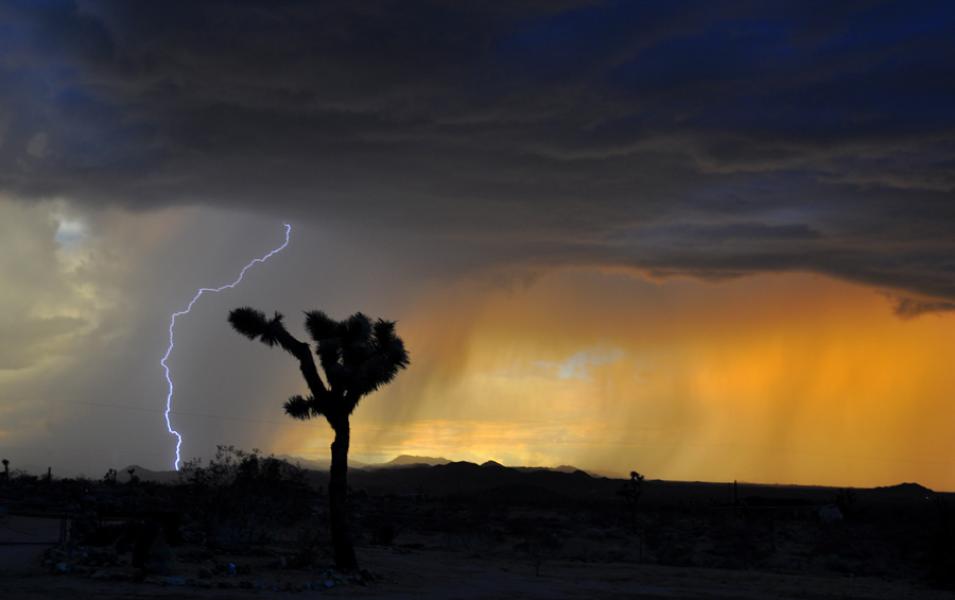
Photograph of cloud-to-ground lightning over the Mojave Desert
Image Caption

This photograph of a storm over the Mojave Desert illustrates cloud-to-ground lightning. (Courtesy Jessie Eastland)

Sparking answers and questions

Each storm and lightning flash may even be part of much larger process. Atmospheric electrical current flows all around us in a continuous stream called the global electrical circuit. Lightning helps transfer some electrical energy between the atmosphere and the ground, charging Earth like a battery. LIS and GLM data reveal places that are more lightning prone than others, such as the Congo Basin in Africa and Venezuela’s Lake Maracaibo. “Identifying these electrified regions has implications for our understanding of the global electrical circuit, which is the global manifestation of electricity,” Peterson said. “It’s kind of like the lightning version of weather versus climate.”

The lengthening satellite record of lightning offers clues about whether storms and lightning patterns around the globe might be changing. “It’s not going to give you a temperature estimate or anything like that,” Peterson said. “But if we can do a good job of understanding how the circuit works, we can use that as a climate indicator.”

Do researchers expect to see a change in lightning as climate changes? “Early work suggested yes; more recent work says maybe, maybe not. It’s an open question,” Bitzer said. “But we certainly have the data to at least answer, ‘Is lightning changing?’”

Even though researchers do not completely understand all the interactions and potential climate connections, TRMM and ISS LIS have generated a growing lightning time series, which researchers continue to learn from. “There’s so much great work that we’ve been able to do with TRMM LIS over the years,” Bitzer said. “It was the first real climatology of worldwide lightning data.” Like Benjamin Franklin, lightning researchers are not just thrill seekers or storm chasers—they too hope to harness the power of lightning. But instead of summoning it from the heavens, they can safely watch and learn from high above.

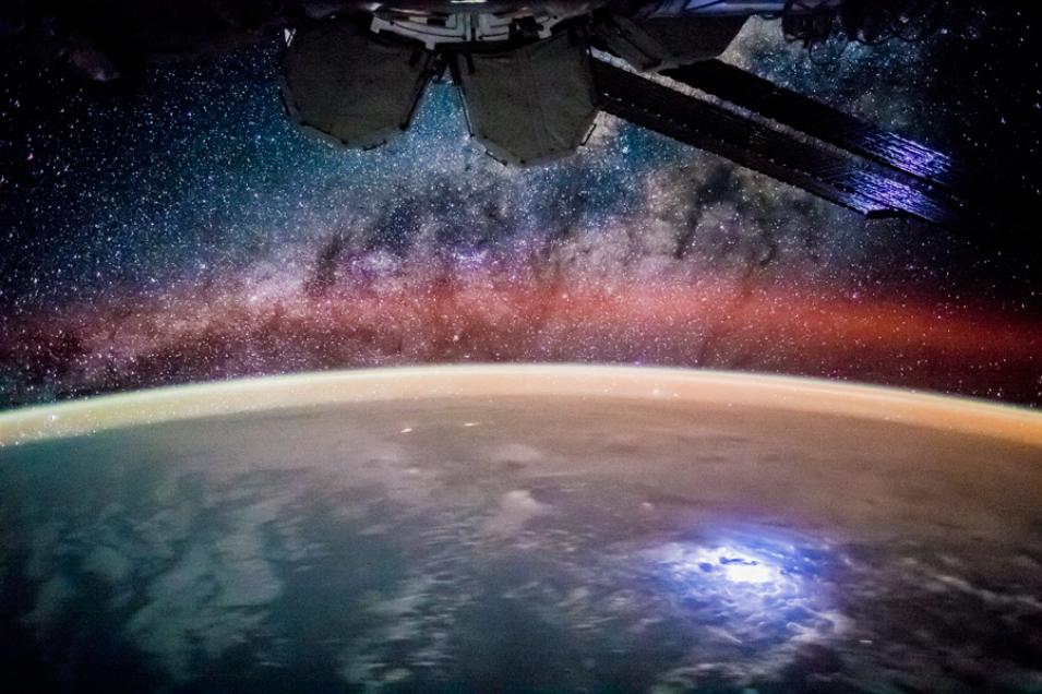
Photograph of lightning taken from the International Space Station
Image Caption

A photograph taken from the International Space Station captures a nighttime lightning flash over the Pacific Ocean. (Courtesy NASA ISS)

For more information

NASA Global Hydrometeorology Resource Center Distributed Active Archive Center (GHRC DAAC)

NASA Land, Atmosphere Near real-time Capability for EOS (LANCE)

NASA Lightning Imaging Sensor on the International Space Station (ISS LIS)

Tropical Rainfall Measuring Mission Lightning Imaging Sensor (TRMM LIS)

Lightning research at NASA GHRC DAAC

References

Blakeslee, Richard J. 1998. Lightning Imaging Sensor (LIS) on TRMM Science Data. Dataset available online from the NASA Global Hydrology Center DAAC, Huntsville, AL, U.S.A. doi:10.5067/LIS/LIS/DATA201.

Blakeslee, Richard J. 2017. Non-Quality Controlled Lightning Imaging Sensor (LIS) on International Space Station (ISS) Provisional Science Data. Dataset available online from the NASA Global Hydrology Center DAAC, Huntsville, AL, U.S.A. doi:10.5067/LIS/ISSLIS/DATA204.

Blakeslee, Richard J. 2017. NRT Lightning Imaging Sensor (LIS) on International Space Station (ISS) Provisional Science Data. Dataset available online from the NASA Global Hydrology Center DAAC, Huntsville, AL, U.S.A. doi:10.5067/LIS/ISSLIS/DATA205.

Peterson, M., S. Rudlosky, and W. Deierling. 2017. The evolution and structure of extreme optical lightning flashes. Journal of Geophysical Research: Atmospheres 122: 13,370-13,386. doi:10.1002/2017JD026855.

Yanoviak, S. P., E. M. Gora, J. M, Burchfield, P. M. Bitzer, and M. Detto. 2017. Quantification and identification of lightning damage in tropical forests. Ecology and Evolution 7: 5,111-5,122. doi:10.1002/ece3.3095.

Yanoviak, S. P., E. M. Gora, J. Fredley, P. M. Bitzer, R.-M. Muzika, and W. P Carson. 2015. Direct effects of lightning in temperate forests: a review and preliminary survey in a hemlock-hardwood forest of the northern Unites States. Canadian Journal of Forest Research 45: 1,258-1,268. doi:10.1139/cjfr-2015-0081.

About the remote sensing data
Satellite Tropical Rainfall Measuring Mission (TRMM)
Platform International Space Station (ISS) ISS
Sensor Lightning Imaging Sensor (LIS) LIS LIS
Data sets

NRT Lightning Imaging Sensor (LIS) on International Space Station (ISS) Provisional Science Data

Non-Quality Controlled Lightning Imaging Sensor (LIS) on International Space Station (ISS) Provisional Science Data

Lightning Imaging Sensor (LIS) on TRMM Science Data

Resolution 4 to 8 kilometer 4 to 8 kilometer 3 to 6 kilometer
Parameter Lightning Lightning Lightning
DAACs NASA Land, Atmosphere Near real-time Capability for EOS (LANCE) NASA Global Hydrometeorology Resource Center Distributed Active Archive Center (GHRC DAAC) NASA GHRC DAAC
LANCE ISS LIS data are only stored for seven days and are not archived.

Details

Last Updated

Published

Data Center/Project

Global Hydrometeorology Resource Center DAAC (GHRC DAAC)