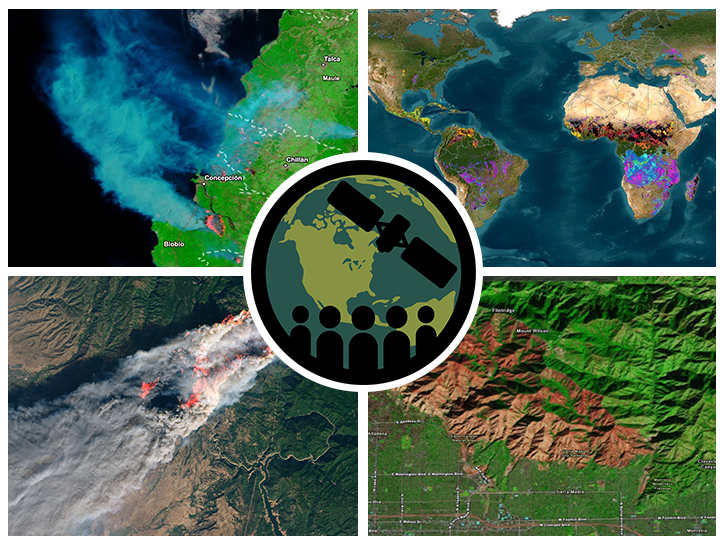
To access active fire/hotspot data, maps, and alerts, the Fire Information for Resource Management System (FIRMS) provides access, with minimal delay, to data and imagery that helps users identify the location, extent, and intensity of wildfire activity.
LANCE
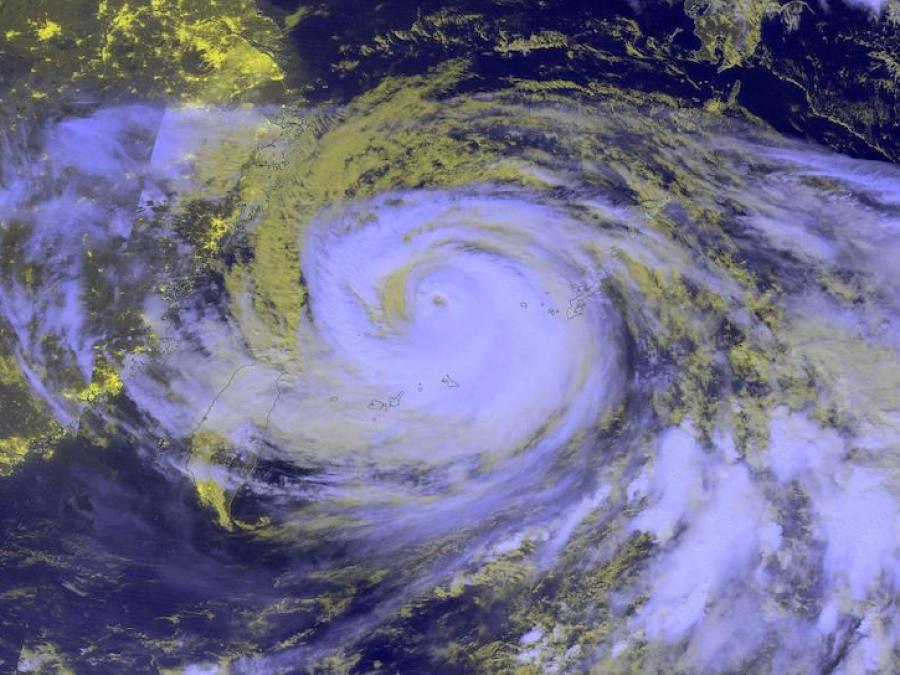
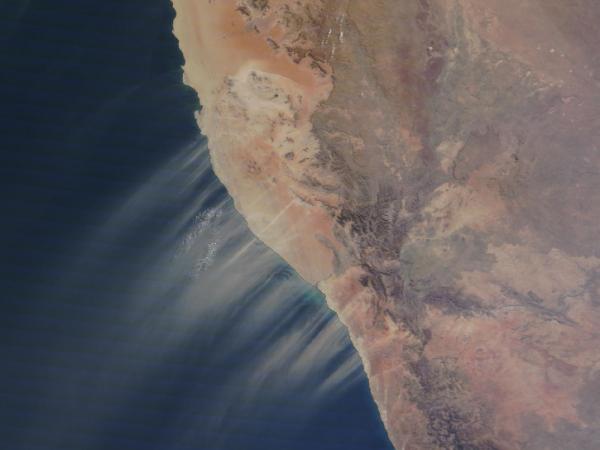
NASA's Land, Atmosphere Near real-time Capability for Earth observation (LANCE) supports users interested in monitoring a wide variety of natural and human-created phenomena using near real-time (NRT) data and imagery that are made available much quicker than routine processing allows.
Most LANCE data products are available within 3 hours from satellite observation, with imagery generally available 3 to 5 hours after an observation through Worldview and GIBS. If latency is not a primary concern, users are encouraged to use standard science products, which are created using the best available ancillary, calibration, and ephemeris information.
LANCE was established to meet the timely needs of applications such as facilitating numerical weather and climate prediction; forecasting and monitoring natural hazards, assessing ecological/invasive species, agriculture, and air quality; providing help with disaster relief; and ensuring homeland security.
Read an Earthdata article celebrating LANCE's Top 10 milestones over a decade of service.
History
NASA’s Earth Observing System Data and Information System (EOSDIS) provides a wealth of data and products supporting scientific research of the atmosphere, oceans, and land. Data from the Earth Observing System (EOS) instruments aboard the Terra, Aqua, and Aura platforms make global measurements daily. The measurements are processed into higher-level "standard" products within 8 to 40 hours of observation and then made available to users, primarily Earth science researchers.
However, application users, operational agencies, and even researchers require EOS products to support research and applications, such as numerical weather and climate prediction; forecasting and monitoring natural hazards, ecological/invasive species, agriculture, and air quality; providing help with disaster relief; and homeland security. These users often need data much sooner than routine science processing allows, usually within three hours, and are willing to trade science product quality for timely access. In response to this need, NASA developed LANCE.
Building on the existing EOSDIS near real-time (NRT) capabilities, NASA’s Earth Science Division sponsored the development of LANCE. LANCE consists of special processing elements, co-located with selected EOSDIS Distributed Active Archive Centers (DAACs) and processing facilities. These elements process expedited data from the Earth Observing System (EOS) Data and Operations System (EDOS) using optimized science algorithms to provide data in near real-time. LANCE development is jointly sponsored by the Flight, Research and Analysis, and Applied Sciences Programs within NASA’s Earth Science Division (ESD).
The Lightning Imaging Sensor (LIS) on the International Space Station was decommissioned on November 16, 2023. There will be no further near real-time data from this instrument. Please see the Earthdata article Lightning Imaging Sensor's Nearly 25-Year Data Record Ends.
The processing of Multi-angle Imaging SpectroRadiometer (MISR) NRT products has not resumed since the change in orbit altitude of NASA's Terra platform in October 2022, which required major updates to Level 1 and Level 2 products. The processing of MISR standard products resumed on November 1, 2023. These products are available through Earthdata search.
System Architecture
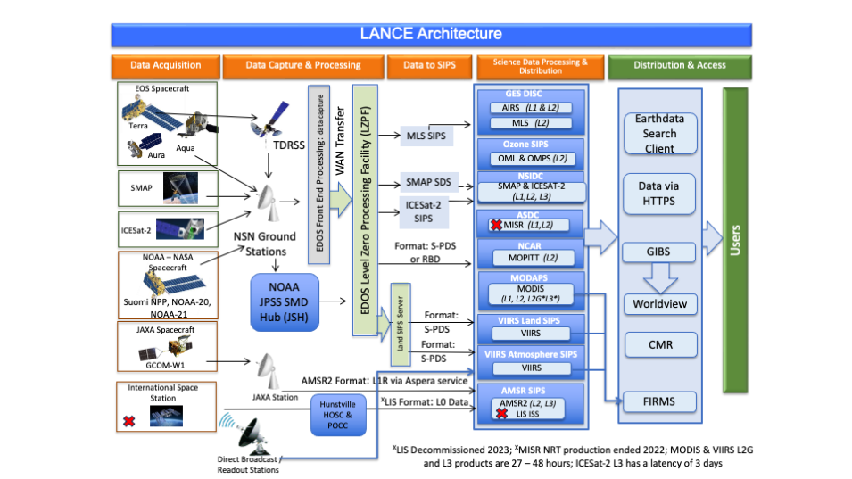
The LANCE architecture leverages existing near real-time satellite data processing systems that are managed by the Earth Science Data and Information System (ESDIS) Project at NASA's Goddard Space Flight Center.
LANCE elements are located at the following facilities:
- Advanced Microwave Scanning Radiometer Science Investigator-led Processing System (AMSR SIPS) providing AMSR2 data and Lightning Information System (LIS) on the International Space Station (ISS)
- Atmospheric Science Data Center (ASDC) providing Multi-angle Imaging SpectroRadiometer (MISR) data with support from the MISR Science Computing Facility at NASA's Jet Propulsion Laboratory (JPL)
- Goddard Earth Sciences Data and Information Services Center (GES DISC) providing Atmospheric Infrared Sounder (AIRS), and Microwave Limb Sounder (MLS) data via the MLS SIPS at JPL
- Moderate Resolution Imaging Spectroradiometer (MODIS) Adaptive Processing System (MODAPS) providing MODIS and Visible Infrared Imaging Radiometer Suite (VIIRS) data
- Measurement of Pollution in the Troposphere SIPS (MOPITT SIPS) providing MOPITT data via the National Center for Atmospheric Research
- Ozone Monitoring Instrument SIPS (OMI SIPS) providing OMI data
- Suomi National Polar-orbiting Partnership (Suomi NPP) Ozone Mapping Profiler Suite (OMPS SIPS) providing OMPS data
- Suomi NPP Land SIPS providing VIIRS Land data
- Suomi NPP Atmosphere SIPS providing VIIRS Atmosphere data
NASA supports full and open sharing of data. We ask that if you provide Land, Atmosphere Near real-time Capability for Earth observation (LANCE) data to a third party, you follow the guidelines below and replicate or provide a link to our disclaimer. View LANCE's citation and acknowledgments as part of the broader Earth Science Data and Information System (ESDIS) Project Data Use Guidance.
Acknowledgments
We acknowledge the use of data and/or imagery from NASA's Land, Atmosphere Near real-time Capability for Earth observations (LANCE) (https://earthdata.nasa.gov/lance), part of NASA's Earth Science Data and Information System (ESDIS).
Disclaimer
LANCE is operated by the ESDIS Project. The information presented through LANCE, GIBS, Worldview, and FIRMS are provided “as is” and users bear all responsibility and liability for their use of data, and for any loss of business or profits, or for any indirect, incidental or consequential damages arising out of any use of, or inability to use, the data, even if NASA or ESDIS were previously advised of the possibility of such damages, or for any other claim by you or any other person. Due to the spatial resolution and other characteristics of these data, their use for tactical decision-making or informing about conditions at a local scale are not advised.
ESDIS makes no representations or warranties of any kind, express or implied, including implied warranties of fitness for a particular purpose or merchantability, or with respect to the accuracy of or the absence or the presence or defects or errors in data, databases of other information. The designations employed in the data do not imply the expression of any opinion whatsoever on the part of ESDIS concerning the legal or development status of any country, territory, city or area or of its authorities, or concerning the delimitation of its frontiers or boundaries. For more information please contact Earthdata Support.
Other NRT Data
The following NRT data are also available from NASA.
Rainfall estimates - IMERG
NASA's Integrated Multi-satellitE Retrievals for GPM (IMERG) algorithm combines data from all passive-microwave instruments in the (Global Precipitation Measurement) GPM Constellation to provide rainfall estimates.
Ocean Biology Ocean Biology Distributed Active Archive Center (OB.DAAC)
Managed by NASA's Ocean Biology Processing Group (OBPG), OB.DAAC is responsible for archiving satellite ocean biology data produced or collected under NASA’s Earth Observing System Data and Information System (EOSDIS). OB.DAAC's holdings include NRT data from both NASA and partner space organizations.
Physical Oceanography DAAC (PO.DAAC)
Visualize and download NRT data for ocean and climate research from the PO.DAAC web portal.
