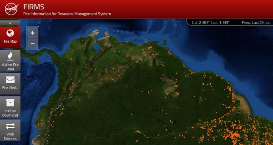
The Fire Information for Resource Management System (FIRMS), initially developed at the University of Maryland, was transitioned to LANCE in May 2010, and became formally operational in LANCE in May 2012. FIRMS provides near real-time thermal anomaly data (including an approximate location of a detected hotspot) from the MODIS and Visible Infrared Imaging Radiometer Suite (VIIRS) instruments. Global active fire detections can be viewed interactively using the FIRMS Fire Map application, and FIRMS users can sign up to receive email Fire Alerts notifying them of potential fires detected in specific areas of interest. Through this free service, alerts can be received in near real-time or as daily or weekly summaries. Every week approximately 240,000 FIRMS alerts (including daily alerts, Rapid Alerts, and weekly alerts) are sent to users in more than 160 countries, according to the FIRMS team.
7. Improvements in Near Real-Time Data Latency and Reliability
The overall LANCE objective is to provide near real-time data and imagery generally within three hours of an instrument observation. NASA’s Earth Observing System (EOS) Data and Operations System (EDOS) is the primary provider of all LANCE instrument data directly downloaded from NASA EOS satellites like Terra, Aqua, and Aura. In 2011, EDOS made significant enhancements to the way these data were streamed from ground stations and also improved the way these data were processed and prioritized, which helped reduce the latency for data delivered to LANCE. Today, most LANCE products are available to data users less than three hours after an observation, with some products being available less than two hours after acquisition.
8. First non-EOS mission instrument data added to LANCE in 2015
The addition of Advanced Microwave Scanning Radiometer 2 (AMSR2) data from the Japan Aerospace Exploration Agency Global Change Observation Mission-Water (GCOM-W1) satellite in March 2015 was the first non-EOS mission data added to LANCE. Currently, six unique AMSR2 data products are available through LANCE.
9. Significant growth in data available through LANCE
The addition of AMSR2 near real-time data was followed by the addition of data from several more instruments, including:
- Multi-angle Imaging SpectroRadiometer (MISR) aboard NASA’s Terra satellite; June 2016
- Measurement of Pollution in the Troposphere (MOPITT) aboard Terra; October 2017
- VIIRS aboard the joint NASA/NOAA Suomi National Polar-orbiting Partnership (Suomi NPP) satellite; first of several data products added February 2016
- Ozone Mapping Profiler Suite (OMPS) aboard Suomi NPP; December 2017
- VIIRS aboard the joint NASA/NOAA NOAA-20 satellite; August 2019
Along with new instrument data, new data products are constantly being added to the system. Recent additions include:
- VIIRS Nighttime Imagery product; January 2017
- MODIS Global Near Real-Time Flood Product; approved in April 2017
- OMPS Pyrocumulonimbus product (PyroCb); October 2018
- MODIS Thermal Alert System (MODVOLC); produced in 2019 by LANCE from MODIS data to serve the volcano monitoring community and distributed primarily through the University of Hawaii
- MODIS Multi-Angle Implementation of Atmospheric Correction (MAIAC); produced in 2019 by LANCE to support the air quality and climate/atmospheric modeling communities
