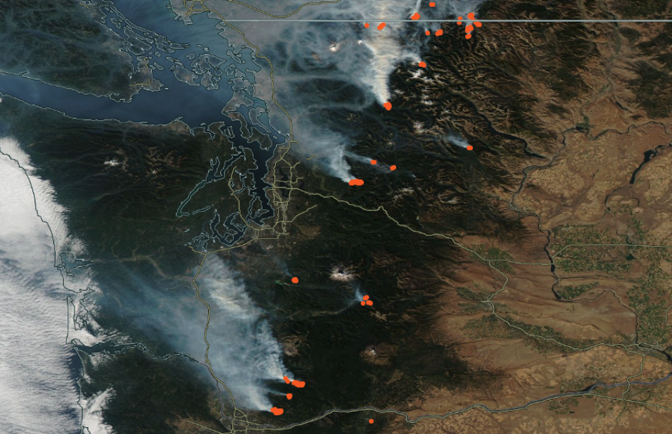
The map shows a true color, or natural color, corrected reflectance image of smoke emanating from fires burning in the state of Washington, USA, on October 16, 2022. This image was acquired by the Moderate Resolution Imaging Spectroradiometer (MODIS) aboard NASA's Aqua satellite. Overlaid on the image is the "Fires and Thermal Anomalies" layer showing the active fire detections as orange dots. Click on a dot to find out more information about the point, such as Fire Radiative Power and Detection Confidence. The National Interagency Fire Center (NIFC) reports that the West is experiencing above normal temperatures and conditions of dry/low humidity.
To fully interact with the map, click on the image to open the full version of Worldview in a new browser tab.
Visit Worldview to visualize near real-time imagery from NASA's EOSDIS; check out more Worldview weekly images in our archive.
Reference: National Fire News (October 17, 2022). National Interagency Fire Center.
