We are in the process of migrating all NASA Earth science data sites into Earthdata from now until end of 2026. Not all NASA Earth science data and resources will appear here until then. Thank you for your patience as we make this transition.
Read about the Web Unification Project
Geodetics News
Articles, resources, and announcements from Geodetics.

Join us on Tues., Sept. 30, to learn more about NASA CSDA program vendor PlanetiQ and to learn how to discover, access, and work with their GNSS Radio Occultation (GNSS-RO) data.
Webinar
Sept. 16, 2025
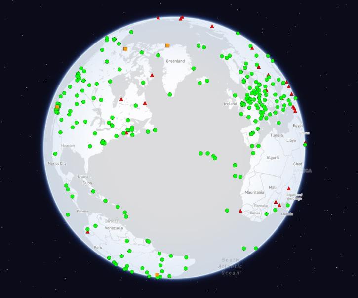
The International Global Navigation Satellite Systems Service (IGS), a voluntary federation of more than 200 self-funding entities, celebrates three decades of providing high-quality data.
Feature Article
Feb. 29, 2024

Bock provides NASA's Crustal Dynamics Data Information System (CDDIS) with data products based on ground displacement data.
Data User Story
Aug. 24, 2023

Data from NASA’s Crustal Dynamics Data Information System help Dr. Sharyl Byram find the exact coordinates of any point on Earth.
Data User Story
Aug. 25, 2022

Who uses NASA Earth science data? Dr. Erricos C. Pavlis, to help accurately measure Earth.
Data User Story
April 22, 2021
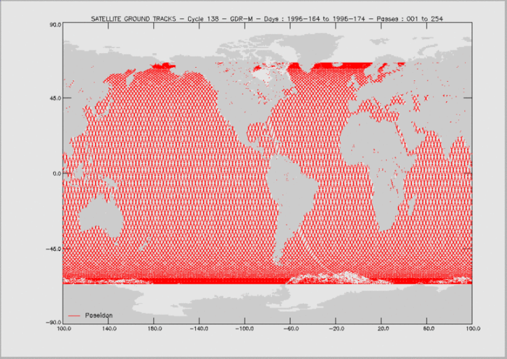
Knowing the precise location of a satellite in space is critical for determining sea surface height and, through this, the rate of global mean sea level rise.
Feature Article
April 19, 2021

50 years ago this October, the first successful Satellite Laser Range measurements were taken, ushering in a new era in the science of measuring the Earth’s exact shape, center of gravity, and precise rotation.
Feature Article
April 15, 2021

The Global Sea Level Change portal is NASA’s home for sea level change data and information. As the portal’s principal investigator, Dr. Boening ensures that it remains a key resource for both scientists and the general public.
Data User Story
April 12, 2021
SHOWING 8 OF 25