Aerosol index (AI) is a measurement related to Aerosol Optical Depth (AOD) that indicates an increased concentration of tiny particles called aerosols suspended in the atmosphere. In general, a lower AI value indicates clearer skies due to a lower concentration of aerosols. 

Aerosol index is an ideal metric for tracking the evolution of episodic aerosol plumes from dust outbreaks, volcanic ash, significant fire events, and biomass burning. Those plumes can harm human and ecosystem health, disrupt the work of important industries, and pose significant hazards to transportation. 

The calculation of the aerosol index is based on wavelength-dependent changes in Rayleigh scattering in the ultraviolet (UV) spectral range, where ozone absorption is very small. The aerosol index is derived from normalized radiances using two wavelength pairs at 340 and 378.5 nanometers. 

UV aerosol index can be calculated even if clouds are present, enabling daily global coverage. Instruments aboard NASA’s Earth-observing satellites provide worldwide aerosol index data, including near real-time data. 

Get UV Aerosol Index Data

Access a range of datasets and data tools to further your UV aerosol index research.

Learn How to Use UV Aerosol Index Data
Access a range of webinars, tutorials, data recipes, and data stories to enhance your knowledge of Earth Observation data.
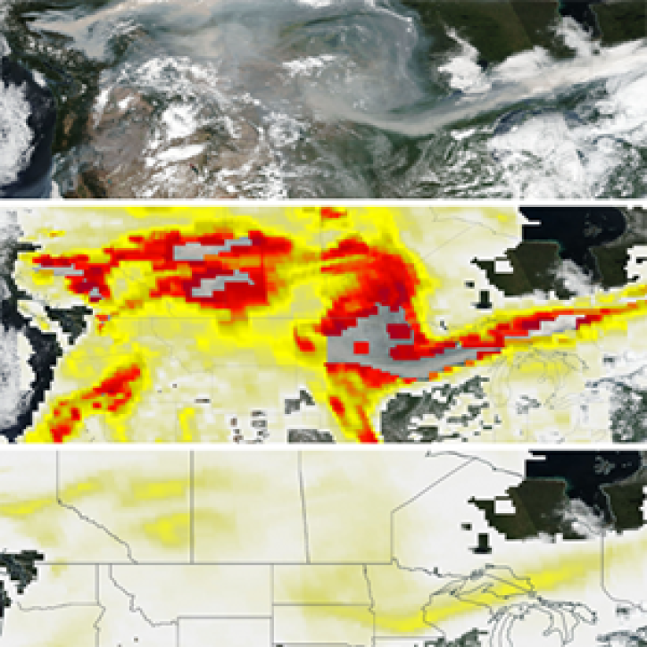
Suomi-NPP images from August 17, 2018 showing the new OMPS PyroCumuloNimbus AI product
OMPS Product Provides a Better View of High-Aerosol Events
The PyroCumuloNimbus product for the Ozone Mapping and Profiler Suite (OMPS) makes it easier to track and analyze high concentrations of aerosols from wildfires and similar events.
Dr. David Peterson, Naval Research Laboratory meteorologist poses with a globe showing wavy patterns of satellite data. Peterson is in a white, button-down shirt and sitting in the lobby of a large office building. A staircase with a white railing can be seen in the background.
Data User: Dr. David Peterson
For meteorologist David Peterson, Ozone Mapping and Profiler Suite (OMPS) data are crucial for studying pyrocumulonimbus events.
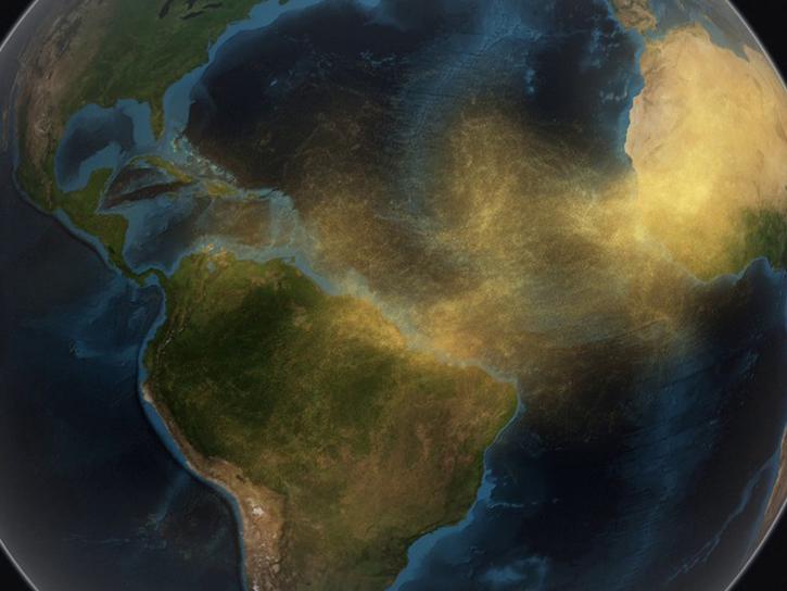
image of dust travelling from the Sahara to the Caribbean
A Clearer View of the Haze – Using NASA GES DISC Data Tools to Examine the June 2020 Sahara Dust Event
Explore how GES DISC tools and data products can augment ongoing vital research on the dynamics of dust transport in Earth’s atmosphere. This webinar will investigate the June 2020 Sahara Dust Event over Barbados as a use case.
Discover and Visualize UV Aerosol Index Data
NASA data help us understand Earth's changing systems in more detail than ever before, and visualizations bring these data to life, making Earth science concepts accessible, beautiful, and impactful.
Data visualization is a powerful tool for analysis, trend and pattern recognition, and communication. Our resources help you find world-class data visualizations to complement and enhance your research. We also have tools and tutorials to help you translate UV aerosol index data into compelling visuals.
Image
This image shows clouds, snow, and smoke over North America. Snow and clouds are colored white. The ground is in shades of brown and green. Over Southern Canada is a swirl of yellow and red to mark the location of a wildfire smoke plume.
The base true-color corrected reflectance images were acquired by the Visible Infrared Imaging Radiometer Suite (VIIRS) aboard the joint NASA/NOAA Suomi National Polar-orbiting Partnership (Suomi NPP) platform. Overlaid on the base images is the UV Aerosol Index layer from the Ozone Mapping and Profiler Suite (OMPS) instrument. This layer indicates the presence of ultraviolet (UV)-absorbing particles in the atmosphere (aerosols) such as soot from burning fires and desert dust.

Join Our Community of NASA Data Users

While NASA data are openly available without restriction, an Earthdata Login is required to download data and to use some tools with full functionality.

Learn About the Benefits of Earthdata Login

Frequently Asked Questions

Earthdata Forum

Our online forum provides a space for users to browse thousands of FAQs about research needs, data, and data applications. You can also submit new questions for our experts to answer.

Submit Questions to Earthdata Forumand View Expert Responses

Earthdata
Forum