Access a range of datasets and data tools to further your research into atmospheric rivers.
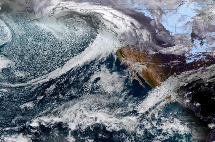
Atmospheric rivers are narrow, elongated corridors of concentrated moisture transport that occur in the lower atmosphere, ahead of the cold front in an extratropical cyclone. They are the largest transport mechanisms of freshwater on Earth. Their significant contribution of rain and snow to the water budget of western states of the United States is vital for water storage and management decisions in the region. However, because atmospheric rivers can deposit significant amounts of precipitation in short periods of time, they may also cause flooding and mudslides.
Atmospheric rivers are a part of the larger system of extratropical cyclones that transport heat and moisture from the tropics toward the poles. Conditions that contribute to their formation usually include high humidity levels, strong low-level winds, and a moist neutral atmospheric profile. They typically occur in the extratropical North Pacific/Atlantic, southeastern Pacific, and South Atlantic oceans, often making landfall on the west coasts of North and South America. Other regions that experience atmospheric river landfalls include Greenland, Antarctica, and the south-central United States.
Instruments aboard NASA’s Earth-observing satellites collect data that can be used to identify atmospheric rivers, such as water vapor, wind, and precipitation. Ground-based instruments like rain gauges and ground radars are also used to study atmospheric river characteristics and effects. By helping scientists identify atmospheric rivers, NASA’s data products further enable studies of topics such as climate change trends, floods, atmospheric processes, water management, and weather forecasting.
Learn How to Use Atmospheric Rivers Data


Join Our Community of NASA Data Users
While NASA data are openly available without restriction, an Earthdata Login is required to download data and to use some tools with full functionality.
Learn About the Benefits of Earthdata LoginFrequently Asked Questions
Earthdata Forum
Our online forum provides a space for users to browse thousands of FAQs about research needs, data, and data applications. You can also submit new questions for our experts to answer.
Submit Questions to Earthdata Forumand View Expert Responses