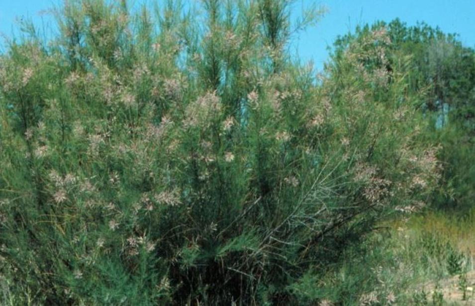
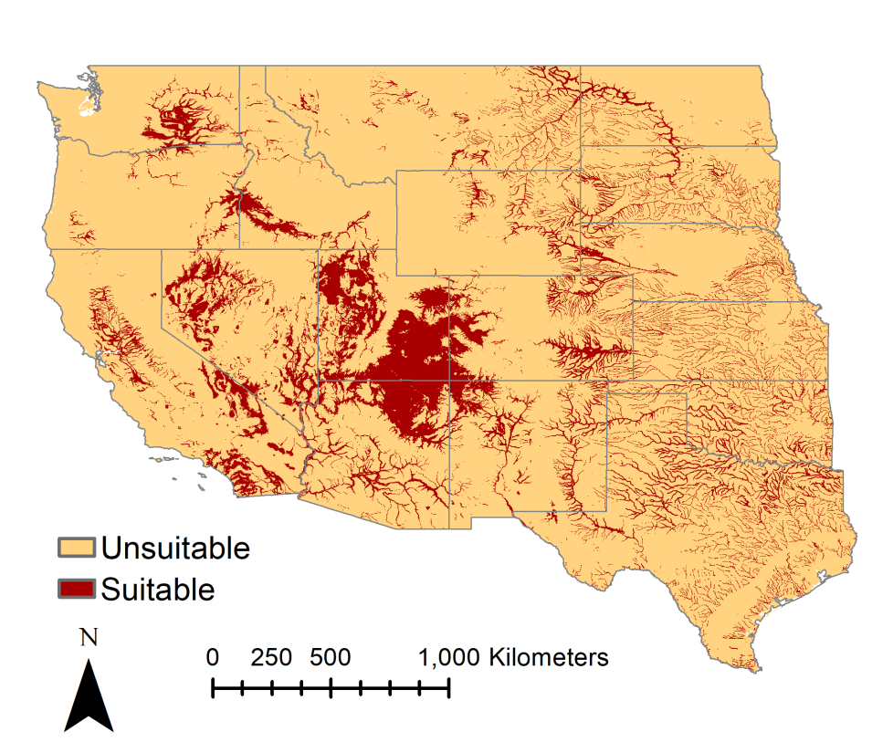
With needle-like leaves and pink flowers that develop in the spring, the small, shrub-like tree called tamarisk (Tamarix spp.) is commonly found on riverbanks in the western United States. Also known as saltcedar, tamarisk was introduced to the U.S. from Eurasia in the late 1800s. Tamarisk was originally celebrated as a successful species introduction because of its ability to stabilize riverbanks and tolerate drought. But the species has since replaced native vegetation in riparian ecosystems across drier parts of the West, altering the dynamics of these ecosystems. Tamarisk is now the second most common riparian tree in western North America after cottonwood (Populus spp.).
Invasive species like tamarisk cost the U.S. economy about $120 billion a year, according to a 2005 study. The U.S. Geological Survey (USGS) reports that "the current annual environmental, economic, and health-related costs of invasive species exceed those of all other natural disasters combined."
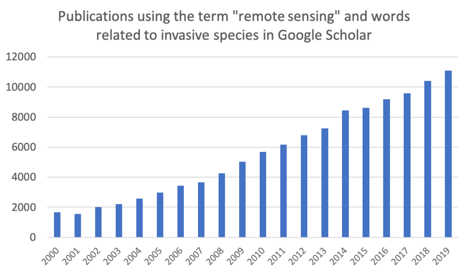
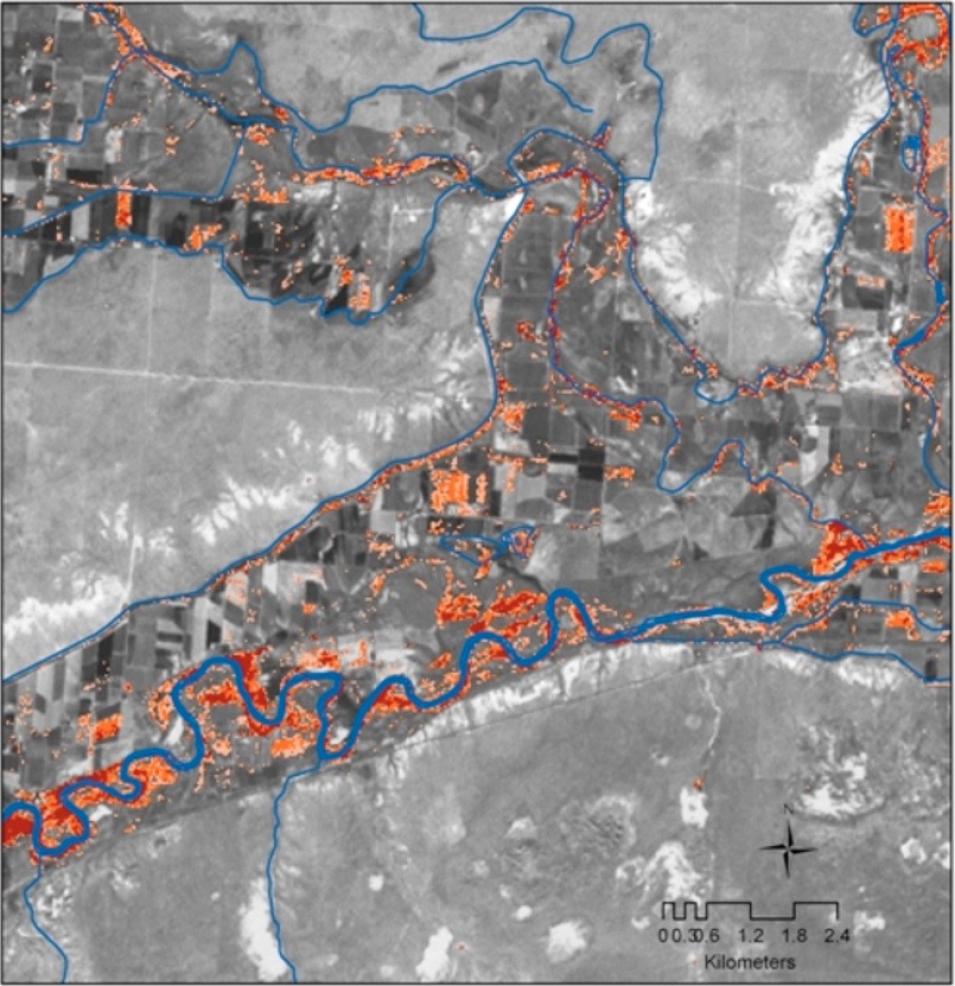
Because invasives have such a large impact on our economy and environment, many researchers at universities and federal agencies are developing strategies to monitor and control them in order to minimize their damage. Remote sensing has been used increasingly to track invasive species distributions and predict where they might spread.
From Surveys to Sensors
On-the-ground surveys, where researchers directly observe species and their habitats, are essential to understanding the characteristics of invasion. Researchers use field surveys to map the current distributions of invasive species and to determine factors related to their establishment and spread. Surveys are time-consuming, expensive, and can be limited in geographic scope, which is why researchers often rely on remote sensing to aid their work.
Mapping the presence of plants and animals using remote sensing can be done with optical imagery when the species has distinguishing characteristics. For example, large animals or plants with a distinctive presence may be detected using freely-available optical imagery from instruments onboard Landsat (30 m resolution), Moderate Resolution Imaging Spectroradiometer (MODIS, 250–1000 m resolution), or other multispectral instruments.
Airborne instruments have also been used to detect unique differences between plant species. For example, Andrew and Ustin (2008) used the HyMap scanner, an airborne hyperspectral imaging sensor, to identify the unique white flowers of invasive pepperweed (Lepidium latifolium) near Sacramento, California. Similarly, Mitchell and Glenn (2009) used HyMap to identify the yellow bracts of invasive leafy spurge (Euphorbia esula) in southeast Idaho.
