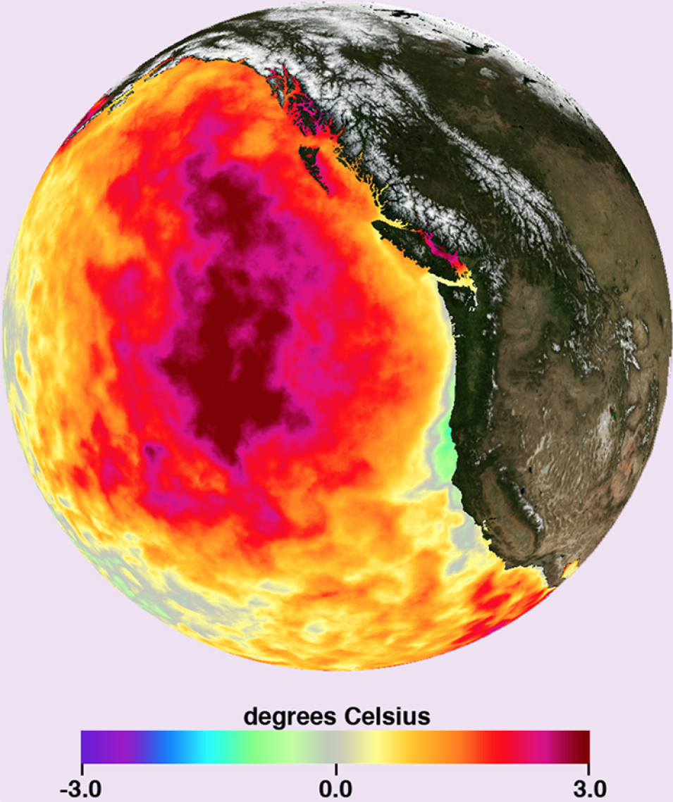
New high-resolution sea surface temperature data are now available in the cloud, as part of the NASA—Amazon Web Services (AWS) Space Act Agreement, executed by the Interagency Implementation and Advanced Concepts Team (IMPACT) for NASA's Earth Science Data Systems (ESDS) Program. This development provides researchers with easy access to some of the highest resolution ocean temperature data available, which are optimized for cloud computing.
“It feels like this is an inflection point where computers go from being a tool for science to an enabler of science,” said Dr. Chelle Gentemann, senior scientist at Farallon Institute, who spearheaded the effort to move the data with the help of NASA's Physical Oceanography Distributed Active Archive Center (PO.DAAC).
Multi-Scale Ultra High Resolution Sea Surface Temperature (MUR SST) data are available from June 2002 to present at 1 km spatial resolution. Making these data freely available in the cloud is part of a larger effort by ESDS to enable researchers and commercial data users to access and work with large quantities of data quickly. These MUR SST data are optimized so that researchers can do large-scale analyses in the cloud.
“Something that took me three months and 3000 lines of code now takes me 10 minutes with 20 lines of code. Now you don't have to have a big supercomputer and a system administrator to figure out how to download, store, and access the data,” Gentemann said. “This is a transformative technology that's paving the way for the democratization of science.”
High-resolution SST data can be used to study how climate is affecting marine ecosystems and contributing to more marine heat waves. Marine heat waves can create toxic algae blooms that can disrupt marine ecosystems and threaten marine mammals and fisheries. Dr. Gentemann has been using these data to see how marine heatwaves affected the U.S. West Coast.
MUR SST data reflect the truly international, multi-agency collaborations that are occurring as a result of NASA's open data policies. They are produced by merging data from multiple sensors: NASA's Advanced Microwave Scanning Radiometer-EOS (AMSR-E), Japan Aerospace Exploration Agency's Advanced Microwave Scanning Radiometer 2 on GCOM-W1, the Moderate Resolution Imaging Spectroradiometer (MODIS) on NASA's Aqua and Terra satellites, the U.S. Navy's microwave WindSat radiometer, the Advanced Very High Resolution Radiometer (AVHRR) on several NOAA and European Space Agency satellites, and in-situ SST observations from the NOAA iQuam project.
Tutorials have been provided for accessing the MUR SST data using Python on the Registry of Open Data on AWS. You can also view the data on PO.DAAC's State of the Ocean tool. The MUR SST data were optimized for the cloud using computing credits provided by AWS Cloud Credits for Research Program and is available via the AWS Public Dataset Program.
More Information
