Notebook and Satellite

A simple tool helps a scientist open the remotely sense world to her students.

Travis Belote had not planned on making space in his already-packed brain for much new information. Just finishing doctoral studies in biology at Virginia Tech, he was about to head for Flagstaff, Arizona, to study the Colorado Plateau drylands. He thought he might squeeze in an overview of one last topic, taught by professor Kirsten de Beurs: Remote Sensing and Phenology. He decided to audit the course, attending one lecture a week.

But soon after the start of the class with the abstract-sounding name, Belote changed his mind. He said, “I ended up coming every day. I looked forward to every lecture because of the fascinating material.” Belote, who anticipated a career of field studies, was inspired to see new angles and scales for research, using satellite instruments that cover the globe. Belote said, “It was eye-opening to see the scale of the data that were being collected with this frequency, all the questions you could potentially ask with the data, all the different applications.” So what hooked him?

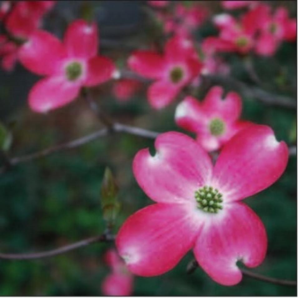
dogwood bloom
Image Caption

Students in Kirsten de Beurs’ Remote Sensing and Phenology class observed the trees on campus for phenological events, such as the bloom of this dogwood tree. They compared these field observations to satellite vegetation data to obtain a broader and more accurate interpretation of these start-of-season signals. (Courtesy A. R. Laurent)

Observing seasonal changes

As he attended the lectures, Belote found that he and de Beurs had a common thread in their research interests: that of ecosystem disturbance. Belote wanted to sort out the factors that can push a landscape over the edge. A dry grassland, such as the Colorado Plateau, might remain stable even after disturbances like fire, drought, or heavy animal and human activity. But sometimes, disturbances can change a grassy prairie to scrubby desert. Belote was especially interested in how land use, such as the intense grazing from ranching, affects an area; at what point can it transform an ecosystem long-term?

Similarly, as a phenologist, de Beurs studies how disturbances change a system, by observing the subtle evidence of plant and animal life cycle events. Triggered by seasons and climate, these life cycles are a closely connected chain of events that sustain an ecosystem. Plants bud when temperature and moisture are just right, bearing flowers, fruit, and seeds that support insects and animals; insects hatch and become food for birds. If something is introduced that disturbs these patterns of timing, effects can cascade through the system, and changes show up on a larger scale.

De Beurs has a radar-like curiosity for detecting all kinds of disturbances in satellite data, piqued during her own doctoral work, a study of Kazakhstan after the former Soviet Union fell apart in 1991. De Beurs said, “We asked, what is the effect of the collapse of the Soviet Union on land use? You can take the concept that the political collapse is an ecological disturbance, too. We can see evidence of land use in remote sensing data, when things green up and brown down. I wondered if we could see the changes in land use that we heard were occurring there, using satellite vegetation data.” Rapid social change had driven farmers to abandon agriculture and migrate to cities. Her interest in the topic continues, as she currently prepares for a more detailed, multi-year study of Russian agriculture, which is projected to decline due to an expected 29 percent population decline by 2050.

Plant and animal evidence

Typical of her all-angles approach, de Beurs’ upcoming Russian study will integrate field, satellite, demographic, and socioeconomic data. It was de Beurs’ integrative approach to phenology that opened new ways of thinking for Belote. De Beurs proved how studies can be conducted with satellite data and computer, as well as notebook and pencil, even for a subject as small as the gypsy moth. De Beurs said, “The gypsy moth larva eats leaves until trees are almost bare.” The Moderate Resolution Imaging Spectroradiometer (MODIS) instrument, on NASA’s Aqua and Terra satellites, could detect the defoliation by sensing leaf reflectance, but the window is small. “The trees refoliate within the same growing season; that makes it hard to track what’s happening,” she said.
Kazakh nomads
Image Caption

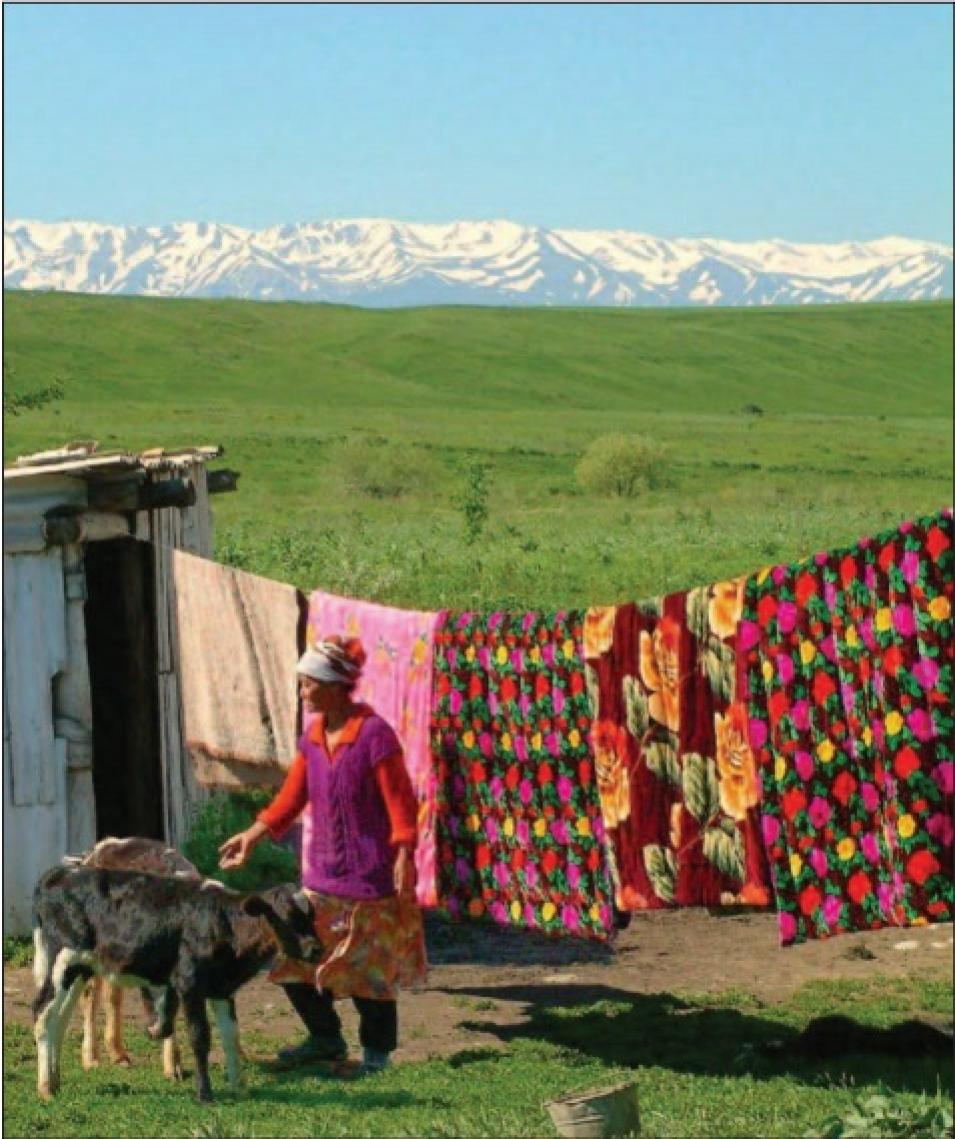
Nomadic people, such as this woman and her cattle, formed the pastoral society common in Kazakhstan before the Soviet Union converted thousands of acres to large-scale modern farm operations. After the Soviet Union collapsed, many large farms disbanded. Satellites detected the changes in land cover, indicating these areas were reverting to their former, uncultivated state. (Courtesy A. C. Braime)

Field data collected on moth lifecycles told her when and where to look in the MODIS data, and she spotted the damage. De Beurs said, “Traditionally, when people look at land cover change, they use a high-resolution sensor like Landsat, but those data are not available as often—they’re like little postage stamps. MODIS offers a much broader overview, helping you see the large-scale effects.”

Over the course of the semester, Belote was surprised to learn the many angles for studying phenology. Belote said, “She lectured on so many different ways we can approach the subject. You can look at the phenology of animals, such as the timing of bird migration or frog breeding. And it’s possible to use historical resources, such as records of cherry blossom festivals in Japan, going back thousands of years, or even Thoreau’s journals.” Henry David Thoreau, better known for works such as Walden, also recorded detailed bud and bloom observations from 1852 to 1858. His phenological observations serve as valuable records of pre-Industrial Revolution climate, and a point of comparison for more recent field or satellite observations.

Zooming in

De Beurs works to give her students hands-on experience with this sort of integrated study. During the class experiments, Belote realized the value of combining data from various sources. De Beurs said, “I try to get them to link satellite data with field observations. Students are interested in the effects of climate change, so I ask them to choose some area of the globe to study. I have them look at start of season changes, so they get to figure out how that works.” Recent studies have shown that spring is coming earlier to mid-latitudes in the Northern Hemisphere, so de Beurs asks them to look at trends in start of season dates, from 2000 to 2008. “The data register is still really short,” she said. “But it can pick up large climate oscillation patterns, and it can pick up disturbances even with coarse resolution data.”

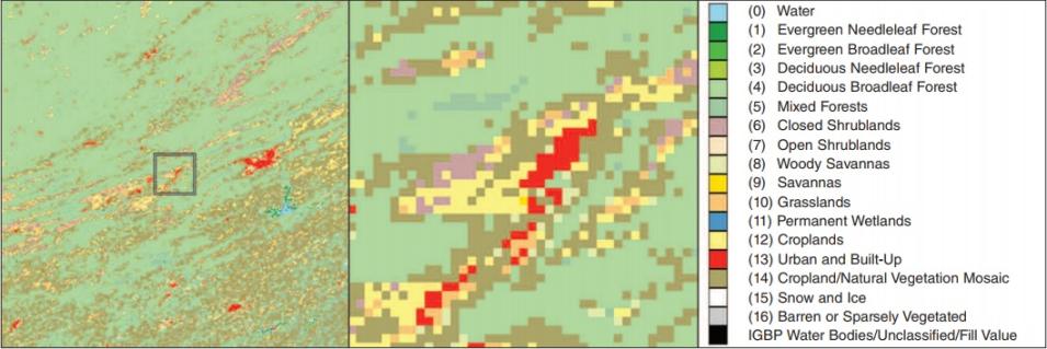
The students must first obtain the MODIS data for their study area, so de Beurs refers students to NASA's Oak Ridge National Laboratory Distributed Active Archive Center (ORNL DAAC). ORNL DAAC developed a data access tool for field researchers, the MODIS subsetter, permitting her students to select a very small amount of data that corresponds to a particular study area. De Beurs said, “The ORNL DAAC tool is very nice for students to work with. The information comes with data quality statements along with ancillary information like a land cover map. The oodles and oodles of data that I work with would be too much for students, even if they just download one tile. You can’t process a whole bunch of tiles in a fifty-minute lab.” De Beurs also gives students a program she wrote that processes the MODIS data and calculates start of season dates.

land cover classification
Image Caption

Land cover classification maps such as this one, including the Virginia Tech campus at Blacksburg, help researchers and students alike interpret a subset of Moderate Resolution Imaging Spectroradiometer (MODIS) vegetation data. Each of the classifications may have a different characteristic in the data. The buildings and pavement associated with the campus are clearly visible as red pixels on the land cover map. The classification maps are also derived from MODIS data. (Courtesy NASA Oak Ridge National Laboratory Distributed Active Archive Center)

Next, she asks them to compare the data to a nearby area. “How do you link a big pixel with field observations?” she said. “I ask them to go outside and monitor the green up of trees on campus. It works quite well with the satellite data.” Other assignments taught students to combine data to interpret variability across an area. Belote said, “In one assignment, we studied large areas called biomes, such as temperate, deciduous forests, or tropical systems. But we also pulled out anthromes, different land use classes, such as rural village, agricultural, urban, and wildland, and looked at how they influenced phenology across the biomes. Why might agricultural zones differ? We tried to see if crops were planted at a certain time, when they green up, when they would be harvested. So then we could speak broadly about what was happening.”

Now out of class and in the midst of his Colorado Plateau study, Belote remains inspired by the potential for remote sensing data on phenology to lead him to larger insights. He said, “It was such a cool link across organisms, and also across ways of exploring the questions. In the midst of taking that class, I ended up pulling MODIS net primary productivity data to compare to forest inventory and analysis plots. It’s an idea that still intrigues me. What can we learn from satellites to help us manage an ecosystem?”

References

de Beurs, K. M., and P. A. Townsend. 2008. Estimating the effect of gypsy moth defoliation using MODIS. Remote Sensing of Environment 112: 3983−3990.

de Beurs, K. M., and G. M. Henebry. 2004. Land surface phenology, climatic variation, and institutional change: Analyzing agricultural land cover change in Kazakhstan. Remote Sensing of Environment 89(4): 497−509.

Oak Ridge National Laboratory Distributed Active Archive Center (ORNL DAAC). 2009. MODIS subsetted land products, Collection 5. Available online from ORNL DAAC, Oak Ridge, Tennessee, U.S.A. Accessed June 30, 2009. https://daac.ornl.gov/cgi-bin/dataset_lister.pl?p=12

For more information

NASA Land Processes Distributed Active Archive Center (LP DAAC)

NASA Oak Ridge National Laboratory DAAC (ORNL DAAC)

MODIS Land Data Products and Services

MODIS Land Products Subsets

About the remote sensing data
Satellites Aqua and Terra Aqua and Terra
Sensor Moderate Resolution Imaging Spectroradiometer (MODIS) MODIS
Data sets MODIS Subsets - Vegetation Indices Vegetation Indices, Surface Reflectance
Resolution 250 meter, 500 meter, and 1 kilometer 250 meter, 500 meter, and 1 kilometer
Parameters Normalized Difference Vegetation Index (NDVI) and Enhanced Vegetation Index (EVI) Normalized Difference Vegetation Index (NDVI), Enhanced Vegetation Index (EVI), Normalized Difference Water Index (NDWI), Normalized Difference Infrared Index (NDII)
DAACs NASA Oak Ridge National Laboratory Distributed Active Archive Center (ORNL DAAC) NASA Land Processes DAAC (LP DAAC)

Details

Last Updated

Published

Data Center/Project

Land Processes DAAC (LP DAAC)
Oak Ridge National Laboratory DAAC (ORNL DAAC)