For the first time, scientists can rely on not one, but two satellites to monitor ocean surface topography, or sea level. TOPEX/Poseidon and Jason-1, launched nearly 10 years apart, are now engaged in a tandem mission, creating a spaceborne ocean observatory that provides scientists, climate modelers, and forecasters with nearly global coverage of the world’s ocean surface at an unprecedented level of precision.
Double Vision

Invented in the late 19th century, the Sigsbee Sounding Machine was the first efficient piano wire sounding instrument. The basic design of ocean sounding instruments remained the same for the next 50 years. Image courtesy of the NOAA Photo Library.
Achieving this high-quality coverage hasn’t been easy. Traditional ocean observation methods such as tide gauges, buoys, profiling floats, and ocean ship crossings offered reliable but sparse coverage. A series of ocean monitoring satellites launched during the 1970s and 1980s made slow progress, some hindered by poor accuracy and short instrument life spans. SEASAT, launched in 1978, failed after only three months in orbit. A subsequent mission, GEOSAT, flown from 1985 to 1990, encouraged the scientific community about the potential of future altimetry missions.
The 1992 launch of TOPEX/Poseidon, as a joint venture between NASA and the Centre National d’Études Spatiales (CNES), the French Space Agency, transformed ocean monitoring by providing a windfall of near-real-time data that exhibited a high level of accuracy. It was also the first of a sequence of missions designed specifically to monitor global ocean surface topography and ocean circulation.
“TOPEX/Poseidon fundamentally changed our understanding of ocean circulation and how we model the ocean for climate prediction,” said Lee-Lueng Fu, project scientist for the TOPEX/Poseidon and Jason-1 mission at NASA’s Jet Propulsion Laboratory (JPL). The mission enabled researchers to monitor large-scale ocean phenomena such as El Niño, La Niña, and the Pacific Decadal Oscillation, and it opened the door for longer-term forecasting. Although its life expectancy was only three to five years, the TOPEX/Poseidon satellite continues to operate successfully after 11 years in orbit.
Planning for the follow-up mission, Jason-1, began in 1994, and the satellite was launched in December 2001. Although Jason-1 was designed to replace TOPEX/Poseidon, scientists took advantage of TOPEX/Poseidon’s unexpected longevity by placing the satellites in a tandem orbit.

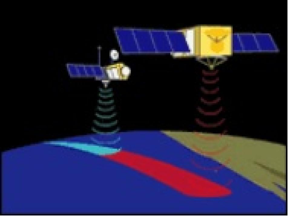
Launched December 7, 2001, Jason-1 complements the TOPEX/Poseidon satellite that was launched in 1992. Image courtesy of the Jet Propulsion Laboratory.
During its first six months of flight, the Jason-1 satellite was placed along the same groundtrack as TOPEX/Poseidon, about one minute apart. Because the two satellites observed nearly identical ocean conditions, scientists could then calibrate the new instruments on Jason-1. Once scientists confirmed that Jason-1 was taking measurements with equal or better accuracy than its predecessor, TOPEX/Poseidon was maneuvered into a parallel groundtrack to increase coverage between the two satellites.
The data processing and distribution for both satellite missions are jointly supported by NASA's Physical Oceanography Distributed Active Archive Center (PO.DAAC), and the CNES Archiving, Validation, and Interpretation of Satellite Oceanographic Data (AVISO) service. This support includes the worldwide distribution of data products to researchers and climate modelers.
TOPEX/Poseidon and Jason-1 use radar altimetry to measure the height of the ocean surface relative to the center of the Earth. However, the ocean surface is affected by factors such as ocean currents, winds, tides, gravity, and atmospheric pressure. Data from the two satellites allow scientists to study the dynamics of ocean currents and their response to the forcing by winds and atmospheric pressure. Scientists are also developing new models of ocean tides and the Earth’s gravity field based on the satellite’s observations.
Ocean surface topography measurements also tell scientists how much heat is stored in the ocean, which can affect sea level. “When temperature rises, water volume expands, so when heat is stored in the ocean, the topography is higher. Measuring the spatial change of the height helps us determine where heat is being stored,” said Fu.

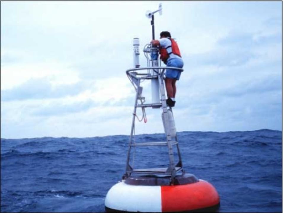
A worker maintains a Tropical Atmosphere Ocean (TAO) buoy on the equatorial El Niño array in the Pacific Ocean. Developed under the auspices of the Tropical Ocean Global Atmosphere (TOGA) Program, the buoys measure ocean temperature at varying depths and give forewarning of El Niño or La Niña events. Although these buoys offer limited coverage, they provide a valuable ongoing record of ocean changes in conjunction with TOPEX/Poseidon and Jason-1 observations. Image courtesy of the NOAA Photo Library.
Oceans are capable of absorbing and storing large amounts of heat, which is why ocean temperatures don’t vary as widely as temperatures on land. This implies that oceans would react slowly to atmospheric changes. But data from TOPEX/Poseidon revealed that the ocean responds to the atmosphere on a much shorter time scale than previously thought. “We used to think that when the atmosphere underwent a sudden change, it would take 20 years for the entire Pacific Ocean to respond to a new pattern of ocean circulation. Now we know it only takes about 10 years for this response to occur,” said Fu.
Observing circulation changes in the tropical Pacific Ocean was key to detecting several past El Niño events. The Earth’s oceans and atmosphere constantly interact, meaning that changes in ocean heat storage and circulation can affect the atmosphere, and vice versa. For instance, the El Niño of 1997-98 produced anomalies in the Pacific Ocean (such as a build-up of warm water accompanied by a rise in sea level), as well as atmospheric disturbances that affected inland and coastal communities around the world. TOPEX/Poseidon’s measurements also revealed acceleration in global sea level rise within the past 10 years, which is about 50 percent faster than the rate of the rest of the 20th century.
Fulfilling scientists’ expectations, Jason-1 demonstrates improved accuracy over its predecessor. Whereas TOPEX/Poseidon measures sea surface height accurate to within four centimeters, Jason-1 improved the measurement accuracy to within three centimeters.

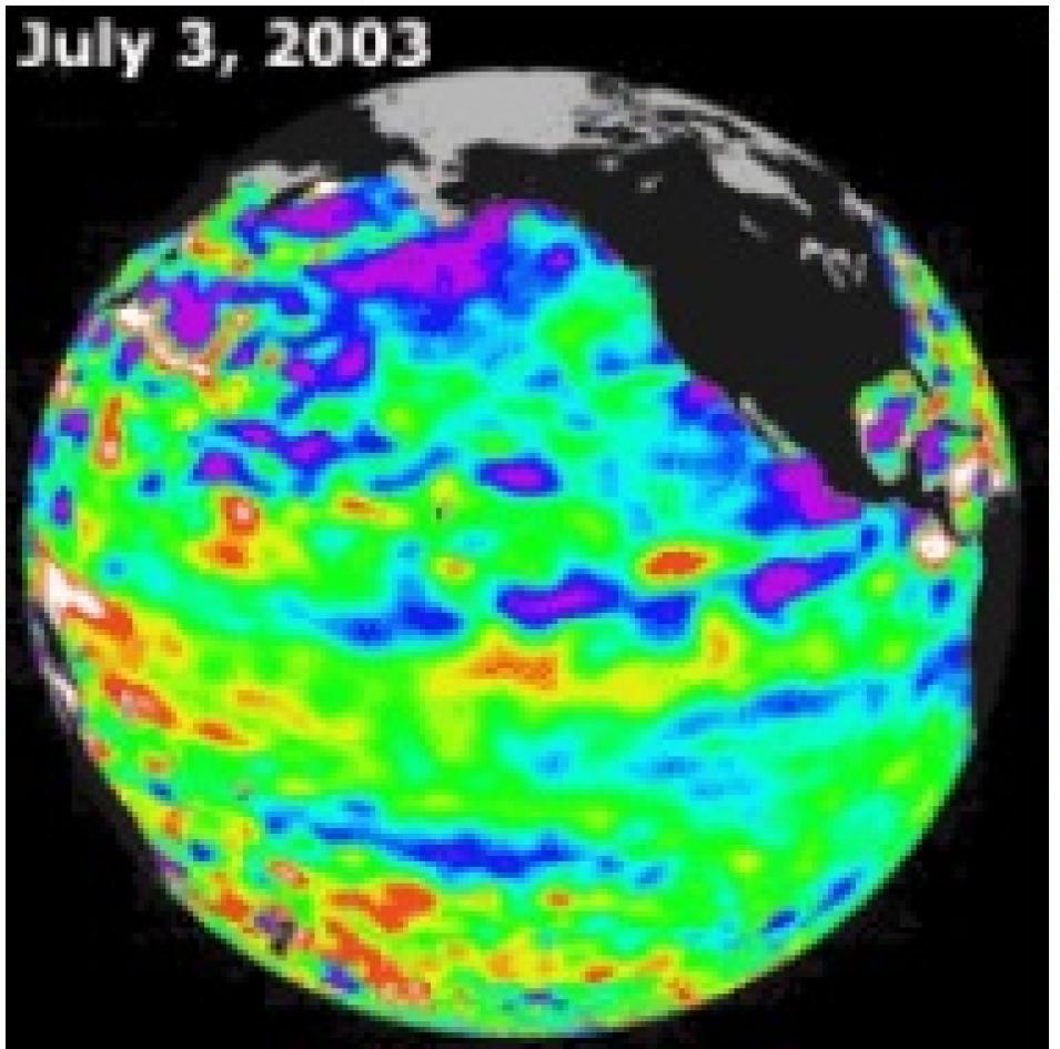
This Jason-1 sea surface height image was taken during a 10-day collection cycle ending July 3, 2003. After the weak El Niño event in the winter of 2002-03, the equatorial Pacific cooled and oceanographers started a La Niña “watch.” Image courtesy of the Jet Propulsion Laboratory.
Jason-1’s accuracy during the tandem mission has helped scientists monitor ocean circulation in greater detail. For instance, tidal motion near the coasts occurs on a spatial scale too small to be detected by TOPEX/Poseidon. The tandem mission’s improved level of accuracy allows for proper removal of this motion, allowing scientists to better detect climate variation near the coasts, Fu said.
Fu also credited the tandem mission with improved observations in the open ocean. Eddies, or rotating swirls of water that carry large amounts of heat, salt, and nutrients, are too small to be resolved by TOPEX/Poseidon, but the tandem mission is capable of measuring these phenomena. Warm water eddies can rise up to 80 centimeters (31.5 inches) higher than surrounding waters, and cold water eddies indicate depressions in the ocean surface, influencing ocean circulation and surface topography.
While scientists have already observed an El Niño and its transition into a La Niña using Jason-1 data, they anticipate more observations of ocean circulation and temperature variations, and increased use in practical applications such as determining coastal environment management practices and forecasting ocean conditions. Currently, both PO.DAAC and the CNES AVISO service provide satellite altimetry data from TOPEX/Poseidon and Jason-1. Aside from science and research applications, data are being applied in a variety of sectors, including commercial fishing, ship routing, marine wildlife monitoring, ocean debris tracking, and offshore industries.
However, Fu stressed that the mission’s long-term goal is to continue the time series of ocean observations. “The revolutionary aspect of Jason-1 is that for the first time we can detect ocean changes on the order of decades rather than years, something that has not been achieved by TOPEX/Poseidon alone,” said Fu. “Extending the time series will be key to understanding global warming and climate change.”

El Niño events can drive away fish and squid, staples of seal and sea lion diets. Young animals like this sea lion pup are especially vulnerable to starvation. Image courtesy of the USGS.
References
Jason-1 Mission Accessed June 5, 2003.
Ocean Surface Topography From Space: Science Accessed May 19, 2003.
Douglas, Bruce, C., and W. Richard Peltier. 2002. The Puzzle of Global Sea-Level Rise. Physics Today. 55(3):35.
Wunsch, C., and Detlef Stammer. 1998. Satellite Altimetry, the Marine Geoid, and the Oceanic General Circulation. Annual Review of Earth and Planetary Sciences. 26:219-53.
For more information
NASA Physical Oceanography Distributed Active Archive Center (PO.DAAC)
Ocean Surface Topography from Space
Aviso, Observing the Ocean from Space
| About the remote sensing data used | ||
|---|---|---|
| Satellites | Jason-1 SEASAT TOPEX Poseidon | |
| Sensor | multiple | |
| Parameter | ocean surface | |
| DAAC | NASA Physical Oceanography Distributed Active Archive Center (PO.DAAC) | |