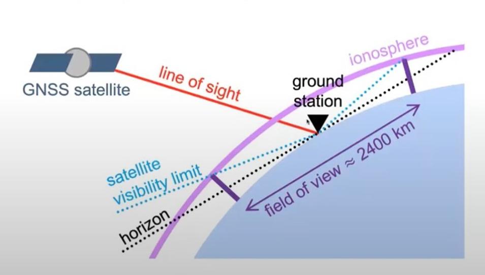
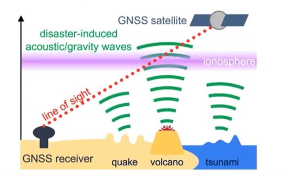
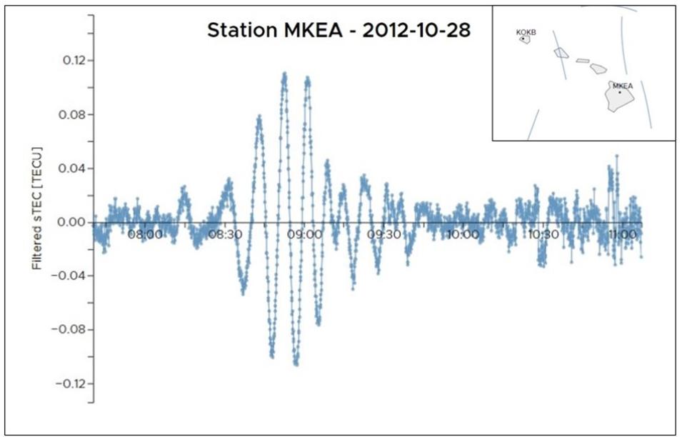
Because a GNSS satellite signal passing through these fluctuations in the ionosphere will experience a delay proportional to the ionospheric electron density along its line of sight, scientists can use this information to calculate the TEC.
Given that GNSS satellites typically travel in medium Earth orbit, approximately 20,000 km or 12.4 miles above the surface, GNSS systems are well suited for detecting fluctuations in ionospheric density.
Further, because ground stations can detect GNSS satellites from such a significant distance (up to 1,200 km), it isn’t necessary to have a GNSS station close to the location of a hazard event for its ionospheric perturbations to be detected. This makes GNSS particularly beneficial for in detecting natural hazards in Earth’s more remote locations, including the Pacific’s Ring of Fire.
Science Objectives
Tsunamis, large oceanic surface waves triggered by submarine events (i.e., earthquakes, landslides, and volcanic eruptions), can travel thousands of kilometers with relatively little attenuation. Due to conservation of energy in the shallow depths, the height of tsunami waves is amplified, leading them to become catastrophic near coastlines. As shown by many tragic events, tsunamis can impose an immense human and economic cost, which makes the development and enhancement of tsunami early warning systems a worthwhile field of research.
There are also a number of international tsunami warning centers and several types of early warning systems that are instrumental in confirming the presence of tsunamis, all of which rely on ground-based or oceanic in-situ instruments such as buoys. Given that it takes 8 to 40 minutes for the atmospheric fluctuations to reach the ionosphere, ocean buoys are quite beneficial for detecting tsunamis, particularly when an earthquake occurs nearby. Nevertheless, these instruments are subject to technical or practical limitations, such as providing sparse coverage, being difficult and expensive to maintain, or lacking the ability to accurately model the far-field propagation of tsunamis. GNSS-based ionospheric monitoring overcomes most of these limitations.
First, extremely large data volumes are already available at no additional cost, thanks to the multiple satellite constellations orbiting earth and the numerous ground-based GNSS receivers spread around the globe. Ionospheric measurements can typically be obtained up to 1,200 km from a given ground station, ensuring excellent spatial coverage. Second, waves traveling in the ionosphere are a direct proxy for the characteristics of the event that generated them, and the inversion of wave parameters is particularly straightforward for simple tsunami waves. Finally, NRT TEC analyses can be performed within minutes of the atmospheric wave reaching the ionosphere. Taken together, these attributes make NRT GNSS-based monitoring of the ionosphere an attractive approach to augmenting existing natural hazard early warning systems.
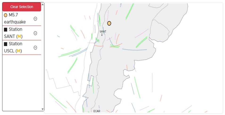
Augmenting these existing early warning hazard systems is GUARDIAN's goal. Its current contributions involve collecting GNSS measurements in NRT, computing TEC time series data, and displaying these data on a public website. At present, the GUARDIAN system uses more than 70 GNSS ground stations distributed around the Pacific Ring of Fire and monitors 4 GNSS constellations (the United States' Global Positioning System (GPS), Europe's Galileo, China's BeiDou Navigation Satellite System, and Russia's GLObal NAvigation Satellite System [GLONASS]). According to JPL, GUARDIAN is currently the only software available and capable of providing multi-GNSS system NRT TEC time series data over the Pacific region and openly sharing it with the public and scientific community. (However, there are similar versions of the software under development in the European Union.)
Instruments/Techniques Used
The GUARDIAN system relies on the JPL’s Global Differential GPS (GDGPS) network, which collects and processes GNSS data from hundreds of globally distributed stations associated with the GPS, Galileo, GLONASS, and BeiDou constellations. Included in this array are a number of stations located along the Pacific Ring of Fire. Depending on the station, the data are transmitted via the Crustal Dynamics Data Information System (CDDIS) Networked Transport of RTCM via Internet Protocol (NTRIP) with either a BINEX (Binary RINEX) or RTCM-3 format to GDGPS servers.
Next, at a GDGPS server dedicated to GUARDIAN processing, data are eventually selected according to data type and a subset list of stations. A GNSS Data Editor developed at JPL then separates arcs in the data, flags disjointed arcs, and attempts to correct cycle slips (caused by a temporary loss of lock in carrier tracking). Finally, these data samples are pushed to a shared memory slot in the memory of the dedicated GUARDIAN GDGPS’ server, allowing other processes to access it.


