The RADARSAT-1 Antarctic Mapping Project (RAMP) was composed of two main missions, the first Antarctic Mapping Mission (AMM-1) and the Modified Antarctic Mapping Mission (MAMM). Both missions utilized RADARSAT-1, a satellite developed by the Canadian Space Agency (CSA) and launched by NASA from Vandenburg Air Force Base on November 4, 1995.
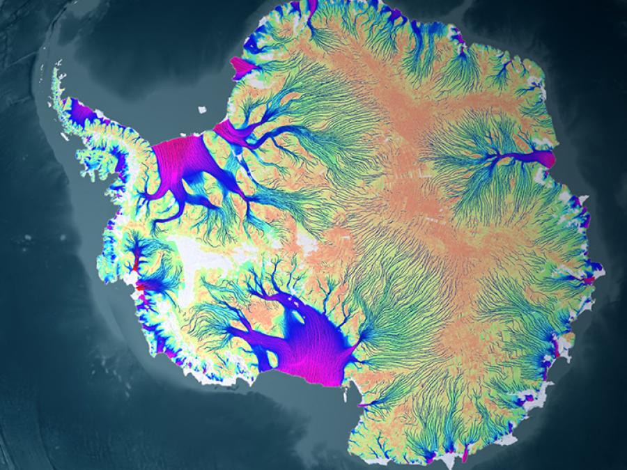
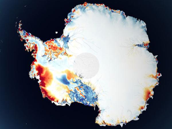
Derived data acquired 1997 and 2000 from two RADARSAT-1 satellite missions (AMM-1 and MAMM) was used to map features of Antarctica and measure ice sheet dynamics. Datasets are available as image tiles and mosaics, and velocity maps. Also available are ice velocity maps from mini-MAMM missions in 2004 and 2007.
Background
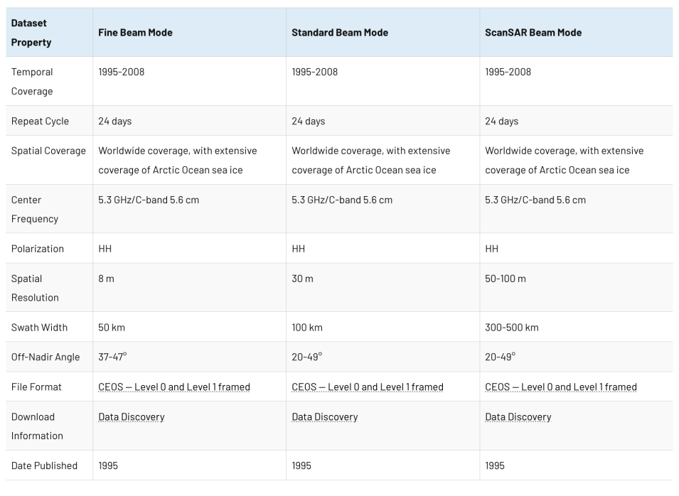
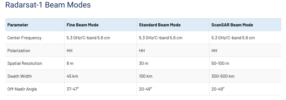
RADARSAT-1 was equipped with synthetic aperture radar (SAR), which enabled the satellite to capture high-resolution Earth imagery day and night regardless of weather conditions. The satellite covered the Earth every 24 days which allowed interferometric analysis. Functioning at C-band (5.3 GHz frequency), RADARSAT-1 was able to direct its radar beam at different angles in the right-side direction. Additional maneuvering of the satellite itself resulted in its invaluable ability to look left, increasing the number of available target locations. These features made RADARSAT-1 a well-matched satellite for the Antarctic Mapping missions.
AMM-1 started on September 9, 1997 and was completed on October 20, 1997. Its goals were to acquire a complete map of Antarctica and better understand the relationships between the southernmost continent’s environmental elements. As Antarctica’s inhospitable environment had limited the success of previous mapping endeavors, this mission’s data and imagery would prove to be a vital baseline to contrast against the data of future missions.
Using the right- and left-looking abilities of RADARSAT-1, a mosaic map of Antarctica at 25 m resolution was created. The map displayed Antarctica’s geological features through variations in radar brightness and texture, including ice streams. Ice velocity vectors were compiled using AMM-1 data to measure ice sheet movement over ice streams.
MAMM began three years after AMM-1 ended, starting on September 3, 2000 and ending on November 17, 2000. It planned to remap Antarctica and measure ice velocity data using interferometric analysis and data from AMM-1. In the three years’ difference between the two main Antarctic Mapping Missions, ice sheet advance and retreat could be observed and better evaluated as episodic change or regional climate change.
The Alaska Satellite Facility (ASF) processed AMM-1 and MAMM data into images, which The Ohio State University converted into maps and velocity fields using Vexcel Corporation software. Additional participants include NASA's Jet Propulsion Laboratory (JPL) and other scientific advisors.
