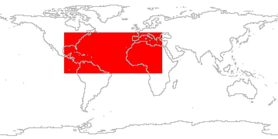
The NASA African Monsoon Multidisciplinary Analyses (NAMMA) campaign was a field research investigation sponsored by NASA's Science Mission Directorate. This campaign was based in the Cape Verde Islands, 350 miles off the coast of Senegal in west Africa. Commenced in August 2006, NASA scientists employed surface observation networks and aircraft to characterize the evolution and structure of African Easterly Waves (AEWs) and Mesoscale Convective Systems over continental western Africa, and their associated impacts on regional water and energy budgets. NASA also made extensive use of its orbiting satellites (including Aqua, TRMM, and Cloudsat/CALIPSO) and modeling capabilities to improve its forecasts and flight plans.
The major research topics of this mission examined the formation and evolution of tropical hurricanes in the eastern and central Atlantic and their impact on the U.S. east coast, and the composition and structure of the Saharan Air Layer, and whether aerosols affect cloud precipitation and influence cyclone development. NASA's DC-8 medium altitude research aircraft served as the primary research tool for the NAMMA investigations.
Cite the Collection
To cite the entire collection, please use the following:
A. Snyder and Z. Pu. 2010. NAMMA Field Campaign Data Collection [indicate subset used]. Data available online [http://earthdata.nasa.gov/centers/ghrc-daac] from the NASA EOSDIS Global Hydrometeorology Resource Center Distributed Active Archive Center, Huntsville, Alabama, U.S.A. doi:http://dx.doi.org/10.5067/NAMMA/DATA101
For more information on citing data archived by NASA's Global Hydrometeorology Resource Center Distributed Active Archive Center (GHRC DAAC), see NASA's data use policy.
General Characteristics
| Projects | NASA African Monsoon Multidisciplinary Analyses (NAMMA) |
|---|---|
| Platforms | NASA DC-8, Aqua, TRMM, Cloudsat/CALIPSO, Ground Stations |
| Sensors/Instruments | ATD Lightning Data, Dropsondes, TOGA Radar, Radiosondes, Lightning ZEUS Data, LARGE, Rain Gauges, CAPS, PIP, SMART-COMMIT Laboratories, DLH, Tower Flux, LASE, MMS, CVI, NPOL, ICATS, COBALT, HAMSR, MODIS, APR-2, BAROMETERS, GPS, TEMPERATURE PROBES, CPI, PMS 2D-S PROBE, LASER SPECTROMETER, INS, CNC, OPC, TUNABLE DIODE LASER AIRCRAFT MOTION SENSOR, GPS, PITOT-STATIC SYSTEM, DIAL, HUMIDITY SENSORS, NET RADIOMETERS, PRESSURE SENSORS, TELEMETER, AERI, AETHALOMETER, APS, CG4, GAS SENSORS, MPL, PHOTOMETERS, PYRANOMETERS, PYRHELIOMETERS, RADIOMETERS, TSI, TSI-3562 Nephelometer, AEROSOL/CLOUD PARTICLE SIZER, CNC, OPC, TSI-3562 Nephelometer, UHSAS, GPS CLOCKS, SFERICS DETECTOR, THERMISTORS |
| Parameters | Atmospheric Electricity, Platform Characteristics, Atmospheric Pressure, Atmospheric Temperature, Atmospheric Water Vapor, Atmospheric Winds, Radar, Aerosols, Precipitation, Clouds, Atmospheric Chemistry, Atmospheric Radiation, Visible Wavelengths, Soils, Vegetation, Sensor Characteristics, Microwave |
| Processing level | 1A, 1B, 2 |
| Formats | ASCII, ASCII-eol, ASCII-csv, ASCII-tsv, PNG, Universal Format (UF), GIF, netCDF-3, JPG, Binary, PostScript, HDF-4 |
