image of GOES satellite in orbit with earth reflected in panel
image of GOES collecting radar data in flight
image collage of GOES radar data with earth in foreground

GOES-R PLT

GOES-R Post Launch Test

The GOES-R Post Launch Test (GOES-R PLT) was an investigation that focused on validating observations for the Geostationary Lightning Mapper (GLM) and the Advanced Baseline Imager (ABI) aboard the GOES-16 satellite. 

GOES-R PLT consisted of 1 deployment during the boreal spring of 2017 across the continental United States. NASA's ER-2 was equipped with several sensors including the Lightning Instrument Package (LIP), Airborne Visible Infrared Imaging Spectrometer-Next Generation (AVIRIS-NG), Fly's Eye GLM Simulator (FEGS), and GEOstationary Coastal and Air Pollution Events (GEO-CAPE) Airborne Simulator to collect observations of various surface weather phenomena such as thunderstorms and wildfires. Measurements from several Lightning Mapping Arrays (LMAs) were also collected. 

GOES-R PLT was a joint investigation between NOAA and NASA.

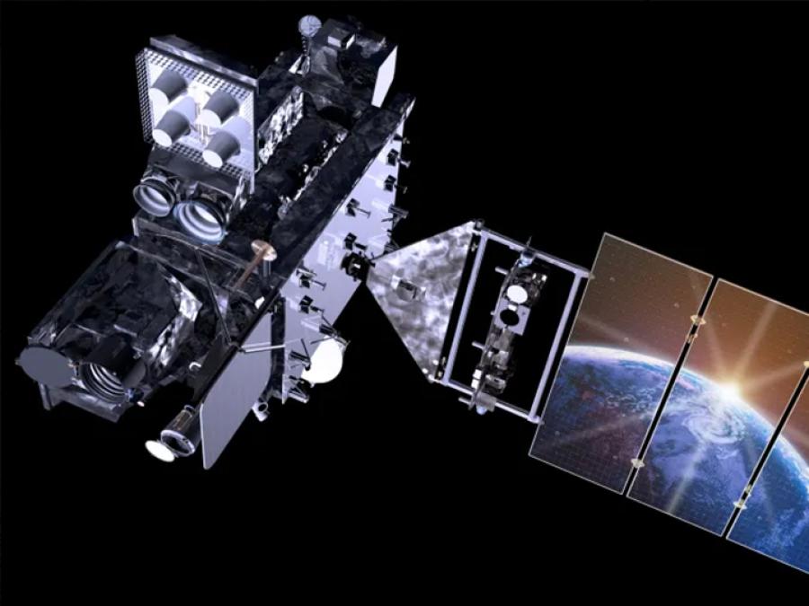
The goal of the GOES-R PLT campaign was to provide a collection of coincident airborne, satellite, ground based, and near surface measurements of surface weather phenomena to test, validate, and improve the accuracy of GOES-R ABI and GLM measurements. 

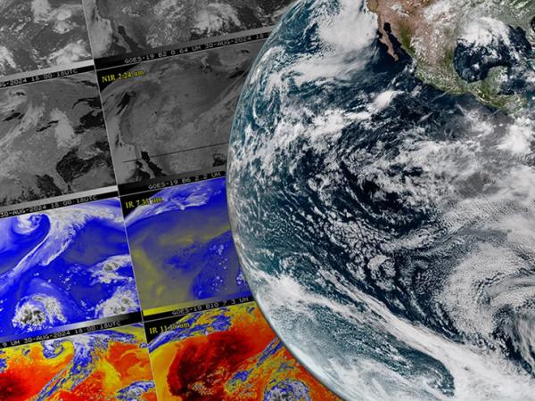
The campaign was comprised of two phases: the first centered on the U.S. west coast, providing tests primarily for the ABI instrument, and the second focused on the central and eastern U.S. with tests primarily for the GLM instrument. Airborne measurements were taken using NASA’s ER-2 aircraft, equipped with spectrometer, radar, lidar, radiometer, and other atmospheric observation instruments to assist with ABI and GLM validation. The target phenomena for validation observations included land and ocean surfaces, active wildfires, and thunderstorms. This campaign provided a blueprint for the operation of future GOES validation projects.

The primary objectives of GOES-R PLT field campaign included:

  • Provide high altitude validation of spectral radiance measurements for all ABI spectral bands
  • Provide surface and atmospheric geophysical measurements for validation products
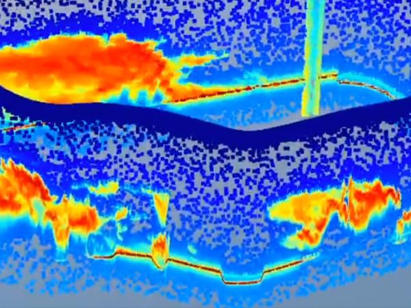
  • Validate GLM lightning flash detection efficiency over land and ocean
  • Validate the location and time accuracy of GLM flash detection
Study Dates03-21-2017 — 05-17-2017
RegionContinental United States
Spatial Bounds

N: 44°N

S: 26°N

W: 125°W

E: 72°W

Focus AreaGlobal water and energy cycle; weather

Multiple instruments were utilized during the GOES-R PLT field campaign to observe phenomena such as lightning, thunderstorms, and wildfires. They were carried on the NASA ER-2 aircraft and at various ground stations. The instruments included the Next-Generation Airborne Visible/Infrared Imaging Spectrometer (AVIRISng), the AVIRIS-Classic (AVIRISc), the Scanning High-resolution Interferometer Sounder (S-HIS), the Fly’s Eye GLM Simulator (FEGS), the Lightning Instrument Package (LIP), the Cloud Physics Lidar (CPL), the Cloud Radar System (CRS), the ER-2 X-band Doppler Radar (EXRAD), the GeoCAPE Airborne Simulator (GCAS), and Lightning Mapping Arrays (LMAs).

PlatformInstrument
Permanent Land Sites

Lightning Mapping Array (LMA)

Pyranometer (Pyranometer)

Generic-Radiometers (Gen-Radiometers)

Generic-Atmospheric State (Gen-AtmsState)

ER-2

GEOstationary Coastal and Air Pollution Events (GEO-CAPE) Airborne Simulator (GCAS)

Airborne Visible/Infrared Imaging Spectrometer - Classic (AVIRIS-C)

Fly's Eye GLM Simulator (FEGS)

Lightning Instrument Package (LIP)

Cloud Physics Lidar (CPL)

Scanning High-resolution Interferometer Sounder (S-HIS)

Airborne Visible InfraRed Imaging Spectrometer - Next Generation (AVIRIS-NG)

ER-2 X-band Doppler Radar (EXRAD)

Cloud Radar System (CRS)

Graphic timeline featuring events of interest in the GOES-R PLT campaign.
Image Caption

The above timeline highlights events within the field campaign of particular scientific interest.

This field campaign made various atmospheric and surface observations over a variety of land and ocean locations that provided extensive validation datasets for the GOES-R ABI and GLM instruments. Over 39.5 hours of airborne lightning observations were collected, including day and night observations of low and high flash rate storms in multiple regions. There were also validation datasets collected for all operational ABI spectral bands. 

This campaign helped ensure the quality of GOES-R ABI and GLM data and demonstrated functional performance methods for future GOES validation projects.

Field Campaign Publication


Padula, F., Goodman, S. J., Pearlman, A., & Cao, C. (2017). GOES-R Advanced Baseline Imager (ABI) and Geostationary Lightning Mapper (GLM) calibration/validation from a field campaign perspective. Proceedings of the 2017 IEEE International Geoscience and Remote Sensing Symposium (IGARSS), 301-304. https://doi.org/10.1109/IGARSS.2017.8126955
 

Background Information


Goodman, S. J., Blakeslee, R. J., Koshak, W. J., Mach, D., Bailey, J., Buechler, D., . . . Stano, G. (2013). The GOES-R Geostationary Lightning Mapper (GLM). Atmospheric Research, 125-126, 34-49. https://doi.org/10.1016/j.atmosres.2013.01.006

Lebair, W., Rollins, C., Kline, J., Todirita, M., & Kronenwetter, J. (2016). Post launch calibration and testing of the Advanced Baseline Imager on the GOES-R satellite. Proceedings of the SPIE Asia-Pacific Remote Sensing. Earth Observing Missions and Sensors: Development, Implementation, and Characterization IV, 98810K. https://doi.org/10.1117/12.2228556

Padula, F., Pearlman, A. J., Cao, C., & Goodman, S. (2016). Towards post-launch validation of GOES-R ABI SI traceability with high-altitude aircraft, small near surface UAS, and satellite reference measurements. Proceedings of the SPIE Optical + Engineering Applications. Earth Observing Systems XXI, 99720V.  https://doi.org/10.1117/12.2238181

Rafal, M., Clarke, J.T., & Cholvibul, R.W. (2016). Post launch calibration and testing of the Geostationary Lightning Mapper on GOES-R satellite. Proceedings of the SPIE Asia-Pacific Remote Sensing. Earth Observing Missions and Sensors: Development, Implementation, and Characterization IV, 98812E. https://doi.org/10.1117/12.2228540

Schmit, T.J., Griffith, P., Gunshor, M.M., Daniels, J.M., Goodman, S.J. & Lebair, W.J. (2017). A Closer Look at the ABI on the GOES-R Series. Bulletin of the American Meteorological Society, 98, 681–698. https://doi.org/10.1175/BAMS-D-15-00230.1
 
S. D. Rudlosky et al., "Characterizing the GOES-R (GOES-16) Geostationary Lightning Mapper (GLM) on-orbit performance," 2017 IEEE International Geoscience and Remote Sensing Symposium (IGARSS), Fort Worth, TX, 2017, pp. 279-282. https://doi.org/10.1109/IGARSS.2017.8126949