Description

The Water Isotope System for Precipitation and Entrainment Research (WISPER) is a counterflow virtual impactor on the NASA P-3 aircraft. WISPER uses a modified commercial Picarro L2120-i δD/δ18O ultra-High-Precision Isotopic Water Analyzer to make in-situ measurements of condensed water contents and water vapor in clouds, along with water vapor isotopic abundances (Henze et al., 2020; Henze and Noone, 2017). The measurement technique is cavity ring-down (CRD) spectroscopy (O'Keefe and Deacon, 1988; Berden et al., 2000; Gupta et al., 2009). 

WISPER has been deployed to the NASA ORACLES (ObseRvations of Aerosols above CLouds and their intEractionS) and IMPACTS (Investigation of Microphysics and Precipitation for Atlantic Coast-Threatening Snowstorms) field campaigns.
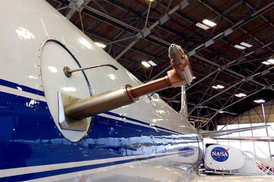
WISPER instrument onboard the NASA P-3 aircraft.
Image Caption

WISPER instrument onboard the NASA P-3 aircraft.
(Image Source: Darin Toohey and David Noone)

Measurements

WISPER measures condensed water contents and water vapor in clouds, along with water vapor isotopic abundances which should provide important information about the origin of air masses and possibly, microphysical processes. Water isotopologues have also proven to be very useful for identifying periods of complications in sampling, such as condensation in the sample lines at high condensed water contents and icing.


Applications

  • Weather events
  • Precipitation characterization and process studies
  • Precipitation microphysics and cloud research
  • Biomass burning
ParameterAccuracy
Condensed Water Contents  < 15% for most situations

Instrument Type

Spectrometer/Radiometer

Specifications

Resolution

Temporal

Daily -< Weekly

Related Data Centers/Projects

Frequently Asked Questions

Earthdata Forum

Our online forum provides a space for users to browse thousands of FAQs about research needs, data, and data applications. You can also submit new questions for our experts to answer.

Submit Questions to Earthdata Forumand View Expert Responses

Earthdata
Forum