N: 90 S: -90 E: 180 W: -180
Description
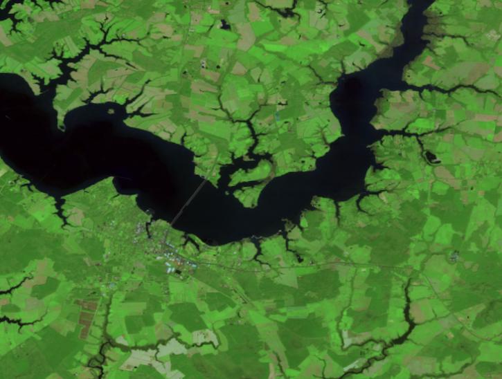
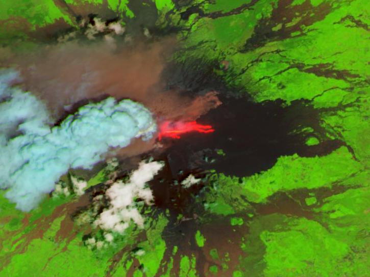
The Harmonized Landsat Sentinel-2 (HLS) project provides consistent surface reflectance data from the Operational Land Imager (OLI) aboard the joint NASA/USGS Landsat 8 satellite and the Multi-Spectral Instrument (MSI) aboard Europe’s Copernicus Sentinel-2A, Sentinel-2B, and Sentinel-2C satellites. The combined measurement enables global observations of the land every 1.6 days at 30-meter (m) spatial resolution. The HLS project uses a set of algorithms to obtain seamless products from OLI and MSI that include atmospheric correction, cloud and cloud-shadow masking, spatial co-registration and common gridding, illumination and view angle normalization, and spectral bandpass adjustment.
The HLSS30 product provides 30-m Nadir Bidirectional Reflectance Distribution Function (BRDF)-Adjusted Reflectance (NBAR) and is derived from Sentinel-2A, Sentinel-2B, and Sentinel-2C MSI data products. The HLSS30 and HLSL30 products are gridded to the same resolution and Military Grid Reference System (MGRS) tiling system and thus are “stackable” for time series analysis.
The HLSS30 product is provided in Cloud Optimized GeoTIFF (COG) format, and each band is distributed as a separate COG. There are 13 bands included in the HLSS30 product along with four angle bands and a quality assessment (QA) band. See the User Guide for a more detailed description of the individual bands provided in the HLSS30 product.
The HLS project is funded by NASA’s Satellite Needs Working Group (SNWG) which provides data products developed to meet the needs of stakeholders from US government agencies.
For information on known issues see the anomalies link under the Documents and Resources tab.
Version Description
Product Summary
Citation
Citation is critically important for dataset documentation and discovery. This dataset is openly shared, without restriction, in accordance with the EOSDIS Data Use and Citation Guidance.
Copy Citation
File Naming Convention
The file name begins with the Product Identifier (HLS.S30) followed by T plus the 5-character MGRS Tile Identifier (T17SLU), the Julian Date and Time of Production designated as YYYYDDDTHHMMSS (2020117T160901), the Version of the data collection (v1.5), the Variable/Band (Fmask), and the Data Format (tif).
Documents
USER'S GUIDE
ALGORITHM THEORETICAL BASIS DOCUMENT (ATBD)
GENERAL DOCUMENTATION
Dataset Resources
Publications Citing This Dataset
| Title | Year Sort ascending | Author | Topic |
|---|---|---|---|
| Remote sensing of urban heat dynamics and the cooling effect of urban green spaces in Ethiopian cities | Moges, Desalew Meseret, Mattisson, Kristoffer, Malmqvist, Ebba, Olsson, Per-Ola | Land Surface Temperature, Emissivity, Reflectance | |
| Prioritizing stream network connectivity for species conservation and | Karanasios, Panagiotis I., Schmeller, Dirk S., Lin, Yu-Pin | Reflectance | |
| Monitoring snow cover dynamics at 30-m resolution in higher latitude regions using Harmonized Landsat Sentinel-2 | Bonney, Mitchell T., Zhang, Yu | Albedo, Snow Cover, Reflectance | |
| GPP-net: a robust high-resolution GPP estimation network for Sentinel-2 using only surface reflectance and photosynthetically active radiation | Wang, Shaoyu, Ryu, Youngryel, Dechant, Benjamin, Zhang, Helin, Feng, Huaize, Lee, Jeongho, Choi, Changhyun | Reflectance | |
| Wheat yield estimation at field level over France using Sentinel 2, Landsat-8, and meteorological time series | Houdmont, Pierre Loup, Claverie, Martin, Defourny, Pierre | Reflectance | |
| Multi-source remote sensing of insect defoliation events in Abisko from | Feng, Shunan, Laursen, Simon Nyboe, Smart, Amy, Srensen, Katrine Stadsholt, Lund, Monika, Grillini, Federico, Rieksta, Jolanta, Jiao, Yi, Rinnan, Riikka, Westergaard-Nielsen, Andreas | Reflectance | |
| Mapping grain crop sowing date in smallholder systems using optical imagery | Prudente, Victor Hugo Rohden, Garcia-Medina, Mariana, Krishna, Vijesh, Euler, Michael, Bhattarai, Nishan, Lerner, Amy M., McDonald, Andrew James, Sherpa, Sonam, Rajan, Harshit, Urfels, Anton, Carneiro de Santana, Cleverton Tiago, Jain, Meha | Reflectance | |
| Mapping Reservoir Water Surface Area in the Contiguous United States | Yadav, Anshul, Zhang, Shuai, Zhao, Bingjie, Allen, George H., Pearson, Christopher, Huntington, Justin, Holman, Kathleen, McQuillan, Katie, Gao, Huilin | Reflectance | |
| Integrating Sparse LiDAR and Multisensor Time-Series Imagery From | Goel, Arnav, Song, Hunsoo, Jung, Jinha | Reflectance | |
| Landsat-Derived Rainfed and Irrigated-Area Product for Conterminous United States for the Year 2020 (LRIP30 CONUS 2020) Using Supervised and Unsupervised Machine Learning on the Cloud | Teluguntla, Pardhasaradhi, Thenkabail, Prasad S., Oliphant, Adam, Aneece, Itiya, Biggs, Trent, Gumma, Murali Krishna, Foley, Daniel, McCormick, Richard, Neelam, Rohitha, Long, Emerson, Lawton, Jake | Crop/Plant Yields, Landscape Patterns, Cropland, Land Use Classes, Vegetation Cover, Reflectance | |
| Novel Spatiotemporal ConvLSTM-Based Cellular Automata Model for | Zhou, Ye, Qiu, Yu, Wu, Tao, Lv, Laishui | Crop/Plant Yields, Landscape Patterns, Cropland, Land Use Classes, Vegetation Cover, Reflectance | |
| Data-driven identification of high-nature value grasslands using Harmonized Landsat Sentinel-2 time series data | Groschler, Kim-Cedric, Martens, Tjark, Schrautzer, Joachim, Oppelt, Natascha | Reflectance | |
| Detecting the onset of rice field inundation in the Lower Mississippi River Basin via Harmonized Landsat Sentinel-2 (HLS) satellite time series | Deng, Yawen, Peng, Bin, Guan, Kaiyu, Runkle, Benjamin R.K., Moreno-Garcia, Beatriz, Wu, Xiaocui, Wang, Sheng, Zhou, Qu, Reba, Michele L. | Reflectance, Brightness Temperature, Surface Soil Moisture | |
| A Learned Reduced-Rank Sharpening Method for Multiresolution Satellite | Armannsson, Sveinn E., Ulfarsson, Magnus O., Sigurdsson, Jakob | Reflectance | |
| Assessing midsummer snow-free land surface albedo variability across multiple Arctic sites using the Harmonized Landsat and Sentinel-2 product | Gottuk, Jannika, Stuenzi, Simone M., Runge, Alexandra, Boike, Julia | Reflectance, Albedo, Anisotropy | |
| Fire Impacts, vegetation Recovery, and environmental drivers in West African savannas (20142023): A High-Resolution remote sensing assessment | Ouattara, Boris, Thiel, Michael, Forkuor, Gerald, Mouillot, Florent, Laris, Paul, Tondoh, Ebagnerin Jerome, Sponholz, Barbara | Reflectance | |
| Modeling wildland fire burn severity in California using a spatial Super Learner approach | Simafranca, Nicholas, Willoughby, Bryant, ONeil, Erin, Farr, Sophie, Reich, Brian J., Giertych, Naomi, Johnson, Margaret C., Pascolini-Campbell, Madeleine A. | RADAR IMAGERY, Terrain Elevation, Topographical Relief Maps, Digital Elevation/Terrain Model (DEM), Reflectance, Land Use/Land Cover Classification, Evapotranspiration, Land Surface Temperature, Emissivity, Potential Evapotranspiration, Plant Characteristics | |
| Overview of satellite image radiometry in the solar-reflective optical domain | Teillet, Philippe M. | Reflectance | |
| Multispectral analysis-ready satellite data for three East African mountain ecosystems | Bhandari, Netra, Bald, Lisa, Wraase, Luise, Zeuss, Dirk | Reflectance | |
| Novel Use of Image Time Series to Distinguish Dryland Vegetation Responses to Wet and Dry Years | Myers, Emily R., Browning, Dawn M., Burkett, Laura M., James, Darren K., Bestelmeyer, Brandon T. | Reflectance | |
| Deciphering anthropogenic and biogenic contributions to selected non-methane volatile organic compound emissions in an urban area | Peron, Arianna, Graus, Martin, Striednig, Marcus, Lamprecht, Christian, Wohlfahrt, Georg, Karl, Thomas | Reflectance | |
| A new constant scattering angle solar geometry definition for normalization of GOES-R ABI reflectance times series to support land surface phenology studies | Gao, Shuai, Zhang, Xiaoyang, Zhang, Hankui K., Shen, Yu, Roy, David P., Wang, Weile, Schaaf, Crystal | Reflectance, Plant Phenology, Plant Phenological Changes | |
| Forests, Biodiversity, Ecology, LULC, and Carbon | Thenkabail, Prasad S. | Reflectance, Vegetation Index, Normalized Difference Vegetation Index (NDVI) | |
| Global Food Security Support Analysis Data (GFSAD) Using Remote Sensing in Support of Food and Water Security in the 21st Century: Current Achievements and ... | Teluguntla, Pardhasaradhi, Thenkabail, Prasad S., Xiong, Jun, Oliphant, Adam, Gumma, Murali Krishna, Giri, Chandra, Milesi, Cristina, Ozdogan, Mutlu, Congalton, Russell G., Tilton, James, Sankey, Temuulen Tsagaan, Massey, Richard, Phalke, Aparna, Yadav, Kamini | Land Use/Land Cover Classification, Reflectance | |
| Impacts of terrain on land surface phenology derived from Harmonized Landsat 8 and Sentinel-2 in the Tianshan Mountains, China | Ding, Chao, Li, Yao, Xie, Qiaoyun, Li, Hao, Zhang, Bingwei | Plant Phenology, Enhanced Vegetation Index (EVI), Terrain Elevation, RADAR IMAGERY, Topographical Relief Maps, Reflectance |
Variables
The table below lists the variables contained within a single granule for this dataset. Variables often contain observed or derived geophysical measurements collected from a variety of sources, including remote sensing instruments on satellite and airborne platforms, field campaigns, in situ measurements, and model outputs. The terms variable, parameter, scientific data set, layer, and band have been used across NASA’s Earth science disciplines; however, variable is the designated nomenclature in NASA’s Common Metadata Repository (CMR). Variable metadata attributes such as Name, Description, Units, Data Type, Fill Value, Valid Range, and Scale Factor allow users to efficiently process and analyze the data. The full range of attributes may not be applicable to all variables. Additional information on variable attributes is typically available in the data, user guide, and/or other product documentation.
For questions on a specific variable, please use the Earthdata Forum.
| Name Sort descending | Description | Units | Data Type | Fill Value | Valid Range | Scale Factor | Offset |
|---|---|---|---|---|---|---|---|
| Band 1 | Coastal Aerosol | N/A | int16 | -9999 | N/A | 0.0001 | N/A |
| Band 2 | Blue | N/A | int16 | -9999 | N/A | 0.0001 | N/A |
| Band 3 | Green | N/A | int16 | -9999 | N/A | 0.0001 | N/A |
| Band 4 | Red | N/A | int16 | -9999 | N/A | 0.0001 | N/A |
| Band 5 | Red Edge1 | N/A | int16 | -9999 | N/A | 0.0001 | N/A |
| Band 6 | Red Edge2 | N/A | int16 | -9999 | N/A | 0.0001 | N/A |
| Band 7 | Red Edge3 | N/A | int16 | -9999 | N/A | 0.0001 | N/A |
| Band 8 | NIR Broad | N/A | int16 | -9999 | N/A | 0.0001 | N/A |
| Band 8A | NIR Narrow | N/A | int16 | -9999 | N/A | 0.0001 | N/A |
| Band 9 | Water Vapor | N/A | int16 | -9999 | N/A | 0.0001 | N/A |
| Band 10 | Cirrus | N/A | int16 | -9999 | N/A | 0.0001 | N/A |
| Band 11 | SWIR1 | N/A | int16 | -9999 | N/A | 0.0001 | N/A |
| Band 12 | SWIR2 | N/A | int16 | -9999 | N/A | 0.0001 | N/A |
| Fmask | Quality Bits | Bit Field | uint8 | 255 | N/A | N/A | N/A |
| SAA | Sun Azimuth Angle | Degree | uint16 | 40000 | N/A | 0.01 | N/A |
| SZA | Sun Zenith Angle | Degree | uint16 | 40000 | N/A | 0.01 | N/A |
| VAA | View Azimuth Angle | Degree | uint16 | 40000 | N/A | 0.01 | N/A |
| VZA | View Zenith Angle | Degree | uint16 | 40000 | N/A | 0.01 | N/A |