N: 48.658 S: 31.073 E: -64.894 W: -95.46
Description
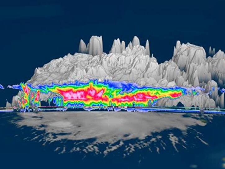
The Cloud Radar System (CRS) IMPACTS dataset consists of calibrated radar reflectivity, Doppler velocity, linear depolarization ratio, and normalized radar cross-section estimates collected by the Cloud Radar System (CRS) onboard the NASA ER-2 high-altitude research aircraft. These data were gathered during the Investigation of Microphysics and Precipitation for Atlantic Coast-Threatening Snowstorms (IMPACTS) field campaign. IMPACTS was a three-year sequence of winter season deployments conducted to study snowstorms over the U.S. Atlantic Coast (2020-2023). The campaign aimed to (1) Provide observations critical to understanding the mechanisms of snowband formation, organization, and evolution; (2) Examine how the microphysical characteristics and likely growth mechanisms of snow particles vary across snowbands; and (3) Improve snowfall remote sensing interpretation and modeling to significantly advance prediction capabilities. The CRS IMPACTS dataset files are available from January 25, 2020, through February 28, 2023, in HDF-5 format.
Product Summary
Citation
Citation is critically important for dataset documentation and discovery. This dataset is openly shared, without restriction, in accordance with the EOSDIS Data Use and Citation Guidance.
Copy Citation
Documents
GENERAL DOCUMENTATION
PUBLICATIONS
MICRO ARTICLE
Dataset Resources
Get Help
QUESTIONS & SUPPORT
Get help with NASA Earth science data, datasets, tools, services, and metadata on the Earthdata Forum. Experienced staff in the data user community review and answer questions.
Get help on Earthdata ForumForum
Publications Citing This Dataset
| Title | Authors | Year Sort ascending | Referenced Datasets |
|---|---|---|---|
| In-cloud characteristics observed in northeastern and midwestern US non-orographic winter storms with implications for ice particle mass growth and residence time |
|
||
| Evaluation of Physical Microphysical Property Retrieval Algorithms During the 2020 IMPACTS Field Campaign |
|
||
| Simultaneous Observations from In Situ Ground-Based and Airborne Radars at Multiple Frequency Bands Over Winter Storms |
|
||
| How does riming influence the observed spatial variability of ice water |
|
||
| HighResolution Snowstorm Measurements and Retrievals Using CrossPlatform MultiFrequency and Polarimetric Radars |
|
||
| Investigation of Microphysical Properties within Regions of Enhanced Dual-Frequency Ratio During the IMPACTS Field Campaign |
|
||
| The NASA GSFC 94-GHz Airborne Solid-State Cloud Radar System (CRS) |
|