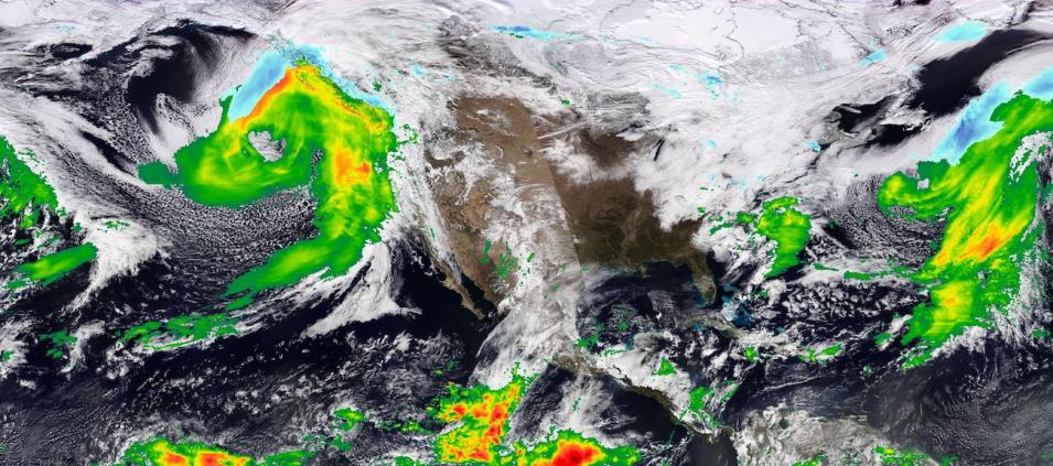
True-color corrected reflectance image of an atmospheric river hitting the U.S. West Coast on January 31, 2024. The image was acquired by the Visible Infrared Imaging Radiometer Suite (VIIRS) aboard the joint NASA/NOAA Suomi National Polar-orbiting Partnership (Suomi NPP) satellite. The true-color image is overlaid with the Integrated Multi-satellitE Retrievals for GPM (IMERG) Precipitation Rate layer, which displays rain rate and snow rate in millimeters per hour (mm/hr).
Red/orange colors indicate areas of heaviest rain; blue indicates areas of snow. IMERG Precipitation Rate is estimated by the IMERG algorithm, which uses passive-microwave data from the Global Precipitation Measurement (GPM) constellation of satellites along with infrared data from geosynchronous satellites.
The West Coast is expected to receive two atmospheric rivers in the next seven days. They will deliver heavy rain that may cause flooding, significant snowfall in the mountains, strong winds, and the possibility of landslides. Visit Worldview to see the atmospheric river hitting the U.S. West Coast.
Visit Worldview to visualize near real-time imagery from NASA's EOSDIS; find more imagery in our Worldview weekly image archive.
