
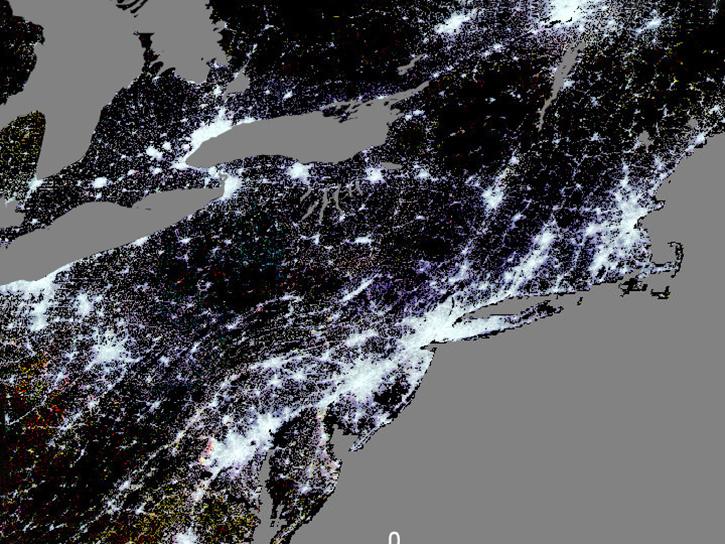
Across the world, the human population of places ranges from single residents in remote areas to more than 37 million people living together in the megacity of Tokyo. Within the human population, of course, is every race, culture, age, sex, nationality, level of wealth, education, and many other characteristics that can be used to define, group, and understand people.  

Population characteristics data is important for discovering how people exist and influence the world and visa versa. The data is key to maintaining or improving their quality of life. Knowing where people are and who they are gives us fundamental knowledge of how they are affected by their location and what happens there. This can lead into understanding the socioeconomics of the population and why people live like they do. Population data is also used to explore how groups of people interact with and use their surrounding natural environment and resources for living, food production, working, and industry.

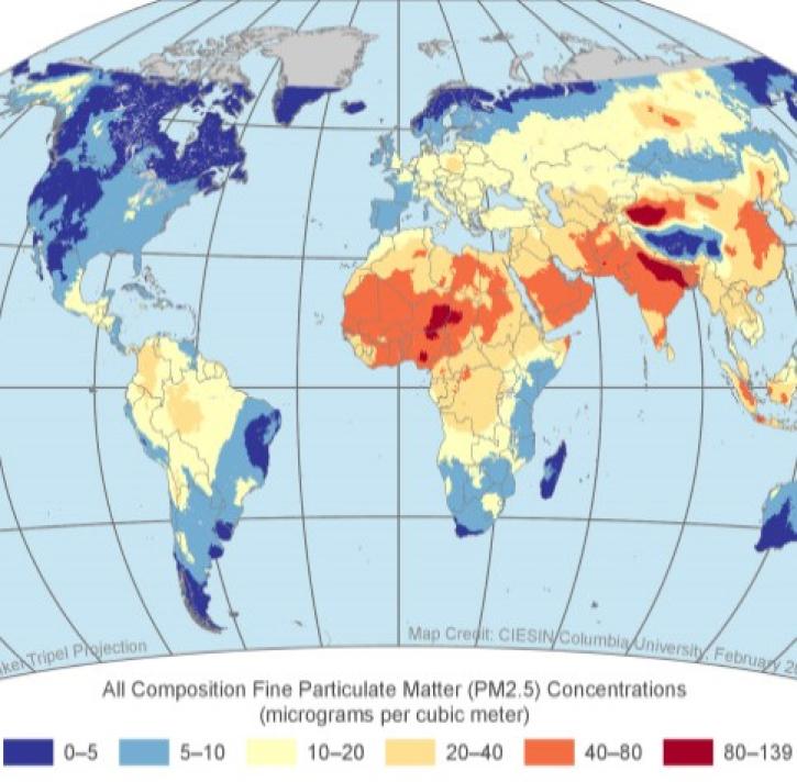
The natural environment exerts its powerful influence on populations. Severe weather, droughts, earthquakes and similar natural hazards can pose a great threat to populations in the areas where they occur. Armed with the facts of who and how many people are in harm's way empowers experts and decision-makers to make appropriate and effective plans to help them.

NASA has vast datasets offering a broad array of human populations measurements that can provide deep insight into how groups of people live on Earth and the ways they in turn influence life on the planet.

Get Population Data

Access a range of datasets and data tools to further your population research.

Learn How to Use Population Data

Access a range of webinars, tutorials, data recipes, and data stories to enhance your knowledge of Earth Observation data.
Example image for the VIIRS Plus DMSP Change in Lights (VIIRS+DMSP dLIGHT) dataset available at NASA's Socioeconomic Data and Applications Center.
The Many Layers of City Life: Urban Datasets from NASA's SEDAC
Learn about urban datasets at NASA's Socioeconomic Data and Applications Center (SEDAC).
This graphic from POPGRID Viewer offers a visual representation of population data (orange and pink) in China, India, Japan, North and South Korea, and several other countries in the region.
Data Tool in Focus: POPGRID Viewer
The POPGRID Viewer tool demystifies the process of finding the right population dataset.
Earthdata graphic identifier on top of satellite image of Earth
Efficient Geospatial Data Access with NASA's AppEEARS
Learn more about NASA's Application for Extracting and Exploring Analysis Ready Samples (AppEEARS). This webinar showcases the system's capabilities and highlights learning resources to help simplify data access workflows using AppEEARS.
Global (GL) Annual PM2.5 Grids from MODIS, MISR and SeaWiFS Aerosol Optical Depth (AOD), v4.03 (1998 – 2019)
An Introduction to NASA's Socioeconomic Data and Applications Center Datasets for Health and Air Quality Impacts
This webinar offers an introduction and analysis of NASA SEDAC's datasets for air quality and health impacts of exposed populations.
Discover and Visualize Population Data
NASA data help us understand Earth's changing systems in more detail than ever before, and visualizations bring these data to life, making Earth science concepts accessible, beautiful, and impactful.
Data visualization is a powerful tool for analysis, trend and pattern recognition, and communication. Our resources help you find world-class data visualizations to complement and enhance your research. We also have tools and tutorials to help you translate population data into compelling visuals.
Image
This map of the world shows data from SEDAC's Global Urban Polygons and Points Dataset (GUPPD), Version 1 dataset.
This graphic shows data from SEDAC's Global Urban Polygons and Points Dataset (GUPPD), Version 1 on a map of the world. Orange circles represent urban settlement population in the year 2015 and yellow circles represent projected population in the year 2030. Credit: SEDAC.

Join Our Community of NASA Data Users

While NASA data are openly available without restriction, an Earthdata Login is required to download data and to use some tools with full functionality.

Learn About the Benefits of Earthdata Login

Frequently Asked Questions

Earthdata Forum

Our online forum provides a space for users to browse thousands of FAQs about research needs, data, and data applications. You can also submit new questions for our experts to answer.

Submit Questions to Earthdata Forumand View Expert Responses

Earthdata
Forum