We are in the process of migrating all NASA Earth science data sites into Earthdata from now until end of 2026. Not all NASA Earth science data and resources will appear here until then. Thank you for your patience as we make this transition.
Read about the Web Unification Project
Snow/Ice News
Articles, resources, and announcements from Snow/Ice.

Join us for a data training webinar to learn about the ICESat-2 Global Geolocated Photons product and two snow depth estimation methods.
Webinar
April 10, 2026

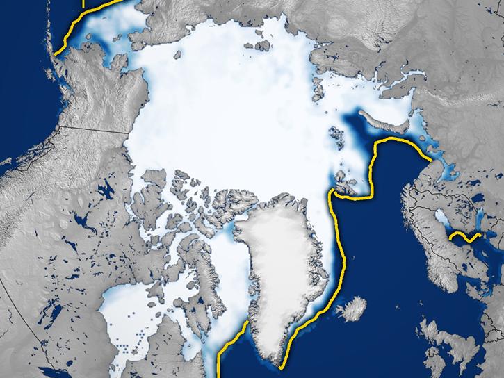
Image captured February 9, 2026, by the MODIS instrument aboard the Terra platform.
Worldview Image of the Week
Feb. 12, 2026

Image captured February 2, 2026, by the VIIRS instrument aboard the joint NASA/NOAA Suomi NPP platform.
Worldview Image of the Week
Feb. 5, 2026
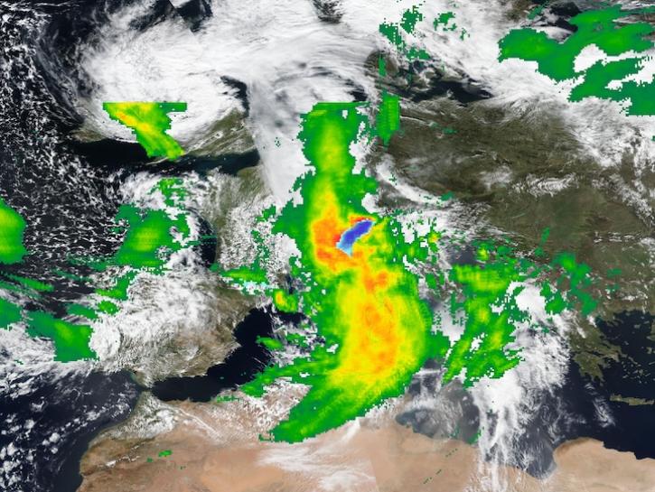
Image captured on Apr 16, 2025, by the VIIRS instrument aboard the Suomi NPP platform, with IMERG Precipitation Rate.
Worldview Image of the Week
April 17, 2025

This citizen science research effort is creating a flurry of excitement for measuring snow in the Catskill and Adirondack Mountains.
News
March 14, 2025
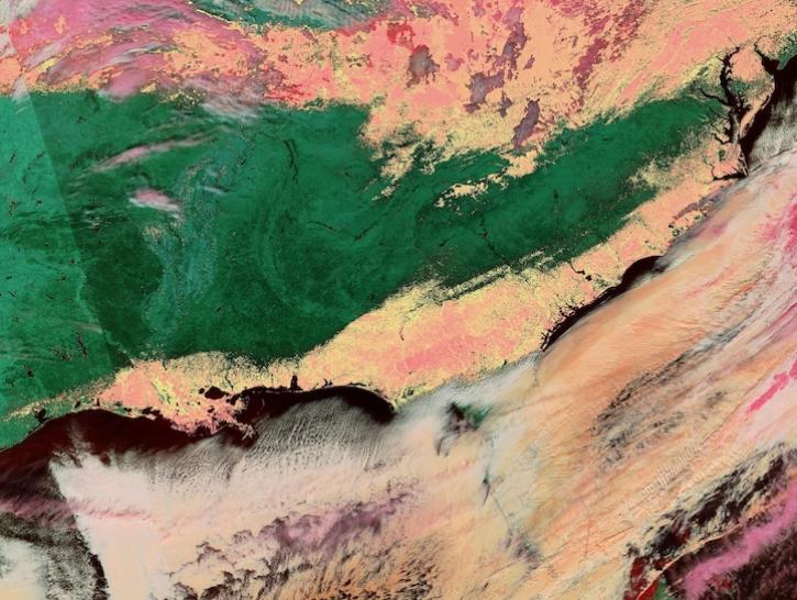
Image captured on Jan 22, 2025, by the VIIRS instrument aboard the joint NASA/NOAA NOAA-20 platform.
Worldview Image of the Week
Jan. 23, 2025
Join us for a tour of enhanced data product landing pages, new user resources, data visualization tools, and a Jupyter Notebook tutorial to access cryospheric data at NASA's National Snow and Ice Data Center DAAC.
Webinar
Aug. 22, 2024

NASA has long used imaging spectroscopy to peer into space. Now, scientists are using the technology to take a closer look at Earth.
Data User Story
Feb. 15, 2024
SHOWING 8 OF 64