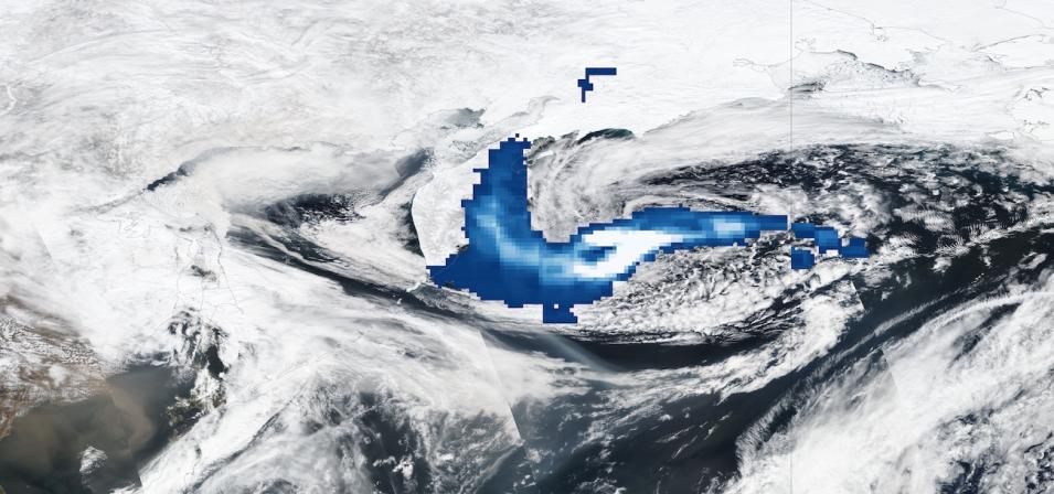
This true-color corrected reflectance image is overlaid with the Sulfur Dioxide (Middle Troposphere) layer showing sulfur dioxide concentrations emitted from the volcanic eruption of the Shiveluch (also called Sheveluch) volcano on the Kamchatka peninsula in the far-eastern part of Russia on April 12, 2023. Shiveluch is one of the largest volcanoes in the region, and the eruption sent a massive plume of ash as high as 65,000 feet, according to the Smithsonian Global Volcanism Program.
The imagery layers shown were acquired by the Visible Infrared Imaging Radiometer Suite (VIIRS) and Ozone Mapping and Profiler Suite (OMPS) aboard the joint NASA/NOAA Suomi National Polar-orbiting Partnership (Suomi NPP) satellite. The OMPS Sulfur Dioxide (Middle Troposphere) layer indicates the column density of sulfur dioxide in the middle troposphere (corresponding to 7.5 km center of mass altitude [CMA]) and is measured in Dobson Units (DU).
White areas in the plume indicate the highest concentrations of sulfur dioxide. This layer can be used in studies on moderate eruptions and long-range transport of sulfur pollution. View the sulfur dioxide plume in Worldview.
Visit Worldview to visualize near real-time imagery from NASA's EOSDIS; check out more Worldview weekly images in our archive.
