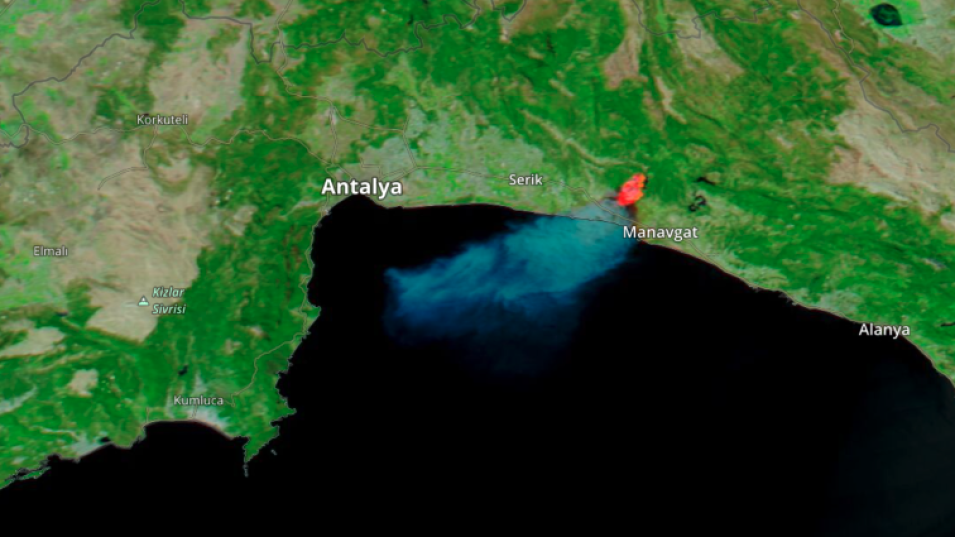
False-color corrected reflectance animation (Bands 7-2-1) of fires in Turkey. These images were acquired by the Moderate Resolution Imaging Spectroradometer (MODIS) aboard NASA's Aqua satellite.
These images are a false-color Red-Green-Blue (RGB) composite where Red is Band 7, Green is Band 2, and Blue is Band 1. This combination is most useful for distinguishing burn scars from naturally low vegetation or bare soil and enhancing floods.
Click on the image to open Worldview with full features in a new tab. Press "Play" to see fires start and spread between 27 July and 2 August 2021 along portions of the southern coast of Turkey. Fires can be seen, from right to left, near the towns of Manavgat, Marmaris, Mila, and Bodrum. Zoom into the map to see more detail from each of those locations. Also, view Worldview with the Fires and Thermal Anomalies layer loaded for more context.
Visit Worldview to visualize near real-time imagery from NASA's EOSDIS, and check out more Worldview weekly images in our archive.
