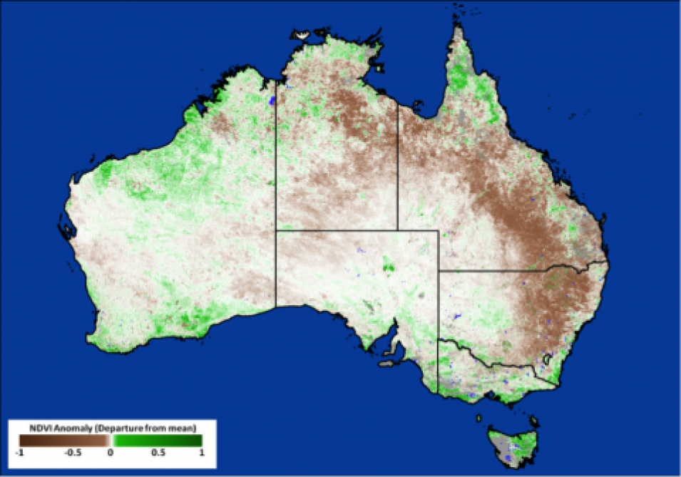
NASA's Land, Atmosphere Near real-time Capability for EOS (LANCE) has started generating near real-time (NRT) daily 8-day rolling datasets following requests from the dust modeling and agricultural monitoring communities. The new Moderate Resolution Imaging Spectroradiometer (MODIS) products are: a daily 8-day rolling vegetation indices product, which includes both Normalized Difference Vegetation Index (NDVI) and Enhanced Vegetation Index (EVI), and an 8-day rolling surface reflectance product.
It is expected that the rolling NRT estimates of NDVI and EVI will provide operational aerosol forecasting models with a more reliable estimate of dust emissions. Currently the parameterization of dust emissions in models are generally formulated in terms of a static dust source function, modulated by surface parameters such as wind speed, soil moisture as well as the vegetative state at a particular time and location. The rolling NRT estimates of NDVI and EVI are intended to provide these models with a more recent and accurate depiction of the vegetation state, affording a more reliable estimate of dust emissions. The products will be used by organizations that routinely carry out operational aerosol forecasting, including the National Oceanic and Atmospheric Administration National Centers for Environmental Prediction, NASA's Global Modeling and Assimilation Office, the European Centre for Medium-Range Weather Forecasts, the U.S. Naval Research Laboratory and the UK Met Office.
Within the agricultural monitoring community, MODIS vegetation indices are routinely used for monitoring vegetation, crop development and crop condition. Crops develop rapidly during the growing season and crop forecasts must be released in a timely fashion. NRT MODIS NDVI data are critical in building up a timely picture of crop development over the growing season. NRT NDVI data are routinely used by the Group on Earth Observations Global Agricultural Monitoring Initiative (GEOGLAM) to provide national, regional and global crop condition assessments. These NRT data are a direct NASA Applied Sciences contribution to the GEOGLAM agriculture monitoring community.
The global Vegetation Indices product dataset are denoted as MOD13Q4N (250m) and MOD13A4N (500m product). The product is created from 8-day rolling surface reflectance files (MOD09Q1N and MOD09A1N). Both the 8-day rolling VI and 8-day surface reflectance files are available from LANCE MODIS.
