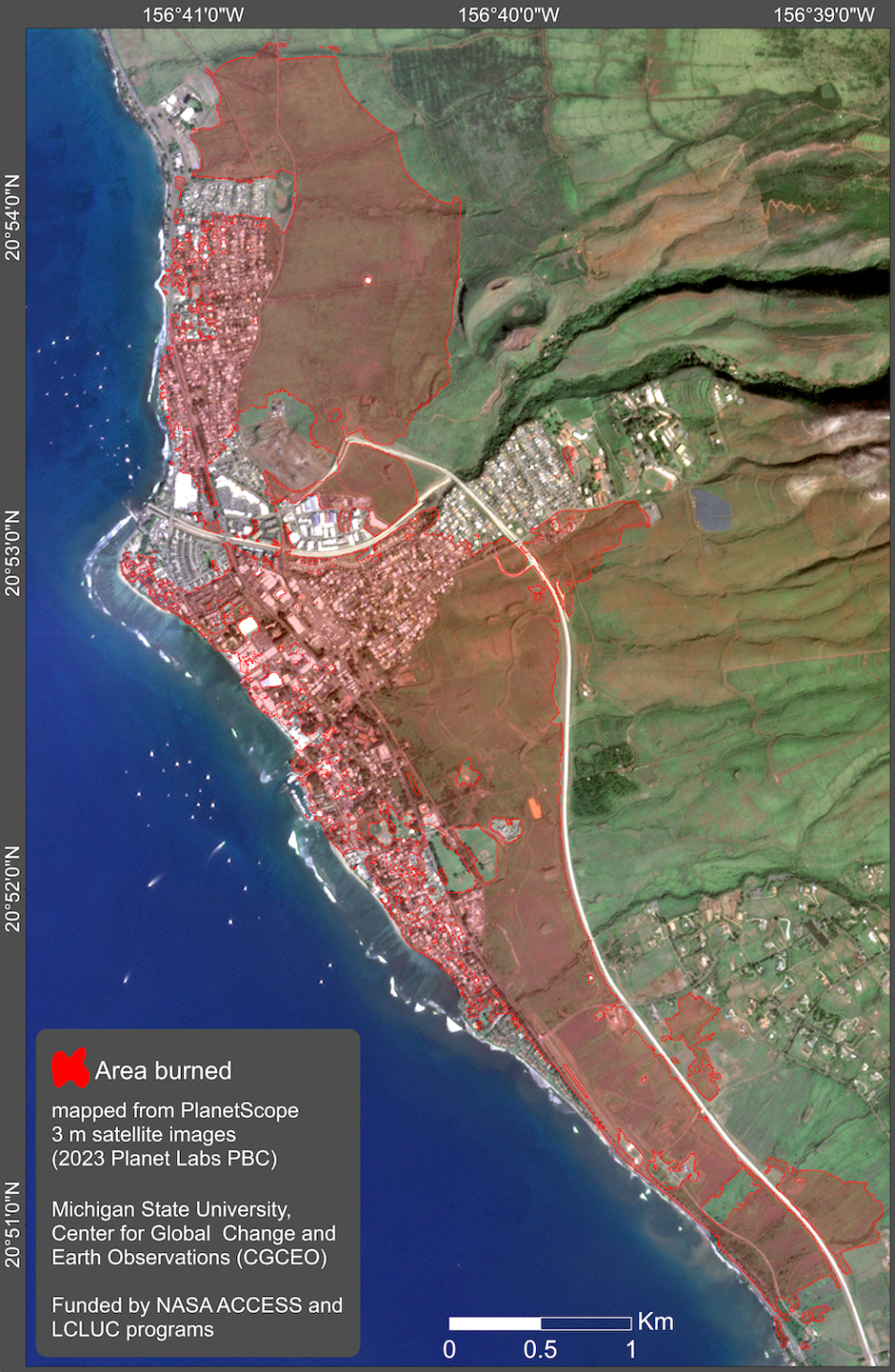
Recovery efforts from the devastating fires that swept through Maui and other Hawaiian islands in August are benefitting from a project funded through NASA’s Advancing Collaborative Connections for Earth System Science (ACCESS) and Land Cover and Land Use Change (LCLUC) programs.
Described as a “breakthrough for fire mapping from space,” the Michigan State University (MSU)-led project uses artificial intelligence (AI) and high-resolution commercial satellite imagery from Planet Labs PBC to produce maps of burned areas in higher detail than ever before. These maps enable scientists, managers, and local governments to better assess post-fire impacts, study burned areas, and help plan mitigation efforts.
“There is an urgent need for timely detailed maps of burned areas as climate warming and drier conditions have led to longer and more active fire seasons,” says Dr. David Roy, project Principal Investigator (PI) and director of MSU’s Center for Global Change and Earth Observations (CGCEO).
Applying a new AI algorithm to Planet imagery acquired between August 3 and 13, 2023, the project team created three-meter resolution maps of Maui's burned areas. This resolution is significantly greater than NASA’s existing burned area products, which are created from data acquired by the Moderate Resolution Imaging Spectroradiometer (MODIS; MCD64A1) and Visible Infrared Imaging Radiometer Suite (VIIRS; VNP64A1) instruments and have a 500-meter resolution. Developing improved algorithms to produce higher resolution burned area maps is a key objective of the NASA-funded work.
“Access to near daily three-meter PlanetScope imagery globally combined with rapid advancements in AI offer exciting opportunities to map smaller burned areas that coarser resolution satellite products usually miss,” says Roy.
The project team notes that by combining satellite detections of actively burning fires—which are available globally in near real-time through NASA’s Fire Information for Resource Management System (FIRMS)—with their high-resolution maps, enables patterns of fire spread and impacts to be readily assessed.

