MEaSUREs Greenland Image Mosaics from Sentinel-1A and -1B Version 4 Dataset
An update to the Making Earth System Data Records for Use in Research Environments (MEaSUREs) Greenland Image Mosaics from Sentinel-1A and -1B, Version 4 dataset has been released. The data product's temporal coverage now spans from January 1, 2015, to May 24, 2023. The dataset consists of 6- and 12-day, 50-meter resolution image mosaics of the Greenland coastline and ice sheet periphery. The mosaics are derived from C-band Synthetic Aperture Radar data acquired by the Copernicus Sentinel-1A and -1B satellites.
Greenland Image Mosaics from Sentinel-1A and -1B V4 data access and more information
EASE-Grid Sea Ice Age Version 4 Dataset
The EASE-Grid Sea Ice Age, Version 4 dataset, which provides weekly estimates of sea ice age for the Arctic derived from remotely sensed sea ice motion and sea ice extent, has been updated through December 31, 2022.
EASE-Grid Sea Ice Age V4 data access and more information
Polar Pathfinder Daily 25 km EASE-Grid Sea Ice Motion Vectors Dataset
The Polar Pathfinder Daily 25 km EASE-Grid Sea Ice Motion Vectors, Version 4 dataset, which provides daily and weekly sea ice motion vectors including browse images of the weekly data, has been updated through December 31, 2022. The source data used to generate the daily and weekly ice motion estimates are derived from several satellite sensors, International Arctic Buoy Program buoys, and NCEP and National Center for Atmospheric Research (NCAR) reanalysis forecasts.
Polar Pathfinder Daily 25 km EASE-Grid Sea Ice Motion data access and more information
AMSR-E/AMSR2 Unified Level 2B Global Swath Ocean Data Product, Version 1 Dataset
The Advanced Microwave Scanning Radiometer for EOS (AMSR-E) and Advanced Microwave Scanning Radiometer 2 (AMSR2) Unified L2B Global Swath Ocean Data Product, Version 1 is being updated to include the AMSR-E portion of the dataset from 2002 to 2011 as well as select AMSR2 data from 2017 to 2021. These files are being delivered to the NSIDC DAAC in batches and will be made available as they are received.
This AMSR Unified global ocean dataset reports integrated water vapor and cloud liquid water content in the atmospheric column, as well as 10-meter sea surface wind speeds. The data are derived from AMSR-E and AMSR2 brightness temperature observations that have been resampled by the Japan Aerospace Exploration Agency to facilitate an intercalibrated (i.e., unified) AMSR-E/AMSR2 data record.
AMSR-E/AMSR2 Unified Level 2B Global Swath Ocean data access and more information
MEaSUREs Calibrated Enhanced-Resolution Passive Microwave Daily EASE-Grid 2.0 Brightness Temperature ESDR, Version 1 Resumes Forward Processing
NSIDC DAAC's MEaSUREs Calibrated Enhanced-Resolution Passive Microwave Daily EASE-Grid 2.0 Brightness Temperature Earth Science Data Record, Version 1 dataset has resumed forward processing. Reprocessing of incomplete files is complete for data from 2023, and reprocessing from December 2021 to December 2022 is ongoing. Corrected files will be added as they become available.
Calibrated Enhanced-Resolution Passive Microwave Daily EASE-Grid 2.0 Brightness Temperature data access and more information
SMAPVEX19-22 Massachusetts and Millbrook Lidar Derived Digital Surface Model, Version 1 Datasets
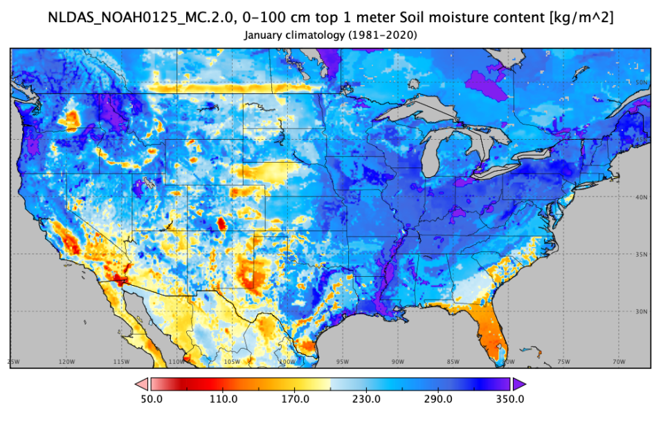
The Soil Moisture Active Passive Validation Experiment (SMAPVEX) 2019-2022 Massachusetts Lidar Derived Digital Surface Model, Version 1 and SMAPVEX19-22 Millbrook Lidar Derived Digital Surface Model, Version 1 datasets are now available. These data consist of ground surface elevations derived from source lidar measurements collected in August 2022 in the vicinity of Millbrook, New York, and Petersham, Massachusetts, during the SMAPVEX19-22 campaign. This location was chosen due to its forested land cover, as SMAPVEX19-22 aims to validate satellite-derived soil moisture estimates in forested areas. The two acquisition periods occurred to characterize differences during "leaf-on" and "leaf-off" conditions.
SMAPVEX19-22 lidar derived DSM data access and more information
Oak Ridge National Laboratory Distributed Active Archive Center (ORNL DAAC)
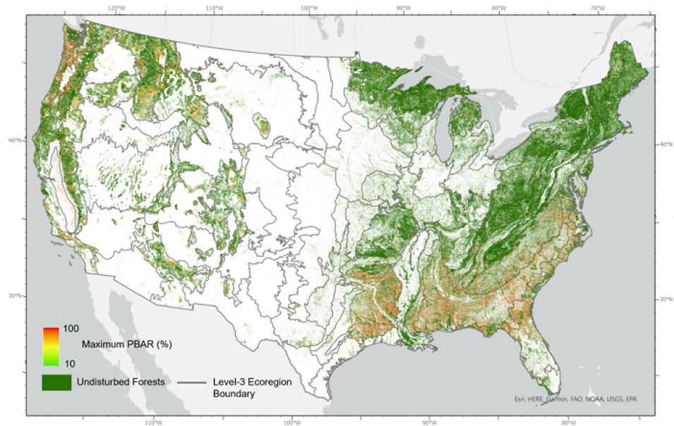
ORNL DAAC Releases Forest Disturbance, Carbon Monitoring, and AVIRIS Datasets
