Soiled Soils

Invisible pollutants lurk under Italy’s most populous valley.

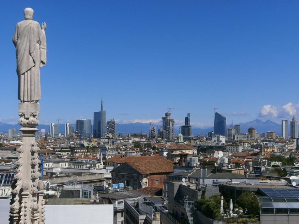
In Milan, 135 spires and pinnacles of the medieval Duomo di Milano pierce the sky. So do numerous skyscrapers that have sprouted around the cathedral in the last fifty years. Wealth from this financial and industrial powerhouse has expanded the city upwards and outwards, sprouting satellite towns in the surrounding Po Valley in northern Italy.

But where there are buildings, there are people. And where there are people, there is sewage. Waste from Milan’s 1.3 million population is shunted beneath cobblestone streets, through underground pipes, and into treatment plants. The pipes can leak and contaminate aquifers—underground layers of rock or soil that hold groundwater and supply drinking water to millions of people.

Marco Masetti, a professor of geology at the University of Milan, has been studying Italy’s groundwater quality over the last twenty years. “Groundwater supplies as much as 60 percent of Po Valley’s drinking water,” Masetti said. “And our groundwater quality has been bad.”

Masetti and his colleagues are trying to find where the contaminants come from. Do these come from burgeoning cities like Milan? Or do these come from the Po Valley countryside, where manure and fertilizer can seep into groundwater?

“Past studies suggest nitrate presence in groundwater is strongly related to urban sources,” said Stefania Stevenazzi, Masetti’s student and the lead researcher on the study. “We want to confirm that, but we also want to know what the trend is,” she said. “How have nitrate concentrations in Po Valley’s groundwater increased or decreased over time?”

Photograph looking up at the UniCredit Tower in Milan, Italy
Image Caption

The UniCredit Tower in downtown Milan towers at 758 feet and is Italy’s tallest building. (Courtesy S. V. Nghiem)

Permeating the Po Valley

Nitrate (NO3) is a chemical compound found in decomposing organic material like manure, plants, and human feces. Natural nitrate levels in aquifers are generally low, but human activities cause them to rise. Farmers could raise levels, for example, when they cultivate in areas where the soil layer is thin or when they over fertilize their crops. City dwellers also raise nitrate levels just by living and working where they are. So nitrate groundwater pollution can happen anywhere in Po Valley, a 18,000-square mile stretch of land in northern Italy that is home to a third of the country’s population and is among the most heavily cultivated lands in Europe. But how to track something you cannot even see?

First, Stevenazzi and her colleagues needed to know what kind of rock and soil layers the nitrate would be moving through underneath Po Valley. They looked at core data from well drillings along extensive transects from a few miles north of Milan to just south of the Po River. With these, they reconstructed the valley’s geological layers, which revealed how quickly or slowly nitrate could soak down into aquifers. It also told them where the aquifers were shallow or deep, and protected or unprotected. The researchers used the data to find out where nitrate contamination likely happens and where future contamination could occur.

Next, they had to find how much nitrate was already present in different parts of the valley. The researchers found nitrate concentration data from the region’s environmental agency, which samples water from 221 wells uniformly distributed in the shallow aquifer of the study area. The well water, sampled every six months from 2001 to 2011, showed an increasing trend in nitrate groundwater contamination in the northern half of the valley, where the sprawling city of Milan is located, and a decreasing trend in the southern half, which was more rural.

Although they now had an idea where nitrate was showing up and evidence that concentrations were increasing, they still could not truly point to a source. They needed to find a connection between the changes in the nitrate concentrations underground and changes happening aboveground. “It’s not possible to identify exactly where the nitrate source is located because it’s underground and invisible,” Stevenazzi said. “So we considered population density as a proxy for the urban nitrate sources.”

The researchers looked into using population data from the Italian government. However, the national census is taken only every ten years, which was not enough data for the study. Next, they looked into using high-resolution aerial photographs of Po Valley. It was more frequent than the census data, but had its own problems. “The number of years between the surveys were inconsistent and some areas were excluded from the surveys,” Stevenazzi said. “We needed data that had continuous coverage both in time and in space.”

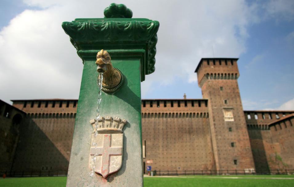
Photograph of a fountain at Sforza Castile in Milan, Italy
Image Caption

Clean drinking water flows out of a fountain at Sforza Castle in Milan, Italy. (Courtesy E. Blaser)

Scanning for skyscrapers

For this, they turned to NASA scientist Son V. Nghiem. Nghiem had developed a novel method to use data from the SeaWinds scatterometer, flying on NASA's Quick Scatterometer (QuikSCAT) satellite, as a proxy for changes in urban landscapes.

Scientists mostly use SeaWinds to measure ocean wind speed and direction. The sensor transmits microwave pulses to Earth’s surface, then measures the power reflected back to the instrument. This backscattered power indicates the ocean surface’s roughness, which in turn relates to near-surface wind speed and direction.

Nghiem’s QuikSCAT-Dense Sampling Method (DSM) would allow Masetti and Stevenazzi to train SeaWinds on land instead. The method detects various urban changes—skyscrapers sprouting, suburbs expanding, factories being torn down and malls built in their stead—even in areas where urban growth occurred at a relatively low rate.

Nghiem compares the SeaWinds sensor to radar instruments on aircraft. “When there is one aircraft near you, you see a dot on the radar. For a bigger aircraft, you see a bigger dot, and more dots for more aircraft,” Nghiem said. QuikSCAT sees buildings the same way as it flies over them. “Over one building, it sees one signature, but when it flies over a bigger, taller building, it would see a bigger signature,” Nghiem said. “And when you have a hundred of these bigger, taller buildings, then the backscatter of the signature becomes stronger.”

Photograph of a cathedral spire against a backdrop of the Milan skyline
Image Caption

A statue on the spire of Duomo Cathedral overlooks the Milan skyline. (Courtesy S. Stabile)

Population paradox

When Masetti and Stevenazzi applied DSM to SeaWinds data over Po Valley for the years 2000 to 2009, the results showed that most of the urban changes clustered around the north and northwest where cities and industries are concentrated. They found few changes in the southern area, which consisted mostly of agricultural fields. When they compared the DSM data to the well data they had earlier acquired, they saw a clear, direct relationship between urban changes and nitrate contamination trends.

The researchers went a step further and used the DSM data and the geological data they had collected earlier to generate a groundwater vulnerability map. The map shows areas in the Po Valley that are vulnerable to groundwater nitrate contamination. The degree of vulnerability depends on natural factors like groundwater depth and groundwater velocity, and man-made factors like the growth of urban areas. Urban areas that grow quickly, for example, are vulnerable. Regions that have deep groundwater are also vulnerable, because nitrate tends to not degrade when it flows through sediments above a deep water table.

To Nghiem, the map challenges the use of population data to represent urbanization. “The old idea is that population is where you register your home and where you sleep,” Nghiem said. Indeed, census data showed that growing cities experience decreasing population density, while the surrounding small towns experience increasing population density. “People may work in Milan but they live in the outskirts where homes are less expensive and there is less pollution,” Nghiem said. However, the well data and DSM data showed that nitrate contamination increases in areas of rapid urban development. That would be in the Milan urban center, and not in the suburbs where people live. “If we had stuck with the census data, we might have represented the wrong trend,” Nghiem said.

Data image showing groundwater vulnerability to nitrate contamination in Po Valley, Italy
Image Caption

This map shows groundwater vulnerability to nitrate contamination in Italy's Po Valley region using QuikSCAT Dense Sampling Method (DSM) data. Colored areas signify vulnerability classes. Green shades represent very low vulnerability; light green is low; yellow is medium; orange is high; and red is very high. The hatched areas show places that have experienced urban changes of more than 6 percent per decade. (Courtesy S. Stevenazzi, et al., 2015, Hydrogeology Journal)

A vulnerable valley

Regional officials have been communicating with Masetti’s team and have been anticipating such a map. It could guide land use planners when deciding whether or not to transform rural land to industrial or commercial land. For example, if the map marks an area as extremely vulnerable, then the cost to the community’s groundwater quality might outweigh projected economic benefits. It can also tell water resource managers which aquifers need more or less protection.

“If you force people to clean the water where water is already clean, you waste your money, while an insufficient restriction may not work where the groundwater contamination is severe,” Nghiem said. “Because of the map, a more effective policy can be implemented.”

What the team accomplished extends beyond Po Valley. The map will help Italy comply with a European Union directive that requires member countries to identify areas where groundwater is showing increasing trends of contamination. Other countries can benefit as well. Masetti said, “With DSM, existing and future satellite scatterometer data can be used to make and update maps of groundwater vulnerability as urbanization accelerates across the world.”

References

JPL QuikSCAT Project. 2006. SeaWinds on QuikSCAT Level 2A Surface Flagged Sigma0 and Attenuations in 25Km Swath Grid Version 2. Ver. 2. PO.DAAC, CA, USA. doi:10.5067/QSX25-L2A02.

Masetti, M., S. V. Nghiem, A. Sorichetta, S. Stevenazzi, P. Fabbri, M. Pola, M. Filippini, and G. R. Brakenridge. 2015. Urbanization Affects Air and Water in Italy’s Po Plain. EOS 96(21): 13–16. doi:10.1029/2015EO037575.

Nghiem S. V., D. Balk, E. Rodriguez, G. Neumann, A. Sorichetta, C. Small, and C. D. Elvidge. 2009. Observations of urban and suburban environments with global satellite scatterometer data. ISPRS Journal of Photogrammetry and Remote Sensing 64(4): 367–380. doi:10.1016/j.isprsjprs.2009.01.004.

Stevenazzi, S., M. Masetti, S. V. Nghiem, and A. Sorichetta. 2015. Groundwater vulnerability maps derived from a time-dependent method using satellite scatterometer data. Hydrogeology Journal 23: 631–647. doi:10.1007/s10040-015-1236-3.

For more information

NASA Physical Oceanography Distributed Active Archive Center (PO.DAAC)

NASA Quick Scatterometer (QuikSCAT)

NASA Po Plain Experiment (POPLEX) Field Campaign

About the remote sensing data
Satellite QuikSCAT
Sensor SeaWinds scatterometer
Data set SeaWinds on QuikSCAT Level 2A Surface Flagged Sigma0 and Attenuations in 25Km Swath Grid Version 2
Resolution 25 kilometer
Parameter Radar backscatter
DAAC NASA Physical Oceanography Distributed Active Archive Center (PO.DAAC)

Details

Last Updated

Published

Data Center/Project

Physical Oceanography DAAC (PO.DAAC)