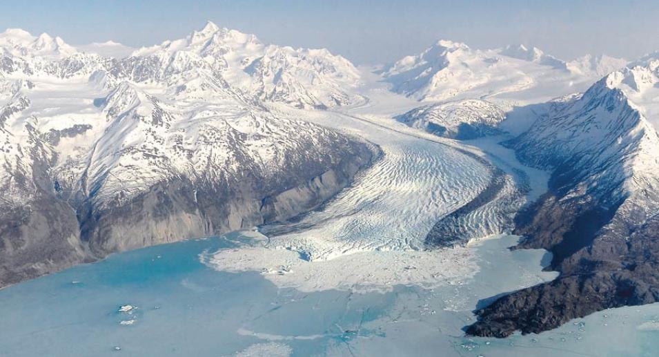
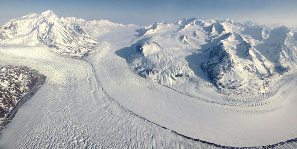
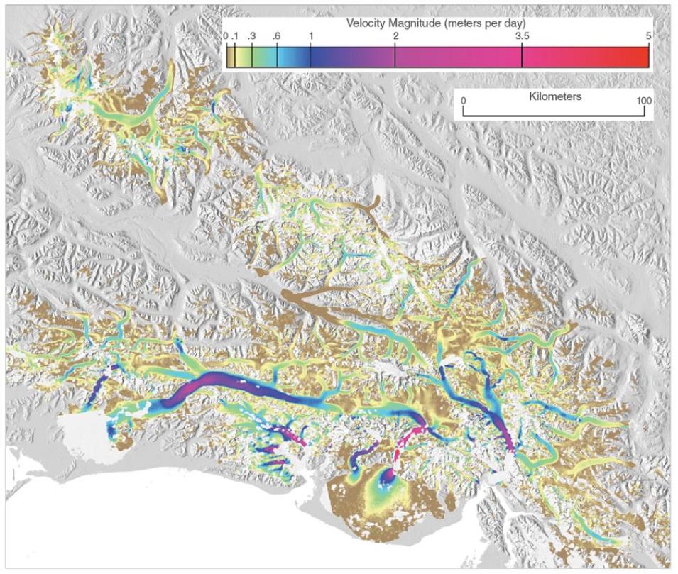
Conditions for many mountain glaciers are no longer consistently normal, however, and one of the keys to understanding short-term sea level rise is knowing how mountain glaciers are changing. The ice velocity maps Burgess created are now available from ASF DAAC, and help fill a gap in the mass balance equation for Alaska’s glaciers as they continue to change. Burgess said, “Most of the tidewater glaciers have pulled up almost to the point of getting out of the water. And this changes how those glaciers interact with climate, so we’re expecting a lot of changes in their flow dynamics.”
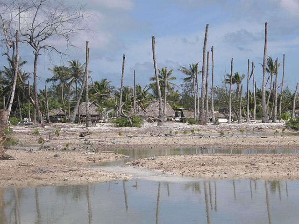
Even after tidewater glaciers become land-terminating glaciers, their melt water ends up in rivers that eventually run off into the ocean. Keeping an eye on ice velocity and mass balance will help researchers project sea level rise and gain more insight about the climate forces acting on glaciers. Sea level rise remains complicated, a tangle of processes gradually reshaping the world’s coastlines. “When it comes to century-scale sea level change, which is important to us as a society and to the engineering of coastal communities, these regions are very important,” Gardner said.
References
Burgess, E. W., R. R. Forster, and C. F. Larsen. 2013. Flow velocities of Alaskan glaciers. Nature, doi:10.1038/ncomms3146.
Burgess, E. W., C. F. Larsen, and R. R. Forster. 2013. Summer melt regulates winter glacier flow speeds throughout Alaska. Geophysical Research Letters 40: 6,160–6,164, doi:10.1002/2013GLO58228.
Gardner, A. S., G. Hoholdt, J. G. Cogley, B. Wouters, A. A. Arendt, et al. 2013. A reconciled estimate of glacier contributions to sea level rise: 2003 to 2009. Science 340, doi:10.1126/science.1234532.
NASA Alaska Satellite Facility (ASF) Distributed Active Archive Center (DAAC). 2012. ALOS PALSAR data. Copyrighted by JAXA, METI. Fairbanks, AK, USA: NASA ASF DAAC. https://www.asf.alaska.edu/sar-data/palsar/about-palsar.
NASA Land Processes DAAC (LP DAAC). 2012. Advanced Spaceborne Thermal Emission and Reflection Radiometer (ASTER) Global Digital Elevation Map (GDEM). USGS/Earth Resources Observation and Science (EROS) Center, Sioux Falls, SD. https://lpdaac.usgs.gov/products/astgtmv003/.
Warne, K. 2015. Will Pacific island nations disappear as seas rise? Maybe not. National Geographic, http://news.nationalgeographic.com/2015/02/150213-tuvalu-sopoaga-kench-kiribati-maldives-cyclone-marshall-islands.
For more information
NASA Alaska Satellite Facility Distributed Active Archive Center (ASF DAAC)
NASA Land Processes DAAC (LP DAAC)
Advanced Land Observing Satellite (ALOS) Phased Array type L-Band Synthetic Aperture Radar (PALSAR)
Burgess, et al. data set: Alaska Glacier Flow Speed, 2007-2011
| About the remote sensing data |
| Satellites |
Japan Aerospace Exploration Agency (JAXA) Advanced Land Observing Satellite (ALOS) |
Terra |
| Sensors |
Phased Array type L-Band Synthetic Aperture Radar (PALSAR) |
Advanced Spaceborne Thermal Emission and Reflection Radiometer (ASTER) |
| Data sets |
ALOS PALSAR L1.0 |
ASTER Global Digital Elevation Model (ASTGM) |
| Resolution |
Nominal 9 meter ground resolution |
30 meters |
| Parameters |
Terrain |
Elevation |
| DAACs |
NASA Alaska Satellite Facility Distributed Active Archive Center (ASF DAAC) |
NASA Land Processes DAAC (LP DAAC) |


