As temperatures change, snow melts, and days grow longer across North America, a network of sensors captures these vital data, measuring key weather metrics that inform scientific endeavors from wildlife biology to crop studies to modeling future environmental change. Scientists at NASA's Oak Ridge National Laboratory Distributed Active Archive Center (ORNL DAAC) translate these raw meteorological statistics into an easy-to-use dataset known as Daymet.
Daymet Data Take the Planet’s Pulse
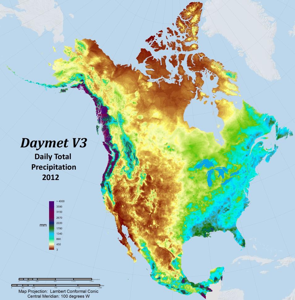
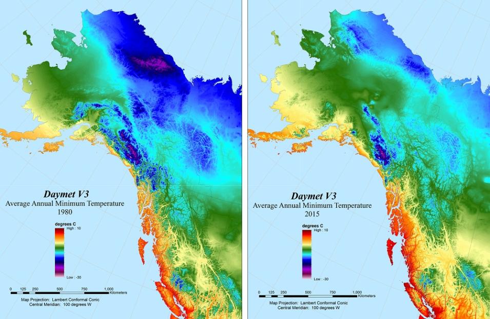
Daymet data include daily precipitation totals for North America (including Hawaii and Puerto Rico). Other daily Daymet weather parameters include continuous surfaces of minimum and maximum temperature, humidity, shortwave radiation, snow water equivalent, and day length. Image courtesy of ORNL DAAC.
Daymet provides seven daily weather parameters for the continent, from Mexico to Canada and Hawaii to Puerto Rico. The data combine temperature and precipitation measurements from 20,000 National Oceanic and Atmospheric Administration (NOAA) stations with modeled values for snowmelt, vapor pressure, day length, and shortwave radiation. With detail available for every square kilometer of the continent, this makes for a dataset of approximately 500 million data points for each year in the series.
Data this big would be challenging to use if not for the efforts of ORNL DAAC experts. ORNL DAAC is part of NASA’s Earth Observing System Data and Information System (EOSDIS) and is responsible for archiving and distributing NASA Earth observing data related to biogeochemical dynamics, ecological data, and environmental processes.
ORNL DAAC recently extended the Daymet data through the year 2017 to create a 37-year time series of weather measurements for the North American continent. “These data fuel a lot of great science,” says Michele Thornton, ORNL DAAC Daymet Project Lead. “With support from NASA, we’ve made this foundational information accessible in ways that save the research community significant processing time so scientists can focus efforts on discoveries in their field.”
Daymet is supported by NASA through NASA's Earth Science Data and Information System (ESDIS) Project, which manages EOSDIS science systems (including the DAACs), as well as through NASA’s Terrestrial Ecology Program. The continued development of the Daymet algorithm and processing is also supported by the Office of Biological and Environmental Research within the Department of Energy’s (DOE’s) Office of Science.
At ORNL DAAC, Daymet Project Lead Thornton leverages several types of coding, algorithms developed by NASA, and her own background in Geographic Information System mapping to translate the raw Daymet binary data into standard data products that have the extensive processing, quality assurance, and validation necessary for use in scientific research. She led the charge in 2013 to make Daymet available on the web and continues to work with a team of ORNL DAAC developers to create new functionality for users. As ORNL DAAC Chief Scientist Dr. Alison Boyer notes, “Making scientific data accessible and transparent is the driving force behind our work.”
With the heavy lifting taken care of by ORNL DAAC, Daymet users can select the information they need through a variety of tools, including the single pixel tool that allows users to pick locations of interest on a map and annual climatologies that provide yearly averages for each variable. A variety of data file formats are available to facilitate use in applications ranging from spreadsheets to modeling software to high-performance computing.
This ease of use, paired with the vital nature of the data, has made Daymet the most popular data collection in the ORNL DAAC archive. During Fiscal Year 2017, over 75.5 terabytes worth of Daymet products were distributed to worldwide data users, according to EOSDIS metrics.
With more than 200 scientific publications citing Daymet in the last five years, this rich data resource has become vital to many fields of study.
The United States Geological Survey (USGS) is one of the biggest users of Daymet. The USGS user community is focused on factors affecting water quality and availability, such as stream flows, groundwater levels, and reservoir stocks. To support the needs of this community, the USGS folds Daymet statistics in with other USGS datasets to create hydrologic summaries that are available through the USGS Geodata Portal. In addition, scientists studying the Alaskan tundra as part of the DOE’s Next-Generation Ecosystem Experiments are using Daymet data to complement their extensive onsite observations as they gain insights about the permafrost landscape and improve models of environmental change.
Due to its ease of use and depth of detail, citizen scientists across the United States also are using Daymet data as part of an initiative called Nature’s Notebook, which encourages participants to track the seasonal changes in plants and animals in their own neighborhoods. A project of the National Phenology Network, Nature’s Notebook offers a visualization tool that combines Daymet temperature and precipitation data with member phenology records to track and visualize patterns in seasonal changes.
The widespread scientific adoption of Daymet is further enabled by the availability of community-developed scientific software. These include the “daymetr” and “daymetpy” packages developed by Dr. Koen Hufkens at the Computational and Applied Vegetation Ecology Lab at Ghent University, Belgium. These tools provide a programmatic interface to Daymet directly from R or Python workspaces.
Like all NASA data, Daymet products are fully and openly available to worldwide data users, and ORNL DAAC provides a series of tutorials to help users get started using Daymet in research applications. User feedback also is important and is used to further develop Daymet products and algorithms. “We want to know how scientists are using Daymet data, and what additional features will benefit their work,” says Daymet Project Lead Thornton.
Experience Daymet for yourself and begin exploring the pulse of the planet!

