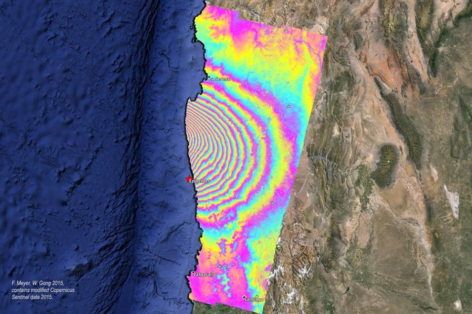
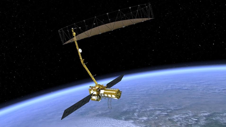
To prepare for the enormous influx of data from NISAR, ASF DAAC is working in collaboration with JPL on a project called Getting Ready for NISAR (GRFN). Agram supports GRFN through his work creating sample interferometric products as part of JPL’s Advanced Rapid Imaging and Analysis (ARIA) Project for Natural Hazards. These sample InSAR products are designed to help the science community prepare for working with similar products from NISAR.
Agram’s NISAR support also includes his work as part of the team that developed the InSAR Scientific Computing Environment (ISCE) software, which will become the processing software for NISAR. In addition, Agram developed the Generic InSAR Analysis Toolbox (GIAnT), which will be used to generate NISAR Level-3 Solid Earth Deformation Time-series products.
As Agram observes, his work enables work by other scientists. The algorithms he is developing and testing for NISAR, along with his work preparing the science community to use NISAR data, will contribute greatly to the research conducted using data from one of the most advanced radar systems ever put into Earth orbit.
Representative data products used:
- SAR data available through ASF DAAC using the ASF Vertex data portal:
- Uninhabited Aerial Vehicle SAR (UAVSAR), L-band products
- Various Sentinel-1, Level 1 Single Look Complex (SLC) data (NASA’s provision of the complete ESA Sentinel-1 SAR data archive through ASF DAAC is by agreement between the U.S. State Department and the European Commission)
- Advanced Land Observing Satellite-1 (ALOS) Phased Array-type L-band Synthetic Aperture Radar (PALSAR), Level 0 and Level 1 SLC data (the Japan Aerospace Exploration Agency (JAXA)/ Japanese Ministry of Economy, Trade, and Industry (METI) is the source for ALOS PALSAR data distributed by ASF DAAC; all ALOS PALSAR imagery and data are © JAXA/METI)
- SRTM data; available through NASA’s Land Processes DAAC (LP DAAC):
- NASA Digital Elevation Model (NASADEM) provisional products; available through LP DAAC
- SAR data from various ESA missions; available through the Western North America InSAR (WinSAR) Consortium archive hosted at UNAVCO
Read about the research:
Fattahi, H., Agram, P. & Simons, M. (2017). A network-based enhanced spectral diversity approach for TOPS time-series analysis. IEEE Transactions on Geoscience and Remote Sensing, 55(2): 777-786. doi:10.1109/tgrs.2016.2614925
Fattahi, H., Simons, M. & Agram, P. (2017). InSAR Time-Series Estimation of the Ionospheric Phase Delay: An Extension of the Split Range-Spectrum Technique. IEEE Transactions on Geoscience and Remote Sensing, 55(10): 5984-5996. doi:10.1109/tgrs.2017.2718566
Podest, E. (2017). Basics of Synthetic Aperture Radar (SAR). NASA Applied Remote Sensing Training (ARSET). PowerPoint presentation, November 29, 2017.
Agram, P. & Simons, M. (2015). A noise model for InSAR time series. Journal of Geophysical Research: Solid Earth, 120(4): 2752-2771. doi:10.1002/2014jb011271
Rosen, P.A., Gurrola, E., Sacco, G.F. & Zebker, H. (2012). The InSAR scientific computing environment. Presentation at EUSAR 2012; 9th European Conference on Synthetic Aperture Radar, April 23-26, 2012, Nuremberg, Germany.
For more information
Explore more Data User Profiles


