A Geographic Information System (GIS) connects a wide range of geospatial data to a map and integrates location data (where things are) with various types of descriptive information (what things are like there). The vision of NASA's Earth Science Data Systems (ESDS) Program is to identify and deliver high value Earth science data in formats compliant and compatible with GIS standards; to ensure data are interactive, interoperable, accessible, and GIS-enabled through primary GIS platforms; and to provide the maximum impact to research, education, and public user communities requiring data visualization and spatial analysis.

Earthdata provides a range of data tools for accessing and using GIS-based Earth science data. In general, these tools require a basic understanding of GIS and GIS-based applications. If you are unfamiliar with GIS or want more information about some of the terms and concepts described below, view more information about the basics of GIS.
NASA Worldview

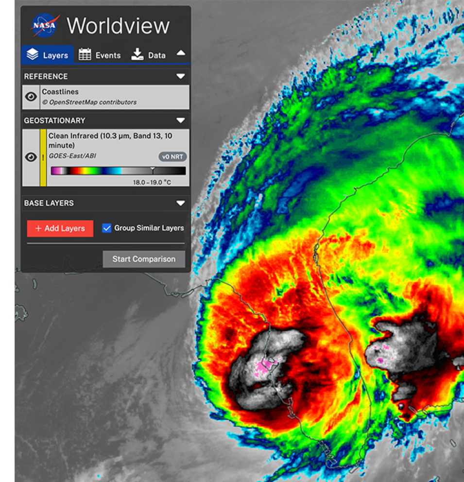
Visually explore the past and present of our dynamic planet through NASA Worldview. This web application provides the ability to interactively browse and download full-resolution, global satellite imagery from over 1,000 data products available through NASA's Global Imagery Browse Services (GIBS). Worldview provides access to global, full-resolution imagery from satellite imagery products via a variety of standards-based web services, such as Web Map Tile Services (WMTS), Tiled Web Map Service (TWMS), Web Map Services (WMS), and Keyhole Markup Language (KML). Most imagery is updated daily and available within a few hours after satellite observation and some product records span almost 30 years.

image of Worldview application showing Hurricane Milton

Earthdata Search

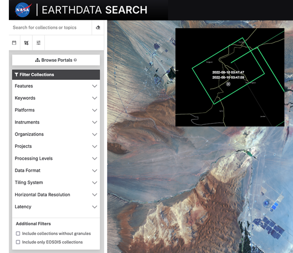
NASA’s Earthdata Search provides sub-second searches through more than 119 petabytes (PB) of Earth observation data in NASA’s archive, which amounts to more the 50,000 data collections. Earthdata Search serves as a one-stop shop for Earth observation data by providing the means for discovering, visualizing, filtering, and accessing these data across all of NASA’s Earth science data holdings. Through Earthdata Search, users can even filter datasets labeled as “customizable” to subsets or extract layers before downloading.

image of EMIT data over Bangladesh using Earthdata Search

Earthdata GIS

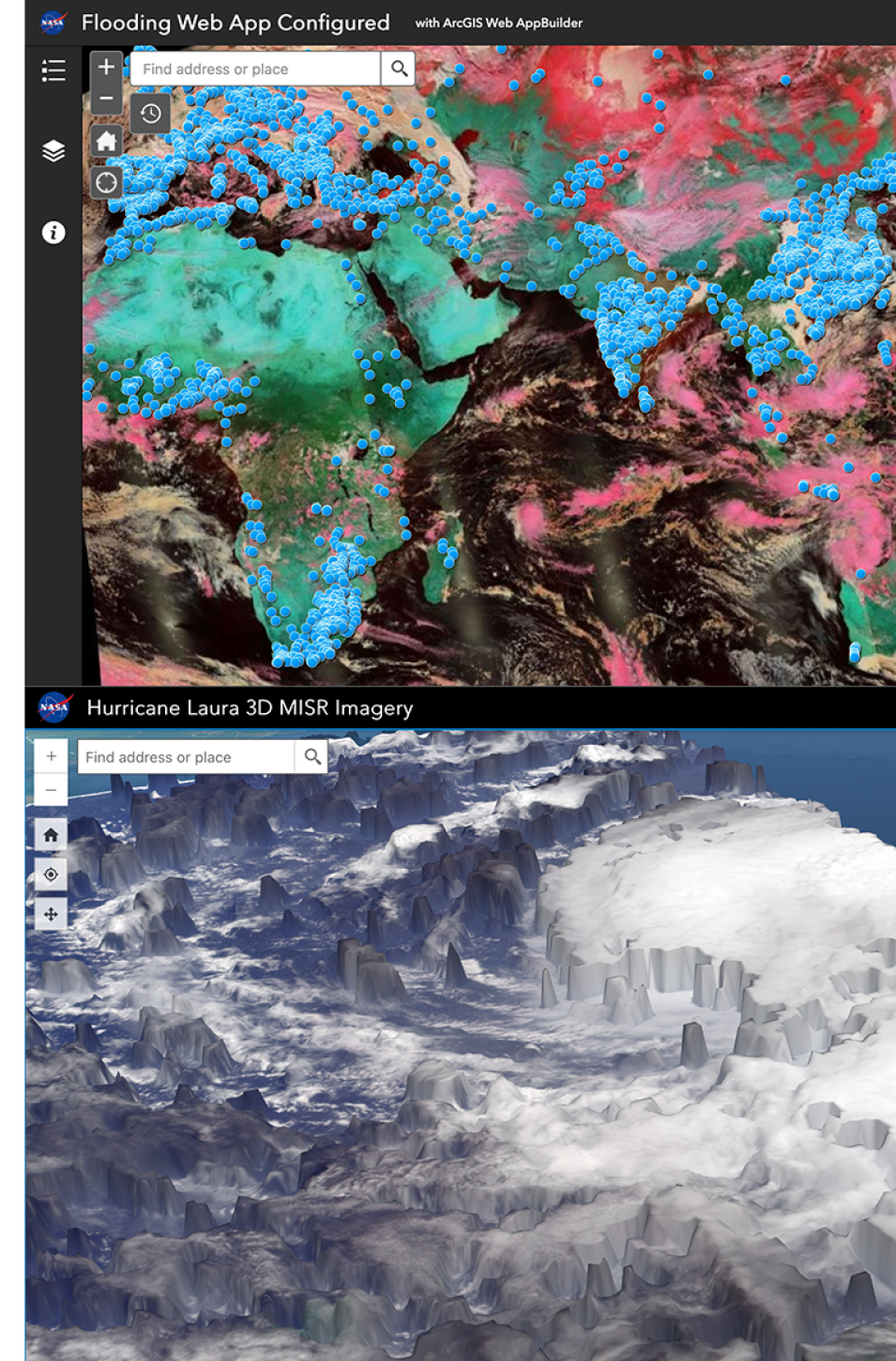
Earthdata GIS is a resource for distributing cloud-native, GIS-ready NASA Earth Science data, services, and resources. This includes over 200 ArcGIS and Open Geospatial Consortium (OGC)-compliant raster and feature geospatial services. EGIS grants users access to these geospatial services through open science tools such as OGC compliant services, common web APIs, and Native SDKs. Through Earthdata GIS, users can also explore learning and data discovery resources such as thematic applications and ArcGIS StoryMaps.  

Furthermore, within NASA’s homepage on ArcGIS Online (AGOL), you can explore a diverse range of data, layers, and maps, ready to be integrated into your next project or study. NASA Earth Science is continuously working increase the number of NASA layers available in the ArcGIS Living Atlas of the World (LAW). The LAW is an ever evolving and growing collection of ready-to-use geographic information from around the globe, tailored to be easy to use within a variety of GIS applications.

image of ArcGIS Flood Mapper showing flood data points over Africa and Asia

AppEEARS

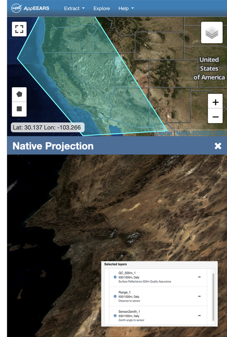
The Application for Extracting and Exploring Analysis Ready Samples (AppEEARS) offers a simple and efficient way to access and transform geospatial data from a variety of federal data archives. AρρEEARS enables users to subset geospatial datasets using spatial, temporal, and band/layer parameters. Two types of sample requests are available: point samples for geographic coordinates and area samples for spatial areas via vector polygons. Users are also able to download data in the GeoTiff, NetCDF-4, or ENVI formats as well as in many different projections. Additionally, sample requests submitted to AρρEEARS provide users not only with data values, but also associated quality data values. Interactive visualizations with summary statistics are provided for each sample within the application, which allow users to preview and interact with their samples before downloading their data.

image of Appeears data over the Amazon

Giovanni

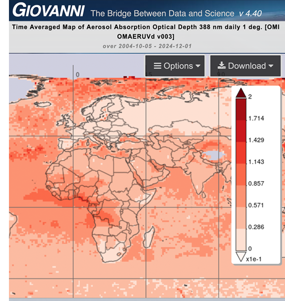
To facilitate data access and evaluation, as well as scientific exploration and discovery, the NASA Goddard Earth Sciences Data and Information Services Center (GES DISC) has developed Giovanni for a wide range of users around the world. Giovanni is a web-based application for the display and analysis of geophysical parameters in which the provenance (data lineage) can easily be accessed.  You can search for and filter parameters by type of observation, discipline, and resolution as well as filter by date and region. Lastly, the web app offers the capability to map, visualize, and chart your selected data/parameters, all within your browser without having to download the data (although data downloads are also supported).  

image of atmosphere data in the Giovanni application

earthaccess

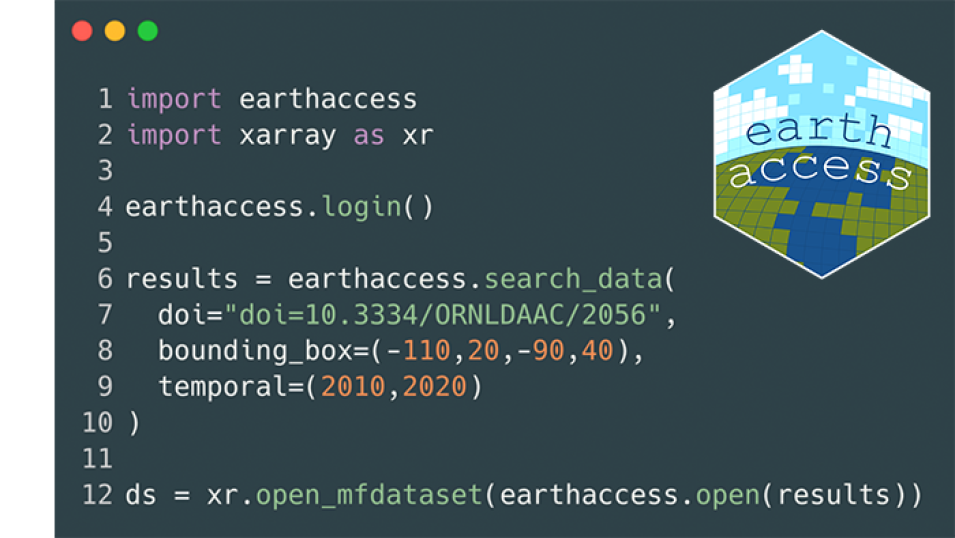
earthaccess is a python library with code snippets that can be used to search for, download, or stream NASA Earth Science data with just a few lines of code. Providing easy access to NASA Earthdata regardless of the data storage location (hosted within or outside of the cloud) is the main motivation behind this Python library. The library is an open-source community effort and welcome contributions to improve earthaccess and its offerings.

image of python code to install earthaccess application with earthaccess logo overlay