Instruments and Techniques Used
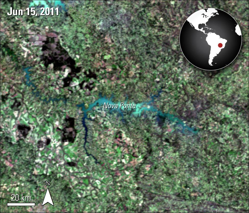
The authors' method maps the water bodies at 8-day intervals, using Combined Terra and Aqua MODIS 16-Day Bidirectional Reflectance Distribution Function (BRDF) (MCD43A4), Terra MODIS 8-day Surface Reflectance (MOD09A1), and Terra MODIS Land-Water Mask data (MOD44W). The authors conduct a global supervised classification of the data to create global classification maps. The maps are then merged into a combined global classification map and filtered using quality data and cloud and snow masks. Finally, the authors correct for mislabeled water areas using elevation information. This process ultimately creates a final global classification map. The data are evaluated by comparing the reservoirs with existing satellite altimetry observations from the U.S. Department of Agriculture, the Laboratoire d'Etudes en Géophysique et Océanographies Spatiales in France, the Database for Hydrological Time Series of Inland Waters, and available in-situ observations. The authors also create Landsat-based reference classification maps for some of the reservoirs. The authors presented five case studies for further validation: Lake Mead (USA), Lake Nasser (Egypt), Kremenshugskoye (Ukraine), Nova Ponte (Brazil), shown in the image, and Williston Lake (Canada).
Major Findings
The authors find a high correlation with surface area between results from their method and altimetry measurements. In the five case studies, the linear correlation improved using the proposed method compared to previous similar classification methods. In the case of Nova Ponte, Brazil, the linear correlation increased from 0.08 in previous studies to 0.88. The results from this study improve upon previous research by providing water classification results more frequently and providing the ability to extract surface water area for water bodies of interest. The authors find despite MODIS’ more coarse resolution, the method performed well compared to Landsat-based classification maps. The authors note that the method described in the paper could be used with finer resolution data as well, as long as there are copious observations of the water bodies. The automation of this method allows the authors to rapidly update information about water bodies as new data are available. The authors plan to update their results with the now available MODIS Version 6 data and plan to extend results beyond August 2015.
Author's Note: MODIS Version 5 data were used in these papers. Forward processing for MODIS Version 5 data ceased at the end of March 2017 and the data products will soon be decommissioned. The Version 6 counterparts of the data are hyperlinked. Please visit the hyperlinked Digital Object Identifier (DOI) Landing Page for more information on improvements from Version 5 to Version 6 products.
References
Publication Reference
Khandelwal, A., Karpatne, A., Marlier, M., Kim, J., Lettenmaier, D., and Kumar. V, 2017, An Approach for Global Monitoring of Surface Water Extent Variations in Reservoirs Using MODIS Data: Remote Sensing of Environment v 202, p. 113-128. DOI: 10.1016/j.rse.2017.05.039
Data Granule ID
- MCD43A4.A2011166.h13v10.006.2016135012109
DOI
- 10.5067/MODIS/MCD43A4.006


