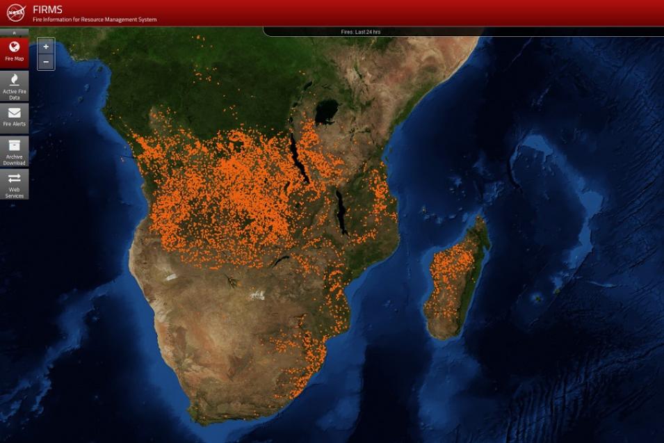
Somewhere on Earth a wildfire is burning.
FIRMS data are an invaluable resource for managing ongoing fires and tracking their spread. As provided by NASA’s open data policy, all MODIS and VIIRS data and data products are fully and openly available. This policy also applies to the algorithms used to process the data along with the application program interfaces (APIs) that facilitate use of the data. This means that anyone, anywhere in the world who has access to a computer with an internet connection can access FIRMS, MODIS, and VIIRS data and receive emailed FIRMS Fire Alerts.
The European Forest Fire Information System (EFFIS) and the Forest Survey of India are just some of the worldwide government organizations and agencies using FIRMS, MODIS, and VIIRS fire and thermal anomaly data to help safeguard lives and property. In addition, the U.S. Climate Resilience Toolkit, a federal website that serves as a clearinghouse for climate-related information from across the U.S. government, recently added FIRMS data to their Tool Webpage.
The U.S. Forest Service uses FIRMS data as an integral component of its Active Fire Mapping Program, which provides near real-time detection and characterization of wildland fire conditions in a geospatial context for the continental United States, Alaska, Hawaii, and Canada. As noted by Brad Quayle, Program Lead for the Disturbance Assessment and Services Program at the Forest Service Geospatial Technology and Applications Center, the combination of FIRMS along with thermal anomaly data directly-downloaded from MODIS and VIIRS during a satellite observation (a process called “direct readout”) provides regional and national fire managers with a comprehensive view of the location, extent, and intensity of current wildfire activity throughout much of North America. In addition, the access to global active fire detection data and other relevant science products provided by FIRMS aids the Forest Service in assisting other countries with fire management and post-fire assessment mapping. “With FIRMS,” observes Quayle, “we never have to worry about gaps in data availability.”
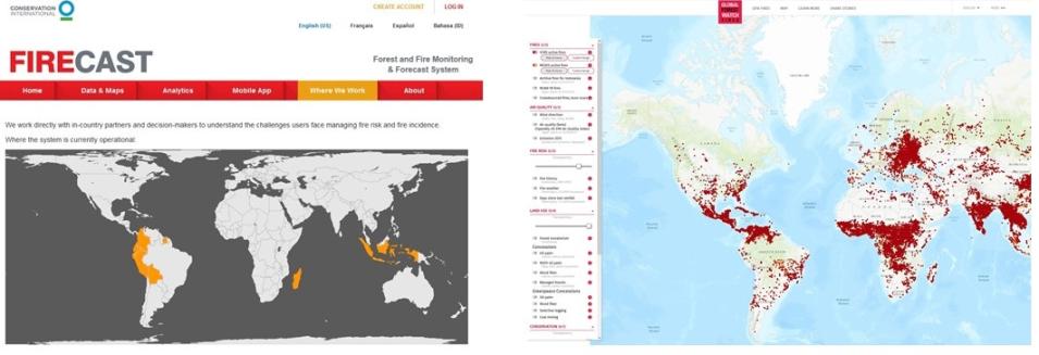
Along with government agencies, numerous non-governmental organizations also have developed systems or websites that use FIRMS data. These include the Firecast system developed by Conservation International (CI) and three websites run by the World Resources Institute (WRI).
As noted by Karyn Tabor, CI’s Director of Early Warning Systems, FIRMS near real-time active fire data help land managers in the tropics monitor ecosystem threats, actively manage fires, strategize patrols of protected areas, and enforce land use policies. According to Tabor, FIRMS data are critical for alerting managers to fires in areas that are impossible to patrol on foot due to terrain or size. FIRMS active fire data also are valuable for protecting restored forest areas that are vulnerable to fires. In one example, the CI Firecast active fire web map showing FIRMS data was used by the World Wildlife Fund Madagascar as part of a community outreach campaign to highlight the importance of safeguarding reforested areas in the Amoron’i Onilahy Protected Area in southwest Madagascar, which was threatened by fires originating from nearby villages.
The World Resources Institute (WRI) uses FIRMS data on three of its most prominent data platforms: Global Forest Watch (GFW), Global Forest Watch Fires (GFW-F), and Resource Watch. Collectively, these three tools enable users to view, analyze, download, and subscribe to active fire alerts. GFW and GFW-F also provide analyses derived from FIRMS data, which are displayed in dashboards and fire reports. Alyssa Barrett, the GFW Platform Manager, notes that most WRI fire work is tied to monitoring the intentional burning of land for agriculture. According to Barrett, FIRMS data not only provide for rapid response to detected fires, they also help identify land being burned illegally and enable those responsible for illegal burning to be held accountable.


