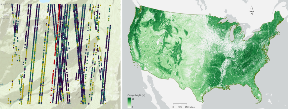
NASA's Ice, Cloud, and land Elevation Satellite-2 (ICESat-2) was launched in September 2018 to measure the heights of all surfaces across the globe, including land ice, sea ice, oceans, water, and vegetation. ICESat-2 carries a photon-counting laser altimeter to measure these surfaces, providing measurements every 70 centimeters along the platform’s ground path at a rate of 10,000 laser pulses per second. NASA’s National Snow and Ice Data Center Distributed Active Archive Center (NSIDC DAAC) distributes ICESat-2 data products in the NASA Earthdata Cloud, along with an abundance of learning resources for users to visualize, access, and customize each data product.
In this webinar, speakers from the NASA ICESat-2 Science and Application teams and Goddard Space Flight Center will introduce the ICESat-2 Land and Vegetation Height data product and provide an overview of a derived continental scale canopy model. In addition, the webinar will showcase the SlideRule Earth web service, demonstrating high-performance, on-demand science data processing of ICESat-2 and other relevant geospatial data.