We are in the process of migrating all NASA Earth science data sites into Earthdata from now until end of 2026. Not all NASA Earth science data and resources will appear here until then. Thank you for your patience as we make this transition.
Read about the Web Unification Project
SANDS
Sediment Analysis Network for Decision Support
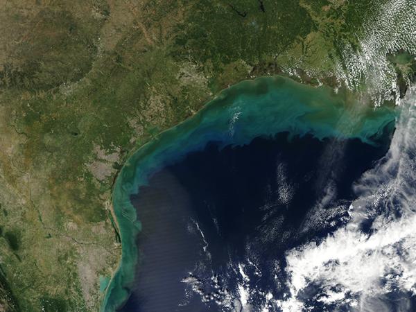
Since the year 2000, eastern Louisiana, coastal Mississippi, Alabama, and the western Florida panhandle have been affected by over 28 tropical storms, seven of which were hurricanes. These tropical cyclones have significantly altered normal coastal processes and characteristics in the Gulf region through sediment disturbance. In fact, tropical storm-induced sediment disturbance is a factor in four of the five Gulf of Mexico Alliance (GOMA) priority issues:
- Water quality for beaches and shellfish beds
- Wetland and coastal conservation restoration
- Characterization of Gulf habitats
- Reduction of nutrient inputs to coastal systems.
The Sediment Analysis Network for Decision Support (SANDS) project helped resolve GOMA priority issues related to tropical storm-induced sediment disturbance along the U.S. Gulf Coast through the provision of NASA Earth science data products. NASA provided products from:
- Landsat 7 Enhanced Thematic Mapper+ (ETM+): all bands for years 2000 through 2002
- Landsat 5 Thematic Mapper (TM): all bands for years 2003 through 2008
- Moderate Resolution Imaging Spectroradiometer (MODIS) Aqua: surface reflectance bands 8 through 16
- Sea-viewing Wide Field-of-view Sensor (SeaWiFS)
The Geological Survey of Alabama (GSA) and the Information Technology and Systems Center (ITSC) at The University of Alabama in Huntsville were collaborators on this NASA funded effort. The ITSC has obtained the remotely sensed data from both NASA and USGS data centers. The datasets were subset over the Northern Gulf of Mexico study region and converted to GeoTiff format for analysis by GSA.
Data Centers
GHRC DAAC