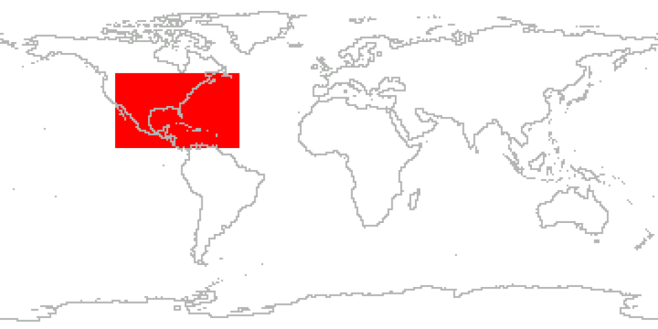
The fourth field campaign in the Convection and Moisture Experiment (CAMEX) series, CAMEX-4, was held from August 16 to September 24, 2001, and was based out of Jacksonville Naval Air Station, Florida. CAMEX-4 was focused on the study of tropical cyclone (hurricane) development, tracking, intensification, and landfalling impacts using NASA-funded aircraft and surface remote sensing instrumentation. The primary aircraft used during CAMEX-4 were the NASA DC-8 and ER-2 research airborne platforms. These instrumented aircraft flew over, through, and around selected hurricanes as they approached landfall in the Caribbean, Gulf of Mexico, and along the east coast of the United States.
The NASA aircraft investigated upper altitude regions of the hurricane not normally sampled. Where possible, measurements were compared and validated with coincident observations from the QuikSCAT, Terra, and Tropical Rainfall Measuring Mission (TRMM) satellites. This study yielded high spatial and temporal information of hurricane structure, dynamics, and motion. These data, when analyzed within the context of more traditional aircraft, satellite, and ground-based radar observations, provided additional insight to hurricane modelers and forecasters who continually strive to improve hurricane predictions. More accurate hurricane predictions at landfall resulted in decreasing the size of necessary coastal evacuations and increasing the warning time for those areas.
Cite the Collection
To cite the entire collection, please use the following:
R. Kakar et al. 2006. CAMEX-4 Field Campaign Data Collection [indicate subset used]. Data available online [http://earthdata.nasa.gov/centers/ghrc-daac] from the NASA EOSDIS Global Hydrometeorology Resource Center Distributed Active Archive Center, Huntsville, Alabama, U.S.A. doi: http://dx.doi.org/10.5067/CAMEX-4/DATA101
For more information on citing data archived by NASA's Global Hydrometeorology Resource Center Distributed Active Archive Center (GHRC DAAC), see NASA's data use policy.
General Characteristics
| Projects | CAMEX-4 |
|---|---|
| Platforms | NASA DC-8, NASA ER-2, QuikSCAT, Terra, TRMM, Ground Stations, GOES-8, WP-3D ORION, MIPS, Balloons |
| Sensors/Instruments | Aerosondes, Rawinsondes, 2DP, PR-2, ACLAIM, CPI, C-STAR, CVI, D8D, HVPS, JLH, LASE, LIP-DC-8, MMS, MTP-DC-8, Nevzorov, AMPR, NOAA-O3, EDOP, EHAD, HAMSR, LIP-ER-2, MAS, MTP-ER-2, TW, MIPS-Ceilometer, MIPS-EFM, MIPS-SFC1, MIPS-SFC2, MIPS-Sodar, MIPS-MPR, MIPS-915, X-POW, NPOL, SMART, TOGA RADAR, DOPPLER RADAR, RDEFM, DROPWINDSONDES, FSSP, PARTICLE SPECTROMETERS, PMS 2D-C PROBE, PMS 2D-P PROBE, ANEMOMETERS, BAROMETERS, HYGROMETERS, PYRANOMETERS, RAIN GAUGES, THERMOMETERS, GOES-8 IMAGER, DROPSONDES, WIND PROFILERS, GPS, TEMPERATURE PROBES, Computer, DIAL, INS, THERMISTORS, VIDEO CAMERA, Radiosondes, SMART-R, AIRCRAFT MOTION SENSOR, Sensor Characteristics, MR, OZONEMETERS, DEWPOINT HYDROMETERS |
| Parameters | Radar, Aerosols, Clouds, Atmospheric Temperature, Atmospheric Water Vapor, Clouds, Atmospheric Electricity, Atmospheric Winds, Infrared Wavelengths, Visible Wavelengths, Atmospheric Pressure, Atmospheric Radiation, Precipitation, Microwave, Platform Characteristics, Weather Events, Weather/Climate Advisories, Atmospheric Chemistry |
| Processing level | 0, 1A, 1B, 2, 3 |
| Formats | 8mm Tape, ASCII, ASCII-asc, ASCII-csv, ASCII-WMO, Binary, DVD, EXCEL, GIF, HDF-4, JPG, McIDAS, NATIVE, PNG, PostScript, RADAR DATA, SIGMET IRIS, Universal Format (UF) |
