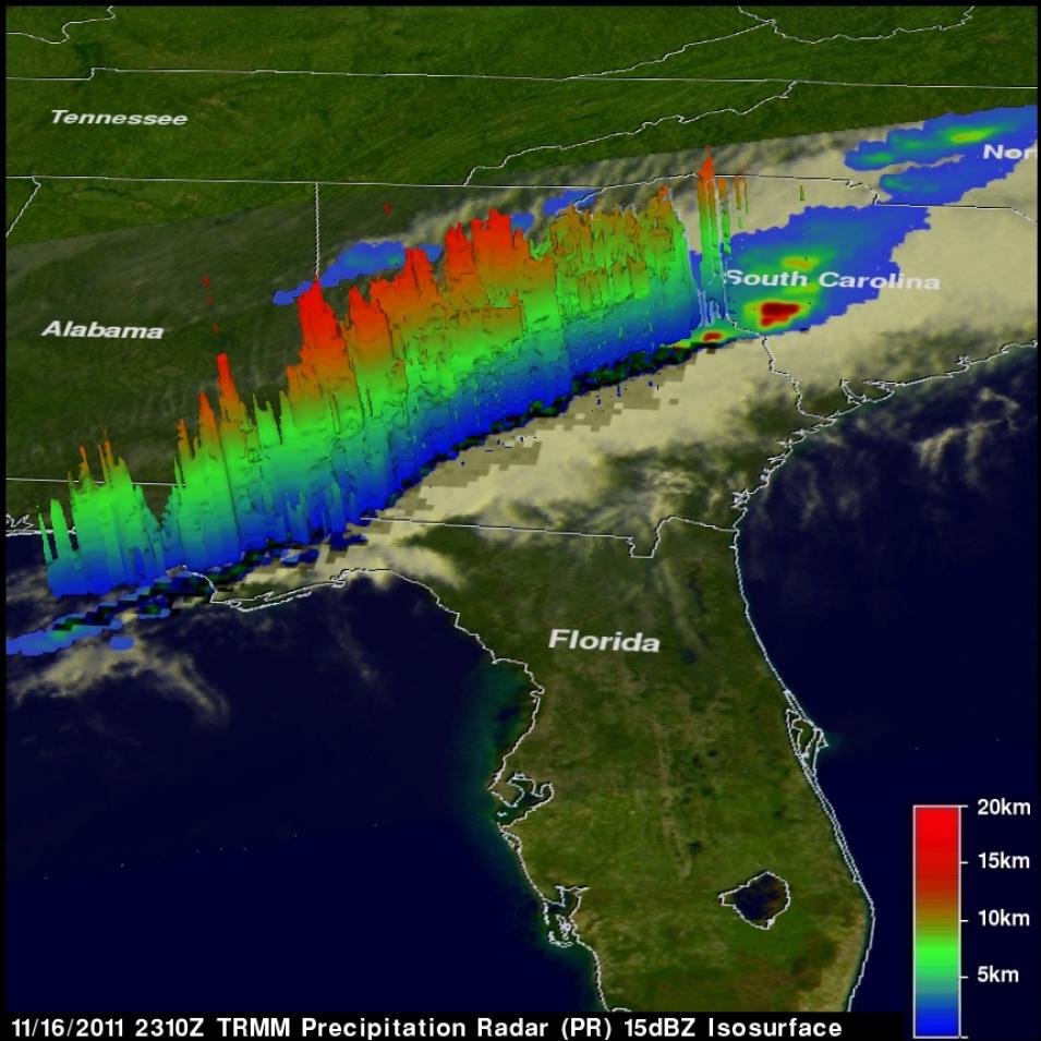
The Precipitation Radar (PR) flew aboard the Tropical Rainfall Measuring Mission (TRMM) spacecraft and was the first spaceborne instrument designed to provide three-dimensional maps of storm structure. TRMM’s goal was to study rainfall in tropical and subtropical regions, approximately 30º north and south of the equator. PR had a horizontal resolution at the ground of about 3.1 miles, a swath width of 154 miles, and could provide vertical profiles of the rain and snow from the surface up to a height of about 12 miles.
PR was able to detect rain rates down to about .027 inches per hour. For heavy rain, the TRMM science team developed new methods of data processing to offset the effects of signal attenuation that commonly occur with significant rainfall. PR was able to separate out rain echoes for vertical sample sizes of about 820 feet when looking straight down. PR was built by the Japanese Space Exploration Agency (JAXA).
