Description
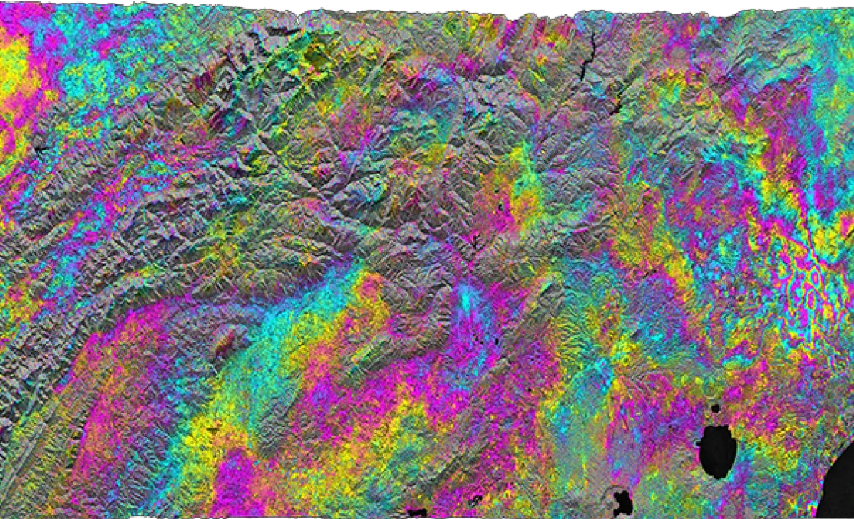
The ARIA Sentinel-1 Geocoded Unwrapped Interferogram (S1 GUNW) products are Level-2 products generated by the Jet Propulsion Lab (JPL) ARIA project. The creation, discovery, and distribution of these products support the use of InSAR science around tectonically active regions, volcanoes, or areas of subsidence/uplift. These products are part of the Alaska Satellite Facility (ASF) long-term archive. The generation of the ARIA-S1-GUNW products was in part funded through collaborations with the AWS Open Data Program and NASA ROSES.
The Advanced Rapid Imaging and Analysis (ARIA) Project is a collaboration between JPL and the California Institute of Technology to exploit radar and optical remote sensing, GPS, and seismic observations for hazard science and response.
ARIA investigates the processes and impacts of earthquakes, volcanoes, landslides, fires, subsurface fluid movement, and other natural hazards by combining modern geodesy with ground-based observations to help improve our resilience to such events. The project develops state-of-the-art ground deformation measurement change detection methods and physical models using GPS and synthetic aperture radar observations, automating the required large-scale processing and producing essential data products for the science community.
As populations grow, response to natural disasters becomes an increasingly important link between science and society. We are developing tools to use the growing networks of ground-based GPS sensors and constellations of imaging satellites for hazard monitoring and response. With these new tools, we anticipate the improvement of situational awareness immediately following disasters.
ARIA S1 GUNW Interferogram Products
The ARIA S1 GUNW interferograms are available as NetCDF-4 products. Detailed information is available in the product specifications document. The following layers are also available as standalone GeoTIFF products:
- Unwrapped phase
- Coherence
- Amplitude
- Connected components
Processor
Products were generated by the JPL ARIA project. Initial product formation and development was done under the Getting Ready for NISAR project using the Hybrid Science Data System (HySDS). Under ACCESS funding, the product was further refined with cloud orchestration using the ASF Hybrid Pluggable Processing Pipeline (HyP3) system. The processor uses the InSAR Scientific Computing Environment (ISCE) software package developed at JPL.
Product Summary
Citation
Citation is critically important for dataset documentation and discovery. This dataset is openly shared, without restriction, in accordance with the EOSDIS Data Use Policy.
Data Center Citation
ARIA S1 GUNW Dataset Citation Information
When using these data in publications such as journal papers, articles, presentations, posters, and websites, please cite:
Buzzanga, Brett, et al. "Toward sustained monitoring of subsidence at the coast using InSAR and GPS: An application in Hampton Roads, Virginia." Geophysical Research Letters 47.18 (2020): e2020GL090013
When using these data as an image in a publication such as journal papers, articles, presentations, posters, and websites, please include the following credit with the image (portions in square brackets are optional).
| Format | Example |
|---|---|
| Dataset: ARIA S1 GUNW, NASA [year of data acquisition]. Contains modified Copernicus Sentinel data, retrieved from ASF DAAC [day month year of data access] | Dataset: ARIA S1 GUNW, NASA 2003. Contains modified Copernicus Sentinel data, retrieved from ASF DAAC 7 June 2023 |
